Cowlesville Topo Map New York
To zoom in, hover over the map of Cowlesville
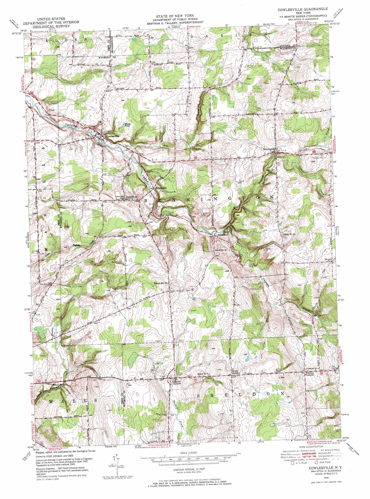
USGS Topo Quad 42078g4 - 1:24,000 scale
| Topo Map Name: | Cowlesville |
| USGS Topo Quad ID: | 42078g4 |
| Print Size: | ca. 21 1/4" wide x 27" high |
| Southeast Coordinates: | 42.75° N latitude / 78.375° W longitude |
| Map Center Coordinates: | 42.8125° N latitude / 78.4375° W longitude |
| U.S. State: | NY |
| Filename: | o42078g4.jpg |
| Download Map JPG Image: | Cowlesville topo map 1:24,000 scale |
| Map Type: | Topographic |
| Topo Series: | 7.5´ |
| Map Scale: | 1:24,000 |
| Source of Map Images: | United States Geological Survey (USGS) |
| Alternate Map Versions: |
Cowlesville NY 1949, updated 1969 Download PDF Buy paper map Cowlesville NY 1951 Download PDF Buy paper map Cowlesville NY 2010 Download PDF Buy paper map Cowlesville NY 2013 Download PDF Buy paper map Cowlesville NY 2016 Download PDF Buy paper map |
1:24,000 Topo Quads surrounding Cowlesville
Clarence Center |
Wolcottsville |
Akron |
Oakfield |
Batavia North |
Clarence |
Alexander |
Batavia South |
||
Orchard Park |
East Aurora |
Cowlesville |
Attica |
Dale |
Colden |
Holland |
Strykersville |
Johnsonburg |
Warsaw |
Springville |
Sardinia |
Arcade |
Bliss |
Pike |
> Back to 42078e1 at 1:100,000 scale
> Back to 42078a1 at 1:250,000 scale
> Back to U.S. Topo Maps home
Cowlesville topo map: Gazetteer
Cowlesville: Airports
Bloecher Farm Airport elevation 435m 1427′Fisher Airport elevation 391m 1282′
Sheldon Airstrip elevation 467m 1532′
Cowlesville: Populated Places
Bennington elevation 368m 1207′Cowlesville elevation 288m 944′
Folsomdale elevation 301m 987′
Harris Corners elevation 402m 1318′
North Sheldon elevation 447m 1466′
Persons Corners elevation 415m 1361′
Cowlesville: Reservoirs
Matts Pond elevation 326m 1069′Cowlesville: Streams
Bender Creek elevation 318m 1043′Fenton Creek elevation 364m 1194′
French Brook elevation 358m 1174′
Gillett Creek elevation 358m 1174′
Red Brook elevation 285m 935′
Right Branch Cayuga Creek elevation 322m 1056′
Cowlesville digital topo map on disk
Buy this Cowlesville topo map showing relief, roads, GPS coordinates and other geographical features, as a high-resolution digital map file on DVD:
 map DVD")