Oakfield Topo Map New York
To zoom in, hover over the map of Oakfield
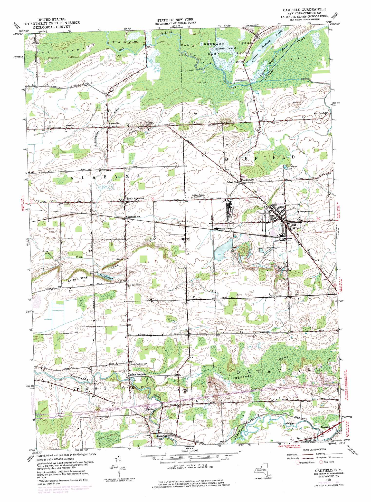
USGS Topo Quad 43078a3 - 1:24,000 scale
| Topo Map Name: | Oakfield |
| USGS Topo Quad ID: | 43078a3 |
| Print Size: | ca. 21 1/4" wide x 27" high |
| Southeast Coordinates: | 43° N latitude / 78.25° W longitude |
| Map Center Coordinates: | 43.0625° N latitude / 78.3125° W longitude |
| U.S. State: | NY |
| Filename: | o43078a3.jpg |
| Download Map JPG Image: | Oakfield topo map 1:24,000 scale |
| Map Type: | Topographic |
| Topo Series: | 7.5´ |
| Map Scale: | 1:24,000 |
| Source of Map Images: | United States Geological Survey (USGS) |
| Alternate Map Versions: |
Oakfield NY 1950, updated 1963 Download PDF Buy paper map Oakfield NY 1952 Download PDF Buy paper map Oakfield NY 2010 Download PDF Buy paper map Oakfield NY 2013 Download PDF Buy paper map Oakfield NY 2016 Download PDF Buy paper map |
1:24,000 Topo Quads surrounding Oakfield
Barker |
Lyndonville |
Ashwood |
Kent |
Kendall |
Gasport |
Medina |
Knowlesville |
Albion |
Holley |
Wolcottsville |
Akron |
Oakfield |
Batavia North |
Byron |
Clarence |
Alexander |
Batavia South |
Stafford |
|
East Aurora |
Cowlesville |
Attica |
Dale |
Wyoming |
> Back to 43078a1 at 1:100,000 scale
> Back to 43078a1 at 1:250,000 scale
> Back to U.S. Topo Maps home
Oakfield topo map: Gazetteer
Oakfield: Lakes
Phelps Pond elevation 249m 816′Upper Stafford Marsh elevation 189m 620′
Oakfield: Parks
Iroquois National Wildlife Refuge elevation 189m 620′Oak Orchard Creek State Game Refuge elevation 191m 626′
Oakfield: Populated Places
Apple Grove Mobile Home Park elevation 274m 898′Bushville elevation 265m 869′
Cookville elevation 259m 849′
Five Corners elevation 229m 751′
North Pembroke elevation 260m 853′
Oakfield elevation 230m 754′
Ridgewood Village elevation 275m 902′
South Alabama elevation 226m 741′
Wheatville elevation 205m 672′
Oakfield: Ridges
Limestone Ledge elevation 268m 879′Oakfield: Streams
Brinningstool Creek elevation 192m 629′Oakfield: Summits
Nichols Hill elevation 225m 738′Oakfield: Swamps
Galloway Swamp elevation 266m 872′Lower Stafford Marsh elevation 189m 620′
Oak Orchard Swamp elevation 187m 613′
Schmidt Marsh elevation 189m 620′
Oakfield digital topo map on disk
Buy this Oakfield topo map showing relief, roads, GPS coordinates and other geographical features, as a high-resolution digital map file on DVD:
 map DVD")