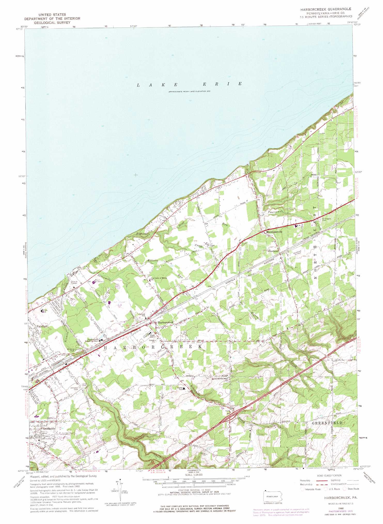
Harborcreek Topo Map Pennsylvania
To zoom in, hover over the map of Harborcreek
USGS Topo Quad 42079b8 - 1:24,000 scale
| Topo Map Name: | Harborcreek |
| USGS Topo Quad ID: | 42079b8 |
| Print Size: | ca. 21 1/4" wide x 27" high |
| Southeast Coordinates: | 42.125° N latitude / 79.875° W longitude |
| Map Center Coordinates: | 42.1875° N latitude / 79.9375° W longitude |
| U.S. State: | PA |
| Filename: | o42079b8.jpg |
| Download Map JPG Image: | Harborcreek topo map 1:24,000 scale |
| Map Type: | Topographic |
| Topo Series: | 7.5´ |
| Map Scale: | 1:24,000 |
| Source of Map Images: | United States Geological Survey (USGS) |
| Alternate Map Versions: |
Harborcreek PA 1960, updated 1962 Download PDF Buy paper map Harborcreek PA 1960, updated 1972 Download PDF Buy paper map Harborcreek PA 1960, updated 1977 Download PDF Buy paper map Harborcreek PA 1996, updated 1996 Download PDF Buy paper map Harborcreek PA 2010 Download PDF Buy paper map Harborcreek PA 2013 Download PDF Buy paper map Harborcreek PA 2016 Download PDF Buy paper map |
1:24,000 Topo Quads surrounding Harborcreek
Ripley |
||||
Erie North |
Harborcreek |
North East |
South Ripley |
|
Swanville |
Erie South |
Hammett |
Wattsburg |
Clymer |
Edinboro North |
Cambridge Springs Ne |
Waterford |
Union City |
Corry |
> Back to 42079a1 at 1:100,000 scale
> Back to 42078a1 at 1:250,000 scale
> Back to U.S. Topo Maps home
Harborcreek topo map: Gazetteer
Harborcreek: Airports
Moorhead Airpark elevation 244m 800′Nelsons Farm Airport (historical) elevation 205m 672′
Harborcreek: Parks
Whitford Park elevation 211m 692′Harborcreek: Populated Places
Brookside elevation 245m 803′Harborcreek elevation 223m 731′
Moorhead elevation 235m 770′
Moorheadville elevation 224m 734′
Harborcreek: Streams
Eightmile Creek elevation 174m 570′Elliotts Run elevation 191m 626′
Scott Run elevation 188m 616′
Sevenmile Creek elevation 174m 570′
Sixmile Creek elevation 174m 570′
Twelvemile Creek elevation 174m 570′
Harborcreek: Summits
Mount Saint Benedict elevation 195m 639′Harborcreek digital topo map on disk
Buy this Harborcreek topo map showing relief, roads, GPS coordinates and other geographical features, as a high-resolution digital map file on DVD:
 map DVD")