Oyens Topo Map Iowa
To zoom in, hover over the map of Oyens
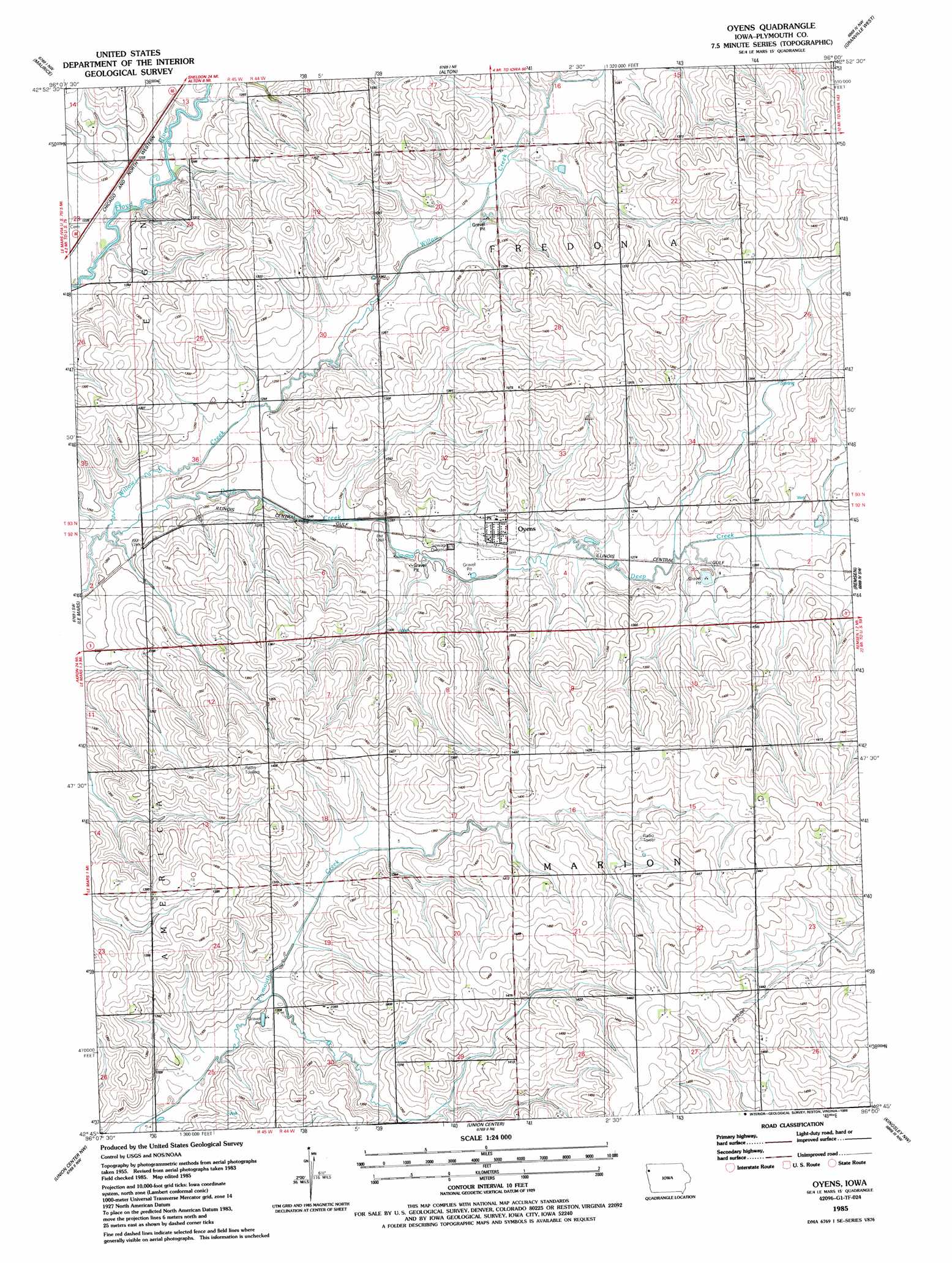
USGS Topo Quad 42096g1 - 1:24,000 scale
| Topo Map Name: | Oyens |
| USGS Topo Quad ID: | 42096g1 |
| Print Size: | ca. 21 1/4" wide x 27" high |
| Southeast Coordinates: | 42.75° N latitude / 96° W longitude |
| Map Center Coordinates: | 42.8125° N latitude / 96.0625° W longitude |
| U.S. State: | IA |
| Filename: | o42096g1.jpg |
| Download Map JPG Image: | Oyens topo map 1:24,000 scale |
| Map Type: | Topographic |
| Topo Series: | 7.5´ |
| Map Scale: | 1:24,000 |
| Source of Map Images: | United States Geological Survey (USGS) |
| Alternate Map Versions: |
Oyens IA 1985, updated 1986 Download PDF Buy paper map Oyens IA 2010 Download PDF Buy paper map Oyens IA 2013 Download PDF Buy paper map Oyens IA 2015 Download PDF Buy paper map |
1:24,000 Topo Quads surrounding Oyens
Lebanon |
Sioux Center |
Orange City |
Hospers |
Sheldon Se |
Ireton |
Maurice |
Alton |
Granville West |
Granville East |
Brunsville |
Le Mars |
Oyens |
Remsen |
Marcus |
Hinton |
Union Center Nw |
Union Center |
Kingsley Nw |
Fielding |
James |
Union Center Sw |
Union Center Se |
Kingsley |
Pierson |
> Back to 42096e1 at 1:100,000 scale
> Back to 42096a1 at 1:250,000 scale
> Back to U.S. Topo Maps home
Oyens topo map: Gazetteer
Oyens: Populated Places
Oyens elevation 391m 1282′Oyens: Post Offices
Oyens Post Office elevation 391m 1282′Oyens: Streams
Deep Creek elevation 372m 1220′Oyens digital topo map on disk
Buy this Oyens topo map showing relief, roads, GPS coordinates and other geographical features, as a high-resolution digital map file on DVD: