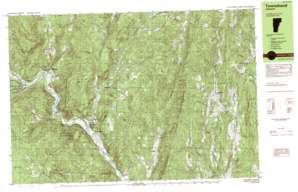
Westminster West Topo Map Vermont
To zoom in, hover over the map of Westminster West
USGS Topo Quad 43072a5 - 1:25,000 scale
| Topo Map Name: | Westminster West |
| USGS Topo Quad ID: | 43072a5 |
| Print Size: | ca. 39" wide x 24" high |
| Southeast Coordinates: | 43° N latitude / 72.5° W longitude |
| Map Center Coordinates: | 43.0625° N latitude / 72.625° W longitude |
| U.S. State: | VT |
| Filename: | k43072a5.jpg |
| Download Map JPG Image: | Westminster West topo map 1:25,000 scale |
| Map Type: | Topographic |
| Topo Series: | 7.5´x15´ |
| Map Scale: | 1:25,000 |
| Source of Map Images: | United States Geological Survey (USGS) |
| Alternate Map Versions: |
Townshend VT 1984, updated 1984 Download PDF Buy paper map Townshend VT 1984, updated 1984 Download PDF Buy paper map |
1:24,000 Topo Quads surrounding Westminster West
Weston |
Andover |
Chester |
Claremont South |
|
Londonderry |
Saxtons River |
Alstead |
||
Jamaica |
Westminster West |
Gilsum |
||
West Dover |
Putney |
Keene |
||
Jacksonville |
Brattleboro |
West Swanzey |
> Back to 43072a1 at 1:100,000 scale
> Back to 43072a1 at 1:250,000 scale
> Back to U.S. Topo Maps home
Westminster West topo map: Gazetteer
Westminster West: Airports
Onyon Airport elevation 126m 413′Westminster West: Bridges
Scott Covered Bridge elevation 140m 459′Simpsonville Stone Arch Bridge elevation 209m 685′
West Townshend Stone Arch Bridge elevation 181m 593′
Westminster West: Dams
Townshend Dam elevation 145m 475′Westminster West: Forests
Townshend State Forest elevation 324m 1062′Westminster West: Lakes
Athens Pond elevation 355m 1164′Watson Pond elevation 251m 823′
Westminster West: Parks
Townshend Dam Recreation Area elevation 155m 508′West Townshend Village Historic District elevation 184m 603′
Westminster West: Populated Places
Brookline elevation 174m 570′East Jamaica elevation 168m 551′
Harmonyville elevation 141m 462′
Simpsonville elevation 215m 705′
Townshend elevation 176m 577′
West Townshend elevation 184m 603′
Westminster West elevation 242m 793′
Westminster West: Reservoirs
Townshend Reservoir elevation 145m 475′Westminster West: Ridges
Hickory Ridge elevation 324m 1062′Rocky Ridge elevation 354m 1161′
Westminster West: Streams
Acton Brook elevation 342m 1122′Athens Brook elevation 205m 672′
Fair Brook elevation 141m 462′
Little Turkey Mountain Brook elevation 232m 761′
Mill Brook elevation 131m 429′
Negro Brook elevation 138m 452′
Ranney Brook elevation 154m 505′
Simpson Brook elevation 206m 675′
Tannery Brook elevation 150m 492′
Turkey Mountain Brook elevation 168m 551′
Wardsboro Brook elevation 168m 551′
Wardsboro Brook elevation 239m 784′
Westminster West: Summits
Acton Hill elevation 605m 1984′Bald Mountain elevation 503m 1650′
Bear Hill elevation 336m 1102′
Crane Mountain elevation 514m 1686′
Hartley Hill elevation 443m 1453′
Ober Hill elevation 493m 1617′
Peaked Mountain elevation 360m 1181′
Putney Mountain elevation 505m 1656′
Rattlesnake Mountain elevation 462m 1515′
Windmill Mountain elevation 499m 1637′
Wiswall Hill elevation 356m 1167′
Westminster West digital topo map on disk
Buy this Westminster West topo map showing relief, roads, GPS coordinates and other geographical features, as a high-resolution digital map file on DVD:
New York, Vermont, Connecticut & Western Massachusetts
Buy digital topo maps: New York, Vermont, Connecticut & Western Massachusetts


