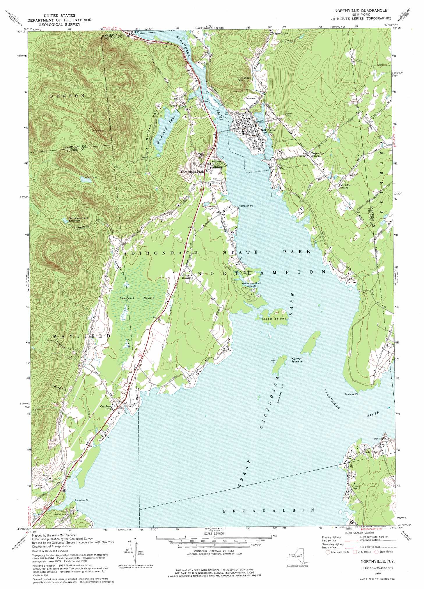
Northville Topo Map New York
To zoom in, hover over the map of Northville
USGS Topo Quad 43074b2 - 1:24,000 scale
| Topo Map Name: | Northville |
| USGS Topo Quad ID: | 43074b2 |
| Print Size: | ca. 21 1/4" wide x 27" high |
| Southeast Coordinates: | 43.125° N latitude / 74.125° W longitude |
| Map Center Coordinates: | 43.1875° N latitude / 74.1875° W longitude |
| U.S. State: | NY |
| Filename: | o43074b2.jpg |
| Download Map JPG Image: | Northville topo map 1:24,000 scale |
| Map Type: | Topographic |
| Topo Series: | 7.5´ |
| Map Scale: | 1:24,000 |
| Source of Map Images: | United States Geological Survey (USGS) |
| Alternate Map Versions: |
Northville NY 1945, updated 1962 Download PDF Buy paper map Northville NY 1946 Download PDF Buy paper map Northville NY 1970, updated 1972 Download PDF Buy paper map Northville NY 1970, updated 1977 Download PDF Buy paper map Northville NY 2010 Download PDF Buy paper map Northville NY 2013 Download PDF Buy paper map Northville NY 2016 Download PDF Buy paper map |
1:24,000 Topo Quads surrounding Northville
Wells |
Harrisburg |
Stony Creek |
||
Cathead Mountain |
Ohmer Mountain |
Conklingville |
||
Caroga Lake |
Jackson Summit |
Northville |
Edinburg |
Porter Corners |
Peck Lake |
Gloversville |
Broadalbin |
Galway |
Middle Grove |
Randall |
Tribes Hill |
Amsterdam |
Pattersonville |
Burnt Hills |
> Back to 43074a1 at 1:100,000 scale
> Back to 43074a1 at 1:250,000 scale
> Back to U.S. Topo Maps home
Northville topo map: Gazetteer
Northville: Capes
Hampton Point elevation 237m 777′Paradise Point elevation 238m 780′
Sinclaire Point elevation 235m 770′
Northville: Islands
Kenyon Islands elevation 236m 774′Mead Island elevation 237m 777′
Northville: Lakes
Mud Lake elevation 484m 1587′Woodward Lake elevation 239m 784′
Northville: Populated Places
Carpenters Corners elevation 289m 948′Cranberry Creek elevation 242m 793′
Fish House elevation 237m 777′
Northville elevation 246m 807′
Sacandaga Park elevation 263m 862′
Sweets Crossing elevation 252m 826′
Northville: Reservoirs
Sacandaga Park Reservoir elevation 407m 1335′Northville: Streams
Hunters Creek elevation 235m 770′Jackson Creek elevation 235m 770′
Northville: Summits
Prospect Hill elevation 369m 1210′Northville: Swamps
Tamarack Swamp elevation 240m 787′Northville: Valleys
Gifford Valley elevation 236m 774′Northville digital topo map on disk
Buy this Northville topo map showing relief, roads, GPS coordinates and other geographical features, as a high-resolution digital map file on DVD:
New York, Vermont, Connecticut & Western Massachusetts
Buy digital topo maps: New York, Vermont, Connecticut & Western Massachusetts