Tribes Hill Topo Map New York
To zoom in, hover over the map of Tribes Hill
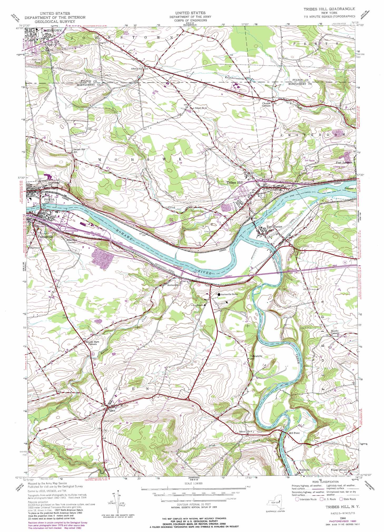
USGS Topo Quad 42074h3 - 1:24,000 scale
| Topo Map Name: | Tribes Hill |
| USGS Topo Quad ID: | 42074h3 |
| Print Size: | ca. 21 1/4" wide x 27" high |
| Southeast Coordinates: | 42.875° N latitude / 74.25° W longitude |
| Map Center Coordinates: | 42.9375° N latitude / 74.3125° W longitude |
| U.S. State: | NY |
| Filename: | o42074h3.jpg |
| Download Map JPG Image: | Tribes Hill topo map 1:24,000 scale |
| Map Type: | Topographic |
| Topo Series: | 7.5´ |
| Map Scale: | 1:24,000 |
| Source of Map Images: | United States Geological Survey (USGS) |
| Alternate Map Versions: |
Tribes Hill NY 1944, updated 1959 Download PDF Buy paper map Tribes Hill NY 1944, updated 1980 Download PDF Buy paper map Tribes Hill NY 2010 Download PDF Buy paper map Tribes Hill NY 2013 Download PDF Buy paper map Tribes Hill NY 2016 Download PDF Buy paper map |
1:24,000 Topo Quads surrounding Tribes Hill
Canada Lake |
Caroga Lake |
Jackson Summit |
Northville |
Edinburg |
Lassellsville |
Peck Lake |
Gloversville |
Broadalbin |
Galway |
Canajoharie |
Randall |
Tribes Hill |
Amsterdam |
Pattersonville |
Sharon Springs |
Carlisle |
Esperance |
Duanesburg |
Rotterdam Junction |
Richmondville |
Cobleskill |
Schoharie |
Gallupville |
Altamont |
> Back to 42074e1 at 1:100,000 scale
> Back to 42074a1 at 1:250,000 scale
> Back to U.S. Topo Maps home
Tribes Hill topo map: Gazetteer
Tribes Hill: Airports
Amsterdam Airfield elevation 128m 419′Fulton County Airport elevation 269m 882′
Tribes Hill: Crossings
Interchange Number 28 elevation 90m 295′Tribes Hill: Islands
Upper Pepper Island elevation 86m 282′Tribes Hill: Parks
Glen Historic District elevation 210m 688′Knox Recreation Park elevation 212m 695′
Schoharie Crossing State Historic Site elevation 84m 275′
Tribes Hill: Populated Places
Auriesville elevation 95m 311′Church Corners elevation 207m 679′
Fort Hunter elevation 89m 291′
Fultonville elevation 88m 288′
Glen elevation 209m 685′
Tribes Hill elevation 128m 419′
Wellsville elevation 116m 380′
Tribes Hill: Streams
Auries Creek elevation 84m 275′Danascara Creek elevation 84m 275′
Irish Creek elevation 111m 364′
Revine Creek elevation 84m 275′
Schoharie Creek elevation 84m 275′
Tribes Hill digital topo map on disk
Buy this Tribes Hill topo map showing relief, roads, GPS coordinates and other geographical features, as a high-resolution digital map file on DVD:
New York, Vermont, Connecticut & Western Massachusetts
Buy digital topo maps: New York, Vermont, Connecticut & Western Massachusetts