Ethan Topo Map South Dakota
To zoom in, hover over the map of Ethan
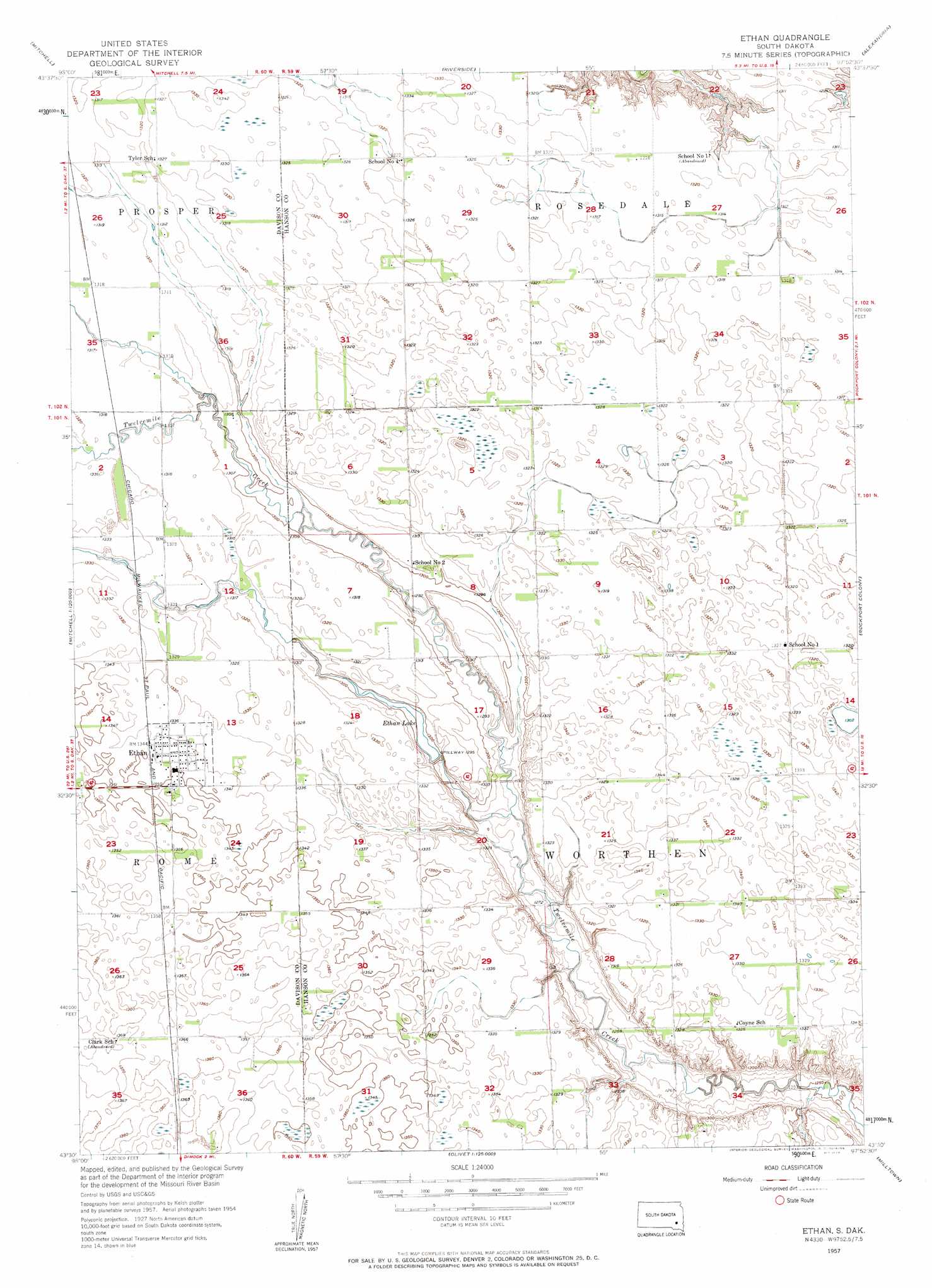
USGS Topo Quad 43097e8 - 1:24,000 scale
| Topo Map Name: | Ethan |
| USGS Topo Quad ID: | 43097e8 |
| Print Size: | ca. 21 1/4" wide x 27" high |
| Southeast Coordinates: | 43.5° N latitude / 97.875° W longitude |
| Map Center Coordinates: | 43.5625° N latitude / 97.9375° W longitude |
| U.S. State: | SD |
| Filename: | o43097e8.jpg |
| Download Map JPG Image: | Ethan topo map 1:24,000 scale |
| Map Type: | Topographic |
| Topo Series: | 7.5´ |
| Map Scale: | 1:24,000 |
| Source of Map Images: | United States Geological Survey (USGS) |
| Alternate Map Versions: |
Ethan SD 1957, updated 1958 Download PDF Buy paper map Ethan SD 2012 Download PDF Buy paper map Ethan SD 2015 Download PDF Buy paper map |
1:24,000 Topo Quads surrounding Ethan
Letcher Sw |
Loomis |
Farwell |
Ness Chain Lakes |
Epiphany |
Betts |
Mitchell |
Riverside |
Alexandria |
Farmer |
Mitchell Sw |
Shoemaker Dam |
Ethan |
Rockport Colony |
Spencer Sw |
Hillside |
Delmont Ne |
Parkston |
Milltown |
Clayton |
Delmont |
Delmont Se |
Beardsley |
Parkston Se |
Tschetter Colony |
> Back to 43097e1 at 1:100,000 scale
> Back to 43096a1 at 1:250,000 scale
> Back to U.S. Topo Maps home
Ethan topo map: Gazetteer
Ethan: Dams
Ethan Dam elevation 394m 1292′Ethan: Populated Places
Ethan elevation 409m 1341′Maywood (historical) elevation 410m 1345′
Ethan: Reservoirs
Ethan Lake elevation 394m 1292′Ethan digital topo map on disk
Buy this Ethan topo map showing relief, roads, GPS coordinates and other geographical features, as a high-resolution digital map file on DVD:
Eastern North Dakota & Eastern South Dakota
Buy digital topo maps: Eastern North Dakota & Eastern South Dakota