Wickiup Spring Topo Map Oregon
To zoom in, hover over the map of Wickiup Spring
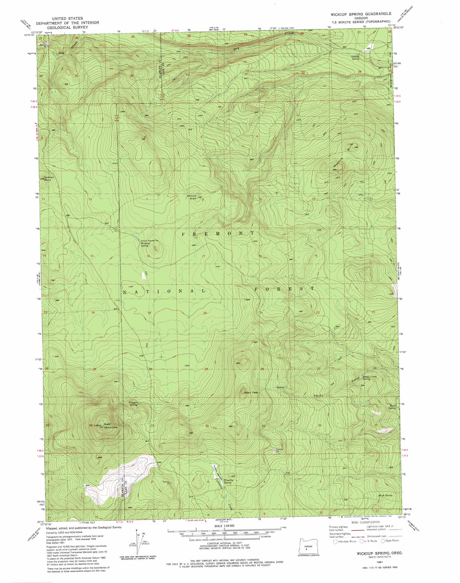
USGS Topo Quad 43121c3 - 1:24,000 scale
| Topo Map Name: | Wickiup Spring |
| USGS Topo Quad ID: | 43121c3 |
| Print Size: | ca. 21 1/4" wide x 27" high |
| Southeast Coordinates: | 43.25° N latitude / 121.25° W longitude |
| Map Center Coordinates: | 43.3125° N latitude / 121.3125° W longitude |
| U.S. State: | OR |
| Filename: | o43121c3.jpg |
| Download Map JPG Image: | Wickiup Spring topo map 1:24,000 scale |
| Map Type: | Topographic |
| Topo Series: | 7.5´ |
| Map Scale: | 1:24,000 |
| Source of Map Images: | United States Geological Survey (USGS) |
| Alternate Map Versions: |
Wickiup Spring OR 1981, updated 1982 Download PDF Buy paper map Wickiup Spring OR 2004, updated 2007 Download PDF Buy paper map Wickiup Spring OR 2011 Download PDF Buy paper map Wickiup Spring OR 2014 Download PDF Buy paper map |
| FStopo: | US Forest Service topo Wickiup Spring is available: Download FStopo PDF Download FStopo TIF |
1:24,000 Topo Quads surrounding Wickiup Spring
Masten Butte |
Moffitt Butte |
Spring Butte |
Indian Butte |
South Ice Cave |
Crescent Ne |
Grass Well |
Big Hole |
Hole In The Ground |
Cabin Lake |
Sellers Marsh |
Stams Mountain |
Wickiup Spring |
Mccarty Butte |
Fort Rock |
Tea Table Mountain |
Location Butte |
Antelope Mountain |
Oatman Flat |
Silver Lake |
Sugarpine Mountain |
Bear Butte |
Rodman Rock |
Bridge Creek Draw |
Hager Mountain |
> Back to 43121a1 at 1:100,000 scale
> Back to 43120a1 at 1:250,000 scale
> Back to U.S. Topo Maps home
Wickiup Spring topo map: Gazetteer
Wickiup Spring: Post Offices
Embody Post Office (historical) elevation 1594m 5229′Wickiup Spring: Reservoirs
Community Reseeding Waterhole elevation 1883m 6177′Wickiup Spring: Springs
Pothole Spring elevation 1495m 4904′Smoke Creek Spring elevation 1665m 5462′
Wickiup Spring: Summits
Bald Mountain elevation 2238m 7342′Wart Peak elevation 2056m 6745′
Wastina Butte elevation 1768m 5800′
Wickiup Butte elevation 1884m 6181′
Wickiup Spring digital topo map on disk
Buy this Wickiup Spring topo map showing relief, roads, GPS coordinates and other geographical features, as a high-resolution digital map file on DVD: