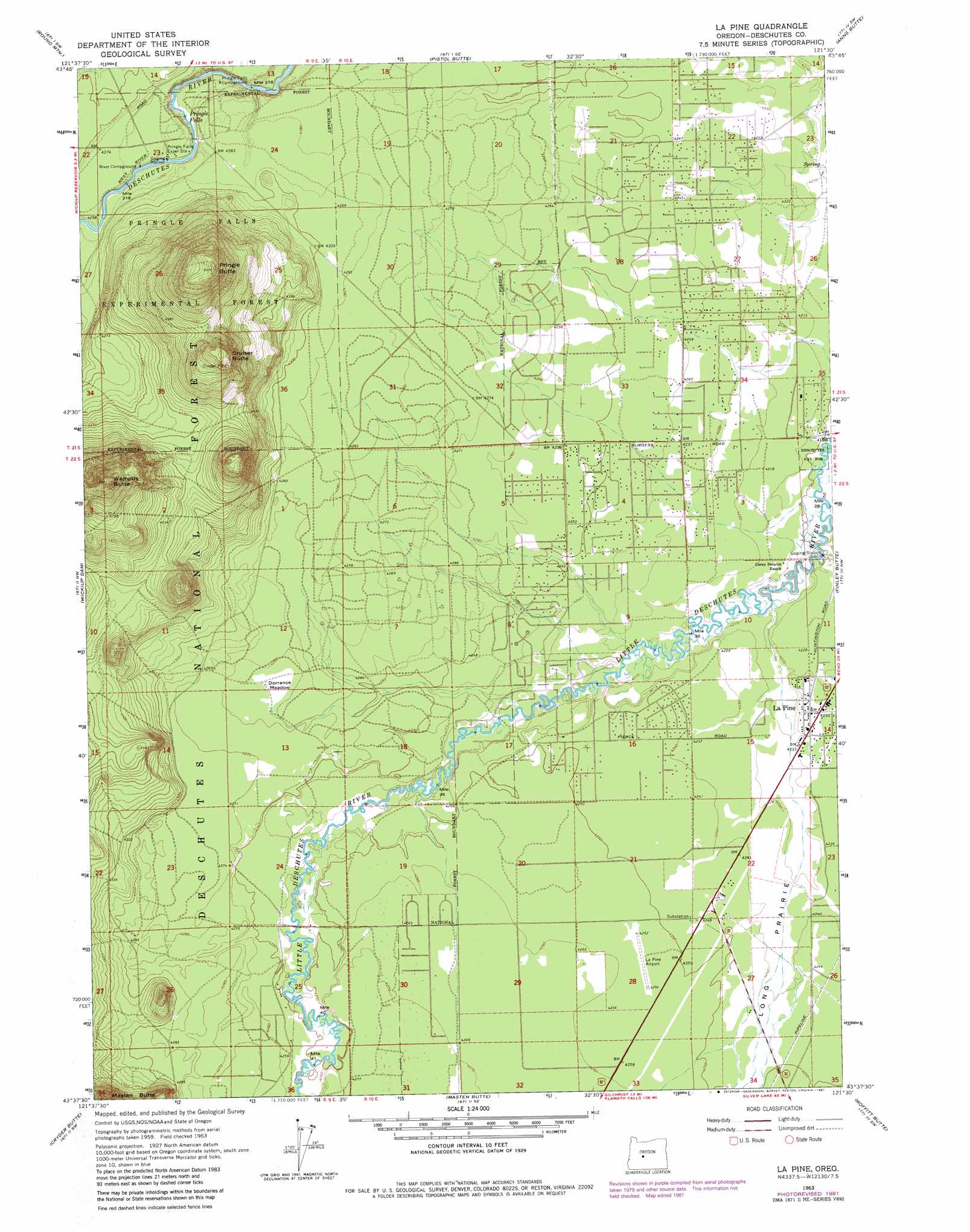
La Pine Topo Map Oregon
To zoom in, hover over the map of La Pine
USGS Topo Quad 43121f5 - 1:24,000 scale
| Topo Map Name: | La Pine |
| USGS Topo Quad ID: | 43121f5 |
| Print Size: | ca. 21 1/4" wide x 27" high |
| Southeast Coordinates: | 43.625° N latitude / 121.5° W longitude |
| Map Center Coordinates: | 43.6875° N latitude / 121.5625° W longitude |
| U.S. State: | OR |
| Filename: | o43121f5.jpg |
| Download Map JPG Image: | La Pine topo map 1:24,000 scale |
| Map Type: | Topographic |
| Topo Series: | 7.5´ |
| Map Scale: | 1:24,000 |
| Source of Map Images: | United States Geological Survey (USGS) |
| Alternate Map Versions: |
La Pine OR 1963, updated 1964 Download PDF Buy paper map La Pine OR 1963, updated 1973 Download PDF Buy paper map La Pine OR 1963, updated 1981 Download PDF Buy paper map La Pine OR 2011 Download PDF Buy paper map La Pine OR 2014 Download PDF Buy paper map |
| FStopo: | US Forest Service topo La Pine is available: Download FStopo PDF Download FStopo TIF |
1:24,000 Topo Quads surrounding La Pine
Elk Lake |
Bachelor Butte |
Wanoga Butte |
Benham Falls |
Lava Butte |
Crane Prairie Reservoir |
Round Mountain |
Pistol Butte |
Anns Butte |
Lava Cast Forest |
Davis Mountain |
Wickiup Dam |
La Pine |
Finley Butte |
Paulina Peak |
Hamner Butte |
Cryder Butte |
Masten Butte |
Moffitt Butte |
Spring Butte |
Odell Butte |
Crescent |
Crescent Ne |
Grass Well |
Big Hole |
> Back to 43121e1 at 1:100,000 scale
> Back to 43120a1 at 1:250,000 scale
> Back to U.S. Topo Maps home
La Pine topo map: Gazetteer
La Pine: Falls
Pringle Falls elevation 1289m 4229′La Pine: Flats
Dorrance Meadow elevation 1299m 4261′La Pine: Populated Places
La Pine elevation 1291m 4235′La Pine: Post Offices
La Pine Post Office elevation 1291m 4235′Pringlefalls Post Office (historical) elevation 1293m 4242′
Rosland Post Office (historical) elevation 1282m 4206′
La Pine: Streams
Long Pine Slough elevation 1281m 4202′La Pine: Summits
Cruiser Butte elevation 1472m 4829′Pringle Butte elevation 1524m 5000′
Wampus Butte elevation 1526m 5006′
La Pine digital topo map on disk
Buy this La Pine topo map showing relief, roads, GPS coordinates and other geographical features, as a high-resolution digital map file on DVD: