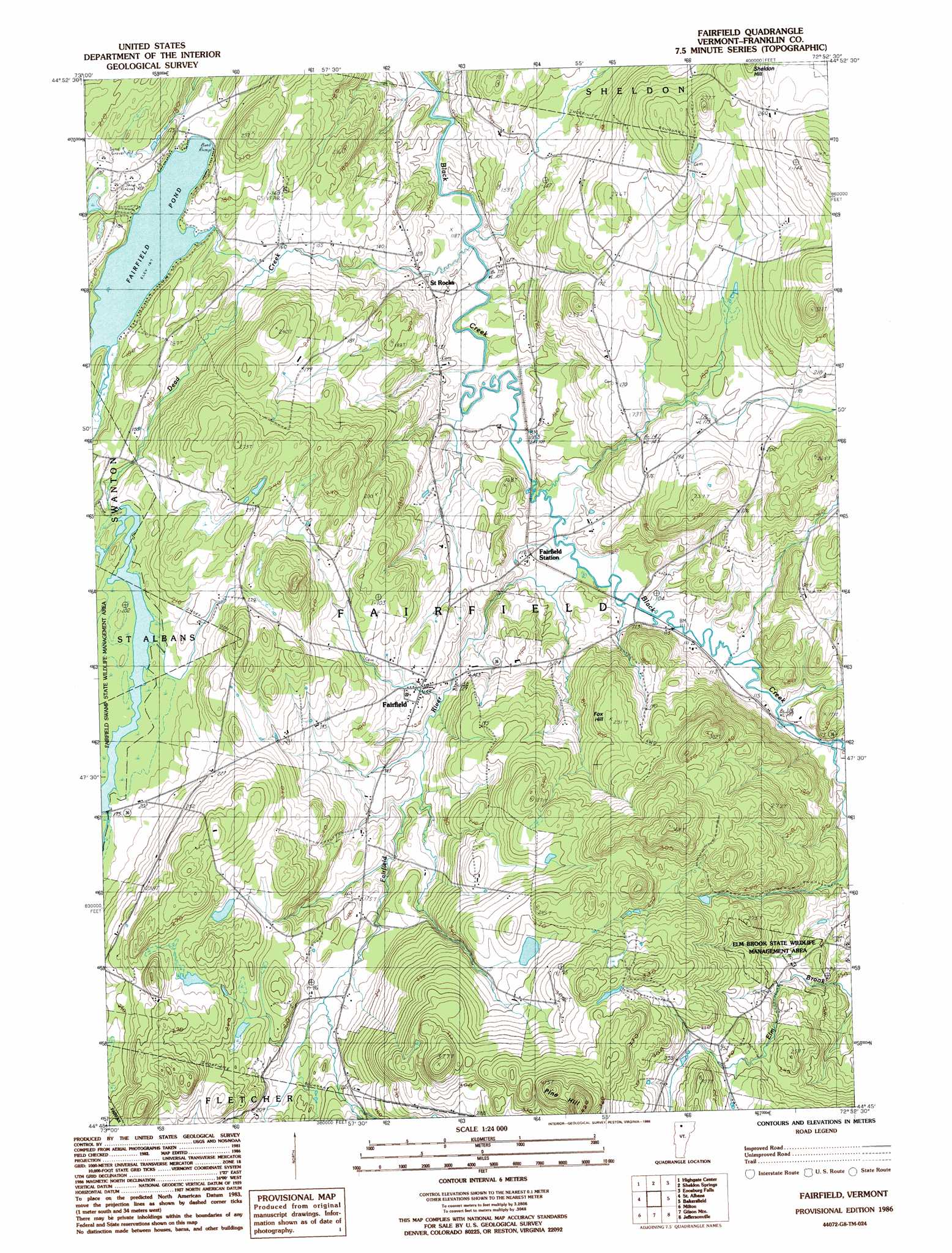
Fairfield Topo Map Vermont
To zoom in, hover over the map of Fairfield
USGS Topo Quad 44072g8 - 1:24,000 scale
| Topo Map Name: | Fairfield |
| USGS Topo Quad ID: | 44072g8 |
| Print Size: | ca. 21 1/4" wide x 27" high |
| Southeast Coordinates: | 44.75° N latitude / 72.875° W longitude |
| Map Center Coordinates: | 44.8125° N latitude / 72.9375° W longitude |
| U.S. State: | VT |
| Filename: | o44072g8.jpg |
| Download Map JPG Image: | Fairfield topo map 1:24,000 scale |
| Map Type: | Topographic |
| Topo Series: | 7.5´ |
| Map Scale: | 1:24,000 |
| Source of Map Images: | United States Geological Survey (USGS) |
| Alternate Map Versions: |
Fairfield VT 1986 Download PDF Buy paper map Fairfield VT 1986, updated 1986 Download PDF Buy paper map Fairfield VT 2012 Download PDF Buy paper map Fairfield VT 2015 Download PDF Buy paper map |
1:24,000 Topo Quads surrounding Fairfield
East Alburg |
Highgate Center |
Sheldon Springs |
Enosburg Falls |
Richford |
Saint Albans Bay |
Saint Albans |
Fairfield |
Bakersfield |
Cold Hollow Mountains |
Georgia Plains |
Milton |
Gilson Mountain |
Jeffersonville |
Johnson |
Colchester |
Essex Center |
Underhill |
Mount Mansfield |
Whiteface Mountain |
> Back to 44072e1 at 1:100,000 scale
> Back to 44072a1 at 1:250,000 scale
> Back to U.S. Topo Maps home
Fairfield topo map: Gazetteer
Fairfield: Dams
Fairfield Swamp Dam elevation 167m 547′Fairfield: Parks
Elm Brook State Wildlife Management Area elevation 227m 744′Fairfield: Populated Places
Fairfield elevation 157m 515′Saint Rocks elevation 117m 383′
Fairfield: Reservoirs
Fairfield Pond elevation 167m 547′Fairfield: Streams
Dead Creek elevation 103m 337′Elm Brook elevation 110m 360′
Fairfield River elevation 105m 344′
Fairfield: Summits
Fox Hill elevation 236m 774′Pine Hill elevation 449m 1473′
Fairfield digital topo map on disk
Buy this Fairfield topo map showing relief, roads, GPS coordinates and other geographical features, as a high-resolution digital map file on DVD:
New York, Vermont, Connecticut & Western Massachusetts
Buy digital topo maps: New York, Vermont, Connecticut & Western Massachusetts