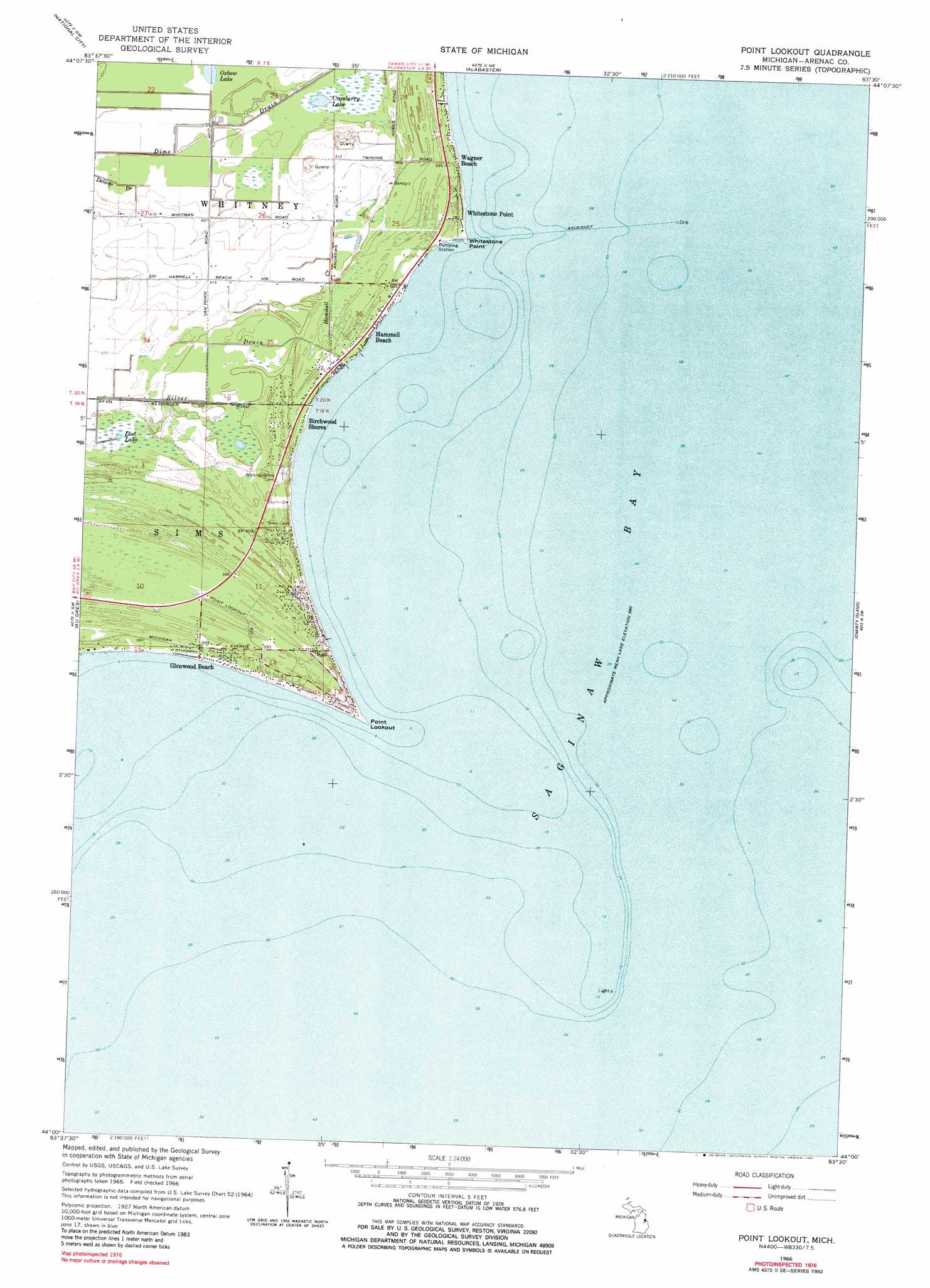
Point Lookout Topo Map Michigan
To zoom in, hover over the map of Point Lookout
USGS Topo Quad 44083a5 - 1:24,000 scale
| Topo Map Name: | Point Lookout |
| USGS Topo Quad ID: | 44083a5 |
| Print Size: | ca. 21 1/4" wide x 27" high |
| Southeast Coordinates: | 44° N latitude / 83.5° W longitude |
| Map Center Coordinates: | 44.0625° N latitude / 83.5625° W longitude |
| U.S. State: | MI |
| Filename: | o44083a5.jpg |
| Download Map JPG Image: | Point Lookout topo map 1:24,000 scale |
| Map Type: | Topographic |
| Topo Series: | 7.5´ |
| Map Scale: | 1:24,000 |
| Source of Map Images: | United States Geological Survey (USGS) |
| Alternate Map Versions: |
Point Lookout MI 1966, updated 1968 Download PDF Buy paper map Point Lookout MI 1966, updated 1981 Download PDF Buy paper map Point Lookout MI 2011 Download PDF Buy paper map Point Lookout MI 2014 Download PDF Buy paper map Point Lookout MI 2016 Download PDF Buy paper map |
1:24,000 Topo Quads surrounding Point Lookout
Hale Se |
Floyd Lake |
Tawas City |
East Tawas |
Spencer Lake |
Whittemore |
National City |
Alabaster |
||
Omer |
Au Gres |
Point Lookout |
Charity Island |
|
Standish Ne |
Au Gres |
Sand Point |
Caseville |
|
Bay Port West |
Bay Port East |
> Back to 44083a1 at 1:100,000 scale
> Back to 44082a1 at 1:250,000 scale
> Back to U.S. Topo Maps home
Point Lookout topo map: Gazetteer
Point Lookout: Capes
Point Lookout elevation 180m 590′Whitestone Point elevation 178m 583′
Point Lookout: Lakes
Cranberry Lake elevation 182m 597′Lost Lake elevation 183m 600′
Oxbow Lake elevation 183m 600′
Point Lookout: Populated Places
Birchwood Shores elevation 179m 587′Glenwood Beach elevation 180m 590′
Hammell Beach elevation 179m 587′
Wagner Beach elevation 181m 593′
Whitestone Point elevation 180m 590′
Point Lookout: Streams
Hammell Creek elevation 178m 583′Silver Drain elevation 178m 583′
Point Lookout digital topo map on disk
Buy this Point Lookout topo map showing relief, roads, GPS coordinates and other geographical features, as a high-resolution digital map file on DVD:
 map DVD")