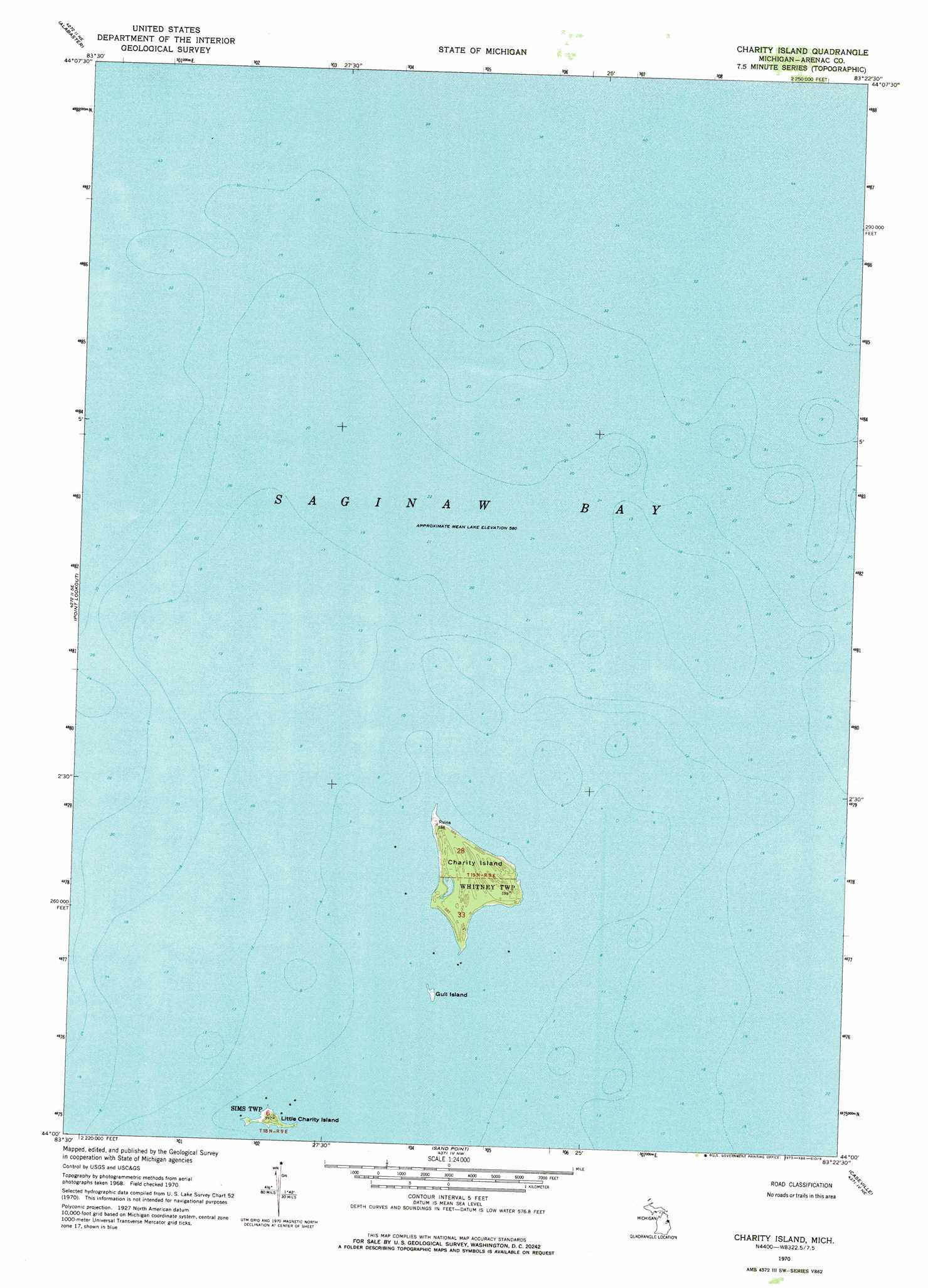
Charity Island Topo Map Michigan
To zoom in, hover over the map of Charity Island
USGS Topo Quad 44083a4 - 1:24,000 scale
| Topo Map Name: | Charity Island |
| USGS Topo Quad ID: | 44083a4 |
| Print Size: | ca. 21 1/4" wide x 27" high |
| Southeast Coordinates: | 44° N latitude / 83.375° W longitude |
| Map Center Coordinates: | 44.0625° N latitude / 83.4375° W longitude |
| U.S. State: | MI |
| Filename: | o44083a4.jpg |
| Download Map JPG Image: | Charity Island topo map 1:24,000 scale |
| Map Type: | Topographic |
| Topo Series: | 7.5´ |
| Map Scale: | 1:24,000 |
| Source of Map Images: | United States Geological Survey (USGS) |
| Alternate Map Versions: |
Charity Island MI 1970, updated 1973 Download PDF Buy paper map Charity Island MI 2011 Download PDF Buy paper map Charity Island MI 2014 Download PDF Buy paper map Charity Island MI 2017 Download PDF Buy paper map |
1:24,000 Topo Quads surrounding Charity Island
Floyd Lake |
Tawas City |
East Tawas |
Spencer Lake |
|
National City |
Alabaster |
|||
Au Gres |
Point Lookout |
Charity Island |
||
Au Gres |
Sand Point |
Caseville |
Rush Lake |
|
Bay Port West |
Bay Port East |
Elkton |
> Back to 44083a1 at 1:100,000 scale
> Back to 44082a1 at 1:250,000 scale
> Back to U.S. Topo Maps home
Charity Island topo map: Gazetteer
Charity Island: Islands
Charity Island elevation 180m 590′Gull Island elevation 177m 580′
Little Charity Island elevation 181m 593′
Charity Island digital topo map on disk
Buy this Charity Island topo map showing relief, roads, GPS coordinates and other geographical features, as a high-resolution digital map file on DVD:
 map DVD")