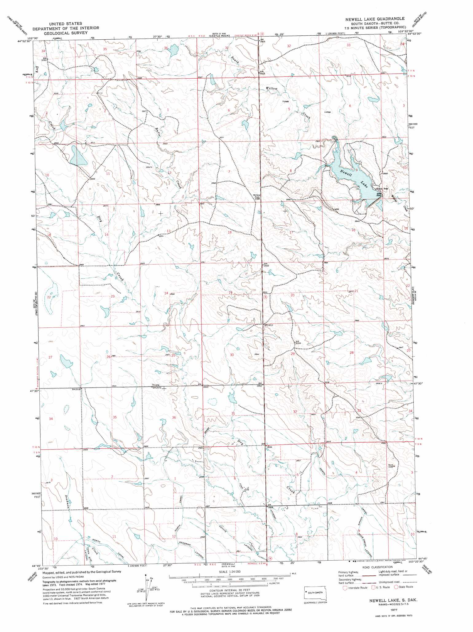
Newell Lake Topo Map South Dakota
To zoom in, hover over the map of Newell Lake
USGS Topo Quad 44103g4 - 1:24,000 scale
| Topo Map Name: | Newell Lake |
| USGS Topo Quad ID: | 44103g4 |
| Print Size: | ca. 21 1/4" wide x 27" high |
| Southeast Coordinates: | 44.75° N latitude / 103.375° W longitude |
| Map Center Coordinates: | 44.8125° N latitude / 103.4375° W longitude |
| U.S. State: | SD |
| Filename: | o44103g4.jpg |
| Download Map JPG Image: | Newell Lake topo map 1:24,000 scale |
| Map Type: | Topographic |
| Topo Series: | 7.5´ |
| Map Scale: | 1:24,000 |
| Source of Map Images: | United States Geological Survey (USGS) |
| Alternate Map Versions: |
Newell Lake SD 1977, updated 1978 Download PDF Buy paper map Newell Lake SD 2012 Download PDF Buy paper map Newell Lake SD 2015 Download PDF Buy paper map |
1:24,000 Topo Quads surrounding Newell Lake
Antelope Creek West |
Antelope Creek East |
Haystack Butte |
Hoover |
Deers Ears Butte North |
Two Top Butte West |
Two Top Butte East |
Castle Rock |
Sulphur Butte |
Deers Ears Butte South |
Arpan |
Two Top Butte Se |
Newell Lake |
Schoepp Flat |
Owl Butte |
Fruitdale |
Nisland |
Newell |
Vale Ne |
Volunteer Nw |
Saint Onge |
Saint Onge Se |
Vale |
Vale Se |
Volunteer |
> Back to 44103e1 at 1:100,000 scale
> Back to 44102a1 at 1:250,000 scale
> Back to U.S. Topo Maps home
Newell Lake topo map: Gazetteer
Newell Lake: Canals
Coyote Lateral elevation 863m 2831′Finn Lateral elevation 877m 2877′
North Canal elevation 880m 2887′
Newell Lake: Dams
Newell Dam elevation 878m 2880′Rodney Winkler Dam Number 1 elevation 910m 2985′
Newell Lake: Reservoirs
Newell Lake elevation 884m 2900′Newell Lake: Streams
Butte Creek elevation 892m 2926′South Willow Creek elevation 875m 2870′
Newell Lake digital topo map on disk
Buy this Newell Lake topo map showing relief, roads, GPS coordinates and other geographical features, as a high-resolution digital map file on DVD:
Eastern Wyoming & Western South Dakota
Buy digital topo maps: Eastern Wyoming & Western South Dakota