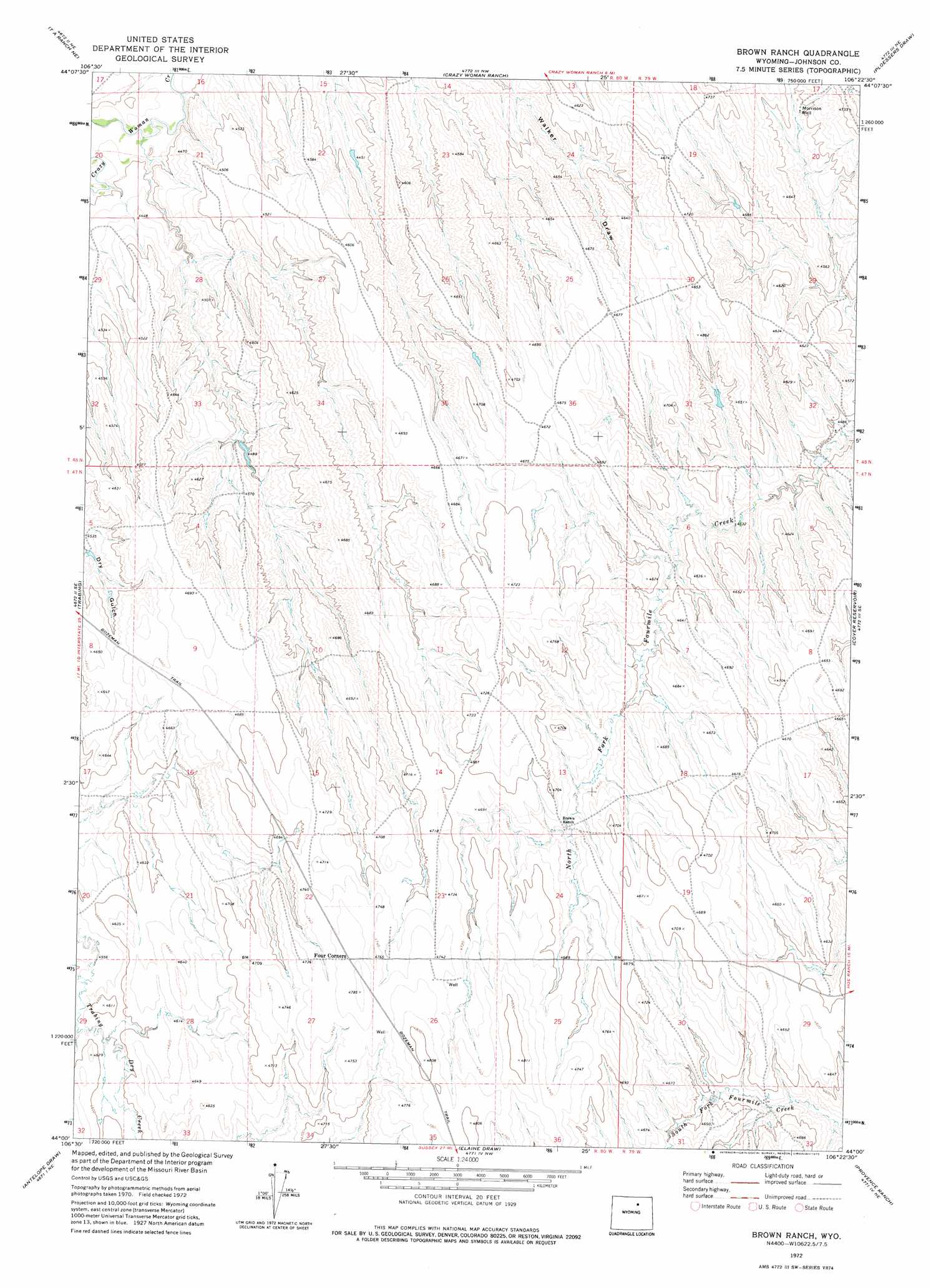
Brown Ranch Topo Map Wyoming
To zoom in, hover over the map of Brown Ranch
USGS Topo Quad 44106a4 - 1:24,000 scale
| Topo Map Name: | Brown Ranch |
| USGS Topo Quad ID: | 44106a4 |
| Print Size: | ca. 21 1/4" wide x 27" high |
| Southeast Coordinates: | 44° N latitude / 106.375° W longitude |
| Map Center Coordinates: | 44.0625° N latitude / 106.4375° W longitude |
| U.S. State: | WY |
| Filename: | o44106a4.jpg |
| Download Map JPG Image: | Brown Ranch topo map 1:24,000 scale |
| Map Type: | Topographic |
| Topo Series: | 7.5´ |
| Map Scale: | 1:24,000 |
| Source of Map Images: | United States Geological Survey (USGS) |
| Alternate Map Versions: |
Brown Ranch WY 1972, updated 1975 Download PDF Buy paper map Brown Ranch WY 2012 Download PDF Buy paper map Brown Ranch WY 2015 Download PDF Buy paper map |
1:24,000 Topo Quads surrounding Brown Ranch
Buffalo |
Buffalo Se |
Pine Gulch |
Bear Draw |
Somerville Flats West |
T A Ranch |
Ta Ranch Ne |
Crazy Woman Ranch |
Ploessers Draw |
Juniper Draw |
Purdy Reservoir |
Trabing |
Brown Ranch |
Boon |
Bowman Flat |
Schlicht Draw |
Antelope Draw |
Elaine Draw |
Provence Ranch |
Hoe Ranch |
Hibbard Draw |
Dry Creek Reservoir |
Fourmile Reservoir |
Soldier Creek |
Fort Reno |
> Back to 44106a1 at 1:100,000 scale
> Back to 44106a1 at 1:250,000 scale
> Back to U.S. Topo Maps home
Brown Ranch topo map: Gazetteer
Brown Ranch: Dams
Murphy Dam elevation 1432m 4698′Brown Ranch: Reservoirs
Murphy Reservoir elevation 1432m 4698′Brown Ranch: Trails
Bozeman Trail elevation 1464m 4803′Brown Ranch: Wells
Morrison Well elevation 1397m 4583′Brown Ranch digital topo map on disk
Buy this Brown Ranch topo map showing relief, roads, GPS coordinates and other geographical features, as a high-resolution digital map file on DVD:
Eastern Wyoming & Western South Dakota
Buy digital topo maps: Eastern Wyoming & Western South Dakota