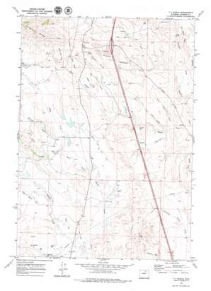
T A Ranch Topo Map Wyoming
To zoom in, hover over the map of T A Ranch
USGS Topo Quad 44106b6 - 1:24,000 scale
| Topo Map Name: | T A Ranch |
| USGS Topo Quad ID: | 44106b6 |
| Print Size: | ca. 21 1/4" wide x 27" high |
| Southeast Coordinates: | 44.125° N latitude / 106.625° W longitude |
| Map Center Coordinates: | 44.1875° N latitude / 106.6875° W longitude |
| U.S. State: | WY |
| Filename: | o44106b6.jpg |
| Download Map JPG Image: | T A Ranch topo map 1:24,000 scale |
| Map Type: | Topographic |
| Topo Series: | 7.5´ |
| Map Scale: | 1:24,000 |
| Source of Map Images: | United States Geological Survey (USGS) |
| Alternate Map Versions: |
T A Ranch WY 1970, updated 1973 Download PDF Buy paper map T A Ranch WY 1970, updated 1979 Download PDF Buy paper map T A Ranch WY 2012 Download PDF Buy paper map T A Ranch WY 2015 Download PDF Buy paper map |
1:24,000 Topo Quads surrounding T A Ranch
> Back to 44106a1 at 1:100,000 scale
> Back to 44106a1 at 1:250,000 scale
> Back to U.S. Topo Maps home
T A Ranch topo map: Gazetteer
T A Ranch: Canals
Fort Collins Canal elevation 1606m 5269′Twenty and One Half Ditch elevation 1526m 5006′
Watkins Ditch elevation 1584m 5196′
T A Ranch: Dams
Basch Dam elevation 1543m 5062′Highway Dam elevation 1541m 5055′
Kelly Dam elevation 1523m 4996′
Kingsbury Todd Number 1 Dam elevation 1550m 5085′
Kingsbury Todd Number 2 Dam elevation 1557m 5108′
Ridge Place Number 2 Dam elevation 1597m 5239′
T A Ranch: Lakes
Frog Pond elevation 1532m 5026′T A Ranch: Ranges
T A Hills elevation 1573m 5160′T A Ranch: Reservoirs
Basch Reservoir elevation 1543m 5062′Dowlin Reservoir elevation 1495m 4904′
Gerkin Reservoir elevation 1475m 4839′
Highway Reservoir elevation 1541m 5055′
Kelly Reservoir elevation 1523m 4996′
Kingsbury Todd Number 1 Reservoir elevation 1550m 5085′
Kingsbury Todd Number 2 Reservoir elevation 1557m 5108′
Ridge Place Number 2 Reservoir elevation 1597m 5239′
T A Ranch: Ridges
Kingsbury Ridge elevation 1797m 5895′Tisdale Divide elevation 1623m 5324′
T A Ranch: Streams
Billy Creek elevation 1466m 4809′Burnett Creek elevation 1525m 5003′
Dry Muddy Creek elevation 1503m 4931′
Kelly Creek elevation 1500m 4921′
Muddy Creek elevation 1464m 4803′
T A Ranch: Valleys
Bates Draw elevation 1453m 4767′Big Draw elevation 1498m 4914′
Coyote Draw elevation 1512m 4960′
East End Draw elevation 1453m 4767′
East Four Draw elevation 1467m 4812′
Eder Draw elevation 1488m 4881′
Hall Field Draw elevation 1453m 4767′
Neilson Draw elevation 1547m 5075′
Ninemile Waterhole Draw elevation 1500m 4921′
Sand Draw elevation 1436m 4711′
South Side Draw elevation 1604m 5262′
Spring Draw elevation 1585m 5200′
T A Ranch digital topo map on disk
Buy this T A Ranch topo map showing relief, roads, GPS coordinates and other geographical features, as a high-resolution digital map file on DVD:
Eastern Wyoming & Western South Dakota
Buy digital topo maps: Eastern Wyoming & Western South Dakota


