Crystal Butte Topo Map Idaho
To zoom in, hover over the map of Crystal Butte
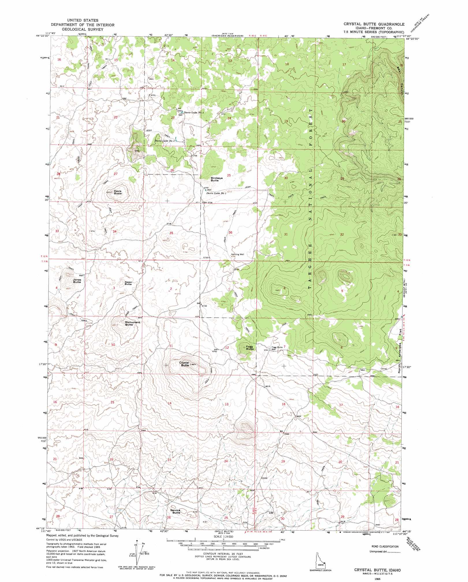
USGS Topo Quad 44111c6 - 1:24,000 scale
| Topo Map Name: | Crystal Butte |
| USGS Topo Quad ID: | 44111c6 |
| Print Size: | ca. 21 1/4" wide x 27" high |
| Southeast Coordinates: | 44.25° N latitude / 111.625° W longitude |
| Map Center Coordinates: | 44.3125° N latitude / 111.6875° W longitude |
| U.S. State: | ID |
| Filename: | o44111c6.jpg |
| Download Map JPG Image: | Crystal Butte topo map 1:24,000 scale |
| Map Type: | Topographic |
| Topo Series: | 7.5´ |
| Map Scale: | 1:24,000 |
| Source of Map Images: | United States Geological Survey (USGS) |
| Alternate Map Versions: |
Crystal Butte ID 1965, updated 1967 Download PDF Buy paper map Crystal Butte ID 2011 Download PDF Buy paper map Crystal Butte ID 2013 Download PDF Buy paper map |
| FStopo: | US Forest Service topo Crystal Butte is available: Download FStopo PDF Download FStopo TIF |
1:24,000 Topo Quads surrounding Crystal Butte
Winslow Creek |
Slide Mountain |
Upper Red Rock Lake |
Mount Jefferson |
Sawtell Peak |
Kilgore |
Antelope Valley |
Sheridan Reservoir |
Icehouse Creek |
Island Park Dam |
Idmon |
Pine Butte |
Crystal Butte |
Bishop Mountain |
Last Chance |
Snowshoe Butte |
Split Rock |
Split Butte |
Blue Creek Reservoir |
Lookout Butte |
Big Grassy Ridge |
Big Grassy Ridge Se |
Black Knoll |
Lemon Lake |
Ashton |
> Back to 44111a1 at 1:100,000 scale
> Back to 44110a1 at 1:250,000 scale
> Back to U.S. Topo Maps home
Crystal Butte topo map: Gazetteer
Crystal Butte: Reservoirs
Davis Lake Number One elevation 2046m 6712′Davis Lake Number Three elevation 2031m 6663′
Davis Lake Number Two elevation 2036m 6679′
Crystal Butte: Summits
Aspen Butte elevation 2037m 6683′Birdseye Butte elevation 2059m 6755′
Crystal Butte elevation 2124m 6968′
Davis Butte elevation 2117m 6945′
Fogg Butte elevation 2092m 6863′
Jones Butte elevation 2051m 6729′
Monument Butte elevation 2068m 6784′
Service Butte elevation 1894m 6213′
Crystal Butte: Valleys
Bear Canyon elevation 1982m 6502′Crystal Butte: Wells
Fogg Butte Well elevation 2065m 6774′Hunting Well elevation 2069m 6788′
Crystal Butte digital topo map on disk
Buy this Crystal Butte topo map showing relief, roads, GPS coordinates and other geographical features, as a high-resolution digital map file on DVD: