Rainbow Lake West Topo Map Maine
To zoom in, hover over the map of Rainbow Lake West
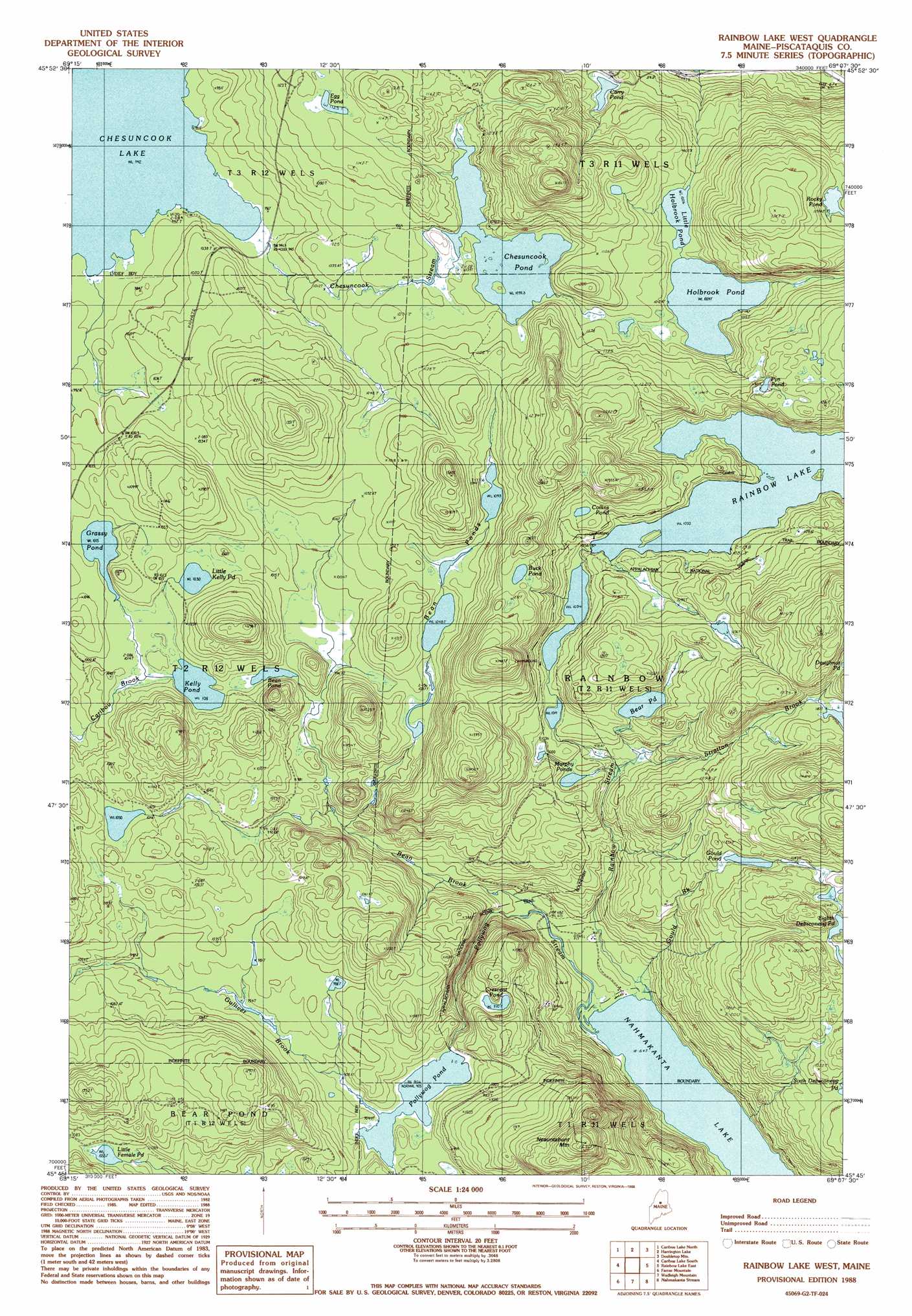
USGS Topo Quad 45069g2 - 1:24,000 scale
| Topo Map Name: | Rainbow Lake West |
| USGS Topo Quad ID: | 45069g2 |
| Print Size: | ca. 21 1/4" wide x 27" high |
| Southeast Coordinates: | 45.75° N latitude / 69.125° W longitude |
| Map Center Coordinates: | 45.8125° N latitude / 69.1875° W longitude |
| U.S. State: | ME |
| Filename: | o45069g2.jpg |
| Download Map JPG Image: | Rainbow Lake West topo map 1:24,000 scale |
| Map Type: | Topographic |
| Topo Series: | 7.5´ |
| Map Scale: | 1:24,000 |
| Source of Map Images: | United States Geological Survey (USGS) |
| Alternate Map Versions: |
Rainbow Lake West ME 1978, updated 1981 Download PDF Buy paper map Rainbow Lake West ME 1988, updated 1988 Download PDF Buy paper map Rainbow Lake West ME 1988, updated 1988 Download PDF Buy paper map Rainbow Lake West ME 2011 Download PDF Buy paper map Rainbow Lake West ME 2014 Download PDF Buy paper map |
1:24,000 Topo Quads surrounding Rainbow Lake West
Chesuncook |
Cuxabexis Lake |
Telos Brook |
Nesowad Nehunk Lake |
Wassataquoik Lake |
Pine Stream Flowage |
Caribou Lake North |
Harrington Lake |
Doubletop Mountain |
Mount Katahdin |
Big Spencer Mountain |
Caribou Lake South |
Rainbow Lake West |
Rainbow Lake East |
Abol Pond |
Kokadjo |
Farrar Mountain |
Wadleigh Mountain |
Nahmakanta Stream |
Pemadumcook Lake |
Number Four Mountain |
Hay Mountain |
Big Shanty Mountain |
Jo-Mary Mountain |
Ragged Mountain |
> Back to 45069e1 at 1:100,000 scale
> Back to 45068a1 at 1:250,000 scale
> Back to U.S. Topo Maps home
Rainbow Lake West topo map: Gazetteer
Rainbow Lake West: Dams
Rainbow Lake Dam elevation 320m 1049′Rainbow Lake West: Lakes
Bean Pond elevation 307m 1007′Bean Ponds elevation 326m 1069′
Bear Pond elevation 320m 1049′
Buck Pond elevation 382m 1253′
Carry Pond elevation 288m 944′
Chesuncook Pond elevation 323m 1059′
Collins Pond elevation 338m 1108′
Crescent Pond elevation 296m 971′
Egg Pond elevation 343m 1125′
Eighth Debsconeag Pond elevation 339m 1112′
Gould Pond elevation 327m 1072′
Grassy Pond elevation 309m 1013′
Holbrook Pond elevation 307m 1007′
Kelly Pond elevation 308m 1010′
Little Female Pond elevation 321m 1053′
Little Holbrook Pond elevation 307m 1007′
Little Kelly Pond elevation 314m 1030′
Murphy Ponds elevation 301m 987′
Nahmakanta Lake elevation 197m 646′
Pollywog Pond elevation 275m 902′
Pym Pond elevation 366m 1200′
Rocky Pond elevation 366m 1200′
Rainbow Lake West: Reservoirs
Rainbow Lake elevation 1049m 3441′Rainbow Lake West: Streams
Bean Brook elevation 206m 675′Chesuncook Stream elevation 289m 948′
Gould Brook elevation 198m 649′
Gulliver Brook elevation 275m 902′
Pollywog Stream elevation 197m 646′
Rainbow Stream elevation 203m 666′
Stratton Brook elevation 285m 935′
Rainbow Lake West digital topo map on disk
Buy this Rainbow Lake West topo map showing relief, roads, GPS coordinates and other geographical features, as a high-resolution digital map file on DVD:
Maine, New Hampshire, Rhode Island & Eastern Massachusetts
Buy digital topo maps: Maine, New Hampshire, Rhode Island & Eastern Massachusetts