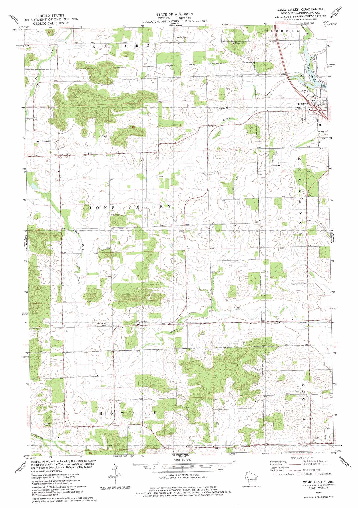
Como Creek Topo Map Wisconsin
To zoom in, hover over the map of Como Creek
USGS Topo Quad 45091a5 - 1:24,000 scale
| Topo Map Name: | Como Creek |
| USGS Topo Quad ID: | 45091a5 |
| Print Size: | ca. 21 1/4" wide x 27" high |
| Southeast Coordinates: | 45° N latitude / 91.5° W longitude |
| Map Center Coordinates: | 45.0625° N latitude / 91.5625° W longitude |
| U.S. State: | WI |
| Filename: | o45091a5.jpg |
| Download Map JPG Image: | Como Creek topo map 1:24,000 scale |
| Map Type: | Topographic |
| Topo Series: | 7.5´ |
| Map Scale: | 1:24,000 |
| Source of Map Images: | United States Geological Survey (USGS) |
| Alternate Map Versions: |
Como Creek WI 1975, updated 1978 Download PDF Buy paper map Como Creek WI 2010 Download PDF Buy paper map Como Creek WI 2013 Download PDF Buy paper map Como Creek WI 2015 Download PDF Buy paper map |
1:24,000 Topo Quads surrounding Como Creek
Dallas |
Chetek |
Moose Ear Lake |
Chain Lake |
Fireside Lakes |
Ridgeland Ne |
Sand Creek |
New Auburn |
Marsh-Miller Lake |
Bob Lake |
Norton |
Colfax North |
Como Creek |
Bloomer |
Jim Falls |
Rusk |
Colfax South |
Albertville |
Chippewa Falls |
Lake Wissota |
Falls City |
Elk Creek Lake |
Eau Claire West |
Eau Claire East |
Fall Creek |
> Back to 45091a1 at 1:100,000 scale
> Back to 45090a1 at 1:250,000 scale
> Back to U.S. Topo Maps home
Como Creek digital topo map on disk
Buy this Como Creek topo map showing relief, roads, GPS coordinates and other geographical features, as a high-resolution digital map file on DVD: