Lindstrom Topo Map Minnesota
To zoom in, hover over the map of Lindstrom
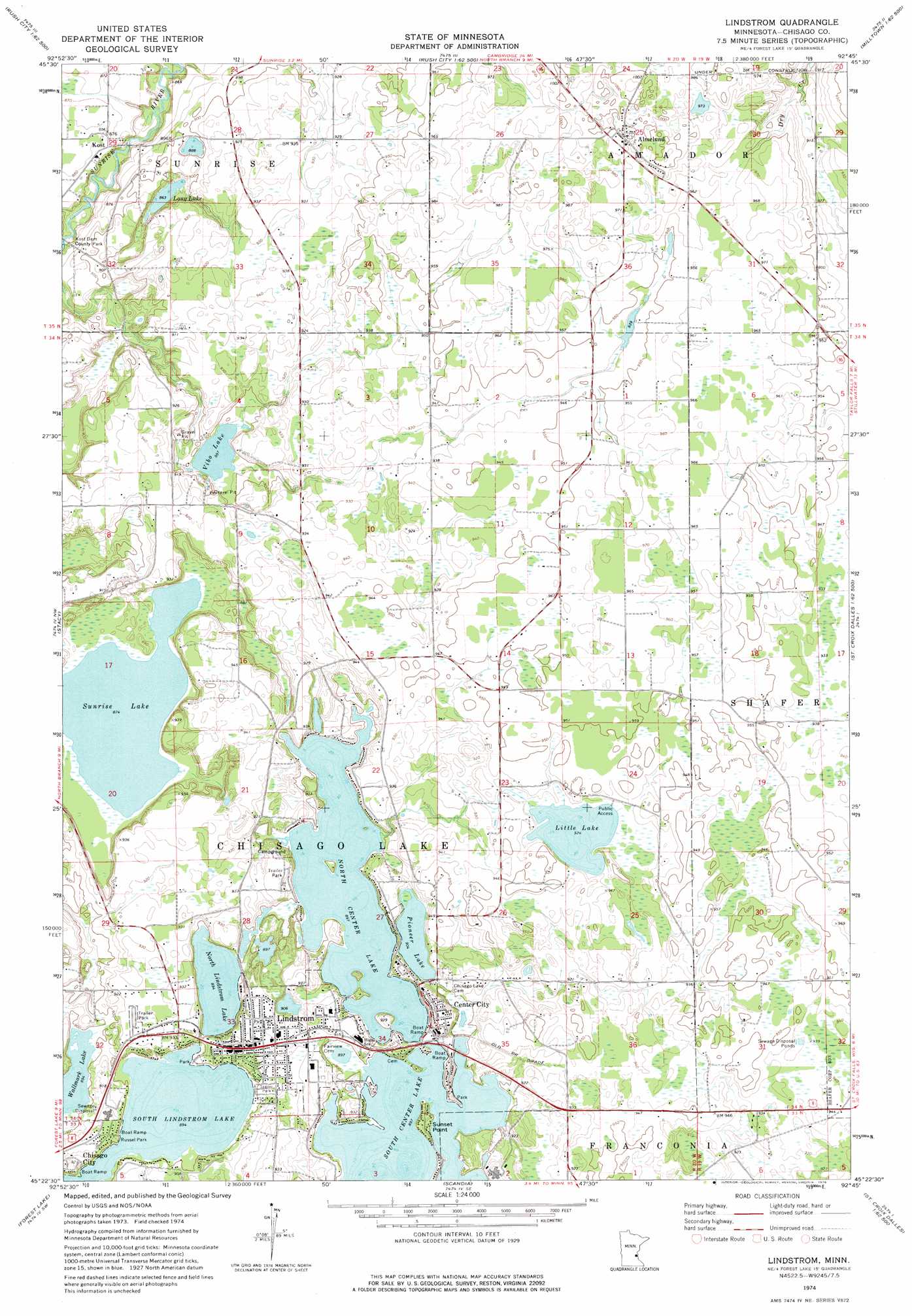
USGS Topo Quad 45092d7 - 1:24,000 scale
| Topo Map Name: | Lindstrom |
| USGS Topo Quad ID: | 45092d7 |
| Print Size: | ca. 21 1/4" wide x 27" high |
| Southeast Coordinates: | 45.375° N latitude / 92.75° W longitude |
| Map Center Coordinates: | 45.4375° N latitude / 92.8125° W longitude |
| U.S. State: | MN |
| Filename: | o45092d7.jpg |
| Download Map JPG Image: | Lindstrom topo map 1:24,000 scale |
| Map Type: | Topographic |
| Topo Series: | 7.5´ |
| Map Scale: | 1:24,000 |
| Source of Map Images: | United States Geological Survey (USGS) |
| Alternate Map Versions: |
Lindstrom MN 1974, updated 1976 Download PDF Buy paper map Lindstrom MN 2010 Download PDF Buy paper map Lindstrom MN 2013 Download PDF Buy paper map Lindstrom MN 2016 Download PDF Buy paper map |
1:24,000 Topo Quads surrounding Lindstrom
Rush Lake |
Rush City |
Randall |
Trade River |
Trade Lake |
Stark |
North Branch |
Sunrise |
Cushing |
Milltown |
Typo Lake |
Stacy |
Lindstrom |
Saint Croix Dalles |
Centuria |
Linwood |
Forest Lake |
Scandia |
Osceola |
Nye |
Centerville |
Hugo |
Marine On Saint Croix |
Somerset North |
New Richmond North |
> Back to 45092a1 at 1:100,000 scale
> Back to 45092a1 at 1:250,000 scale
> Back to U.S. Topo Maps home
Lindstrom topo map: Gazetteer
Lindstrom: Airports
Barnes Airport elevation 287m 941′Chisago Health Services Heliport elevation 284m 931′
North Center Lake Seaplane Base elevation 272m 892′
Lindstrom: Capes
Sunset Point elevation 277m 908′Lindstrom: Dams
Sunrise River Dam elevation 260m 853′Lindstrom: Lakes
Little Lake elevation 281m 921′Long Lake elevation 262m 859′
North Center Lake elevation 272m 892′
North Lindstrom Lake elevation 272m 892′
Pioneer Lake elevation 275m 902′
South Center Lake elevation 272m 892′
South Lindstrom Lake elevation 272m 892′
Sunrise Lake elevation 266m 872′
Vibo Lake elevation 269m 882′
Wallmark Lake elevation 272m 892′
Lindstrom: Parks
Beach Park elevation 275m 902′Blue Waters Leisure Park elevation 279m 915′
Carl Almquist Field elevation 304m 997′
Kost Dam County Park elevation 259m 849′
Russel Park elevation 275m 902′
Triangle Park elevation 304m 997′
Lindstrom: Populated Places
Almelund elevation 304m 997′Center City elevation 283m 928′
Elm Estates elevation 284m 931′
Kost elevation 266m 872′
Lake Shore Terrace Mobile Home Park elevation 280m 918′
Lindstrom elevation 282m 925′
Lindstrom: Post Offices
Almelund Post Office elevation 304m 997′Center City Post Office elevation 285m 935′
Kost Post Office (historical) elevation 266m 872′
Lindstrom Post Office elevation 282m 925′
Lindstrom: Streams
Dry Creek elevation 274m 898′Lindstrom digital topo map on disk
Buy this Lindstrom topo map showing relief, roads, GPS coordinates and other geographical features, as a high-resolution digital map file on DVD: