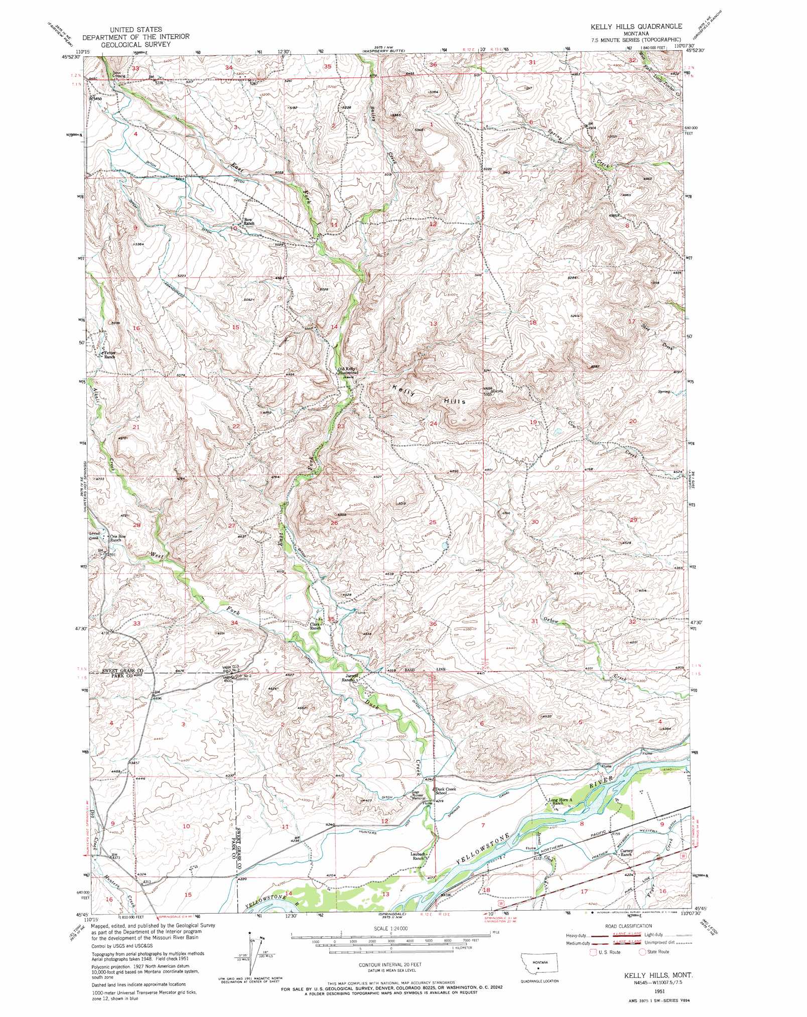
Kelly Hills Topo Map Montana
To zoom in, hover over the map of Kelly Hills
USGS Topo Quad 45110g2 - 1:24,000 scale
| Topo Map Name: | Kelly Hills |
| USGS Topo Quad ID: | 45110g2 |
| Print Size: | ca. 21 1/4" wide x 27" high |
| Southeast Coordinates: | 45.75° N latitude / 110.125° W longitude |
| Map Center Coordinates: | 45.8125° N latitude / 110.1875° W longitude |
| U.S. State: | MT |
| Filename: | o45110g2.jpg |
| Download Map JPG Image: | Kelly Hills topo map 1:24,000 scale |
| Map Type: | Topographic |
| Topo Series: | 7.5´ |
| Map Scale: | 1:24,000 |
| Source of Map Images: | United States Geological Survey (USGS) |
| Alternate Map Versions: |
Kelly Hills MT 1951, updated 1953 Download PDF Buy paper map Kelly Hills MT 1951, updated 1966 Download PDF Buy paper map Kelly Hills MT 2011 Download PDF Buy paper map Kelly Hills MT 2014 Download PDF Buy paper map |
1:24,000 Topo Quads surrounding Kelly Hills
Campfire Lake |
Crazy Peak |
Amelong Creek |
Battleship Butte |
Melville |
Ibex Mountain |
Fairview Peak |
Raspberry Butte |
Grosfield Ranch |
Otter Creek School |
Grannis |
Hunters Hot Springs |
Kelly Hills |
Carney |
Big Timber |
Mission |
Elton |
Springdale |
Mcleod |
Ross Canyon |
Livingston Peak |
Mount Rae |
Mcleod Basin |
Squaw Peak |
Sliderock Mountain |
> Back to 45110e1 at 1:100,000 scale
> Back to 45110a1 at 1:250,000 scale
> Back to U.S. Topo Maps home
Kelly Hills topo map: Gazetteer
Kelly Hills: Canals
Hunters Hot Springs Canal elevation 1287m 4222′Kelly Hills: Parks
Gage Pioneer Memorial elevation 1314m 4311′Kelly Hills: Populated Places
Sioux Crossing elevation 1628m 5341′Kelly Hills: Ridges
Kelly Hills elevation 1555m 5101′Kelly Hills: Springs
01N12E09C___01 Spring elevation 1557m 5108′01S13E08DCDA01 Spring elevation 1281m 4202′
Kelly Hills: Streams
Alkali Creek elevation 1372m 4501′Bailey Creek elevation 1468m 4816′
Dog Creek elevation 1320m 4330′
Duck Creek elevation 1275m 4183′
East Fork Duck Creek elevation 1325m 4347′
Fryer Creek elevation 1269m 4163′
Jarrett Creek elevation 1268m 4160′
Lowell Creek elevation 1391m 4563′
West Fork Duck Creek elevation 1325m 4347′
Kelly Hills: Wells
01S13E08DDBA01 Well elevation 1272m 4173′01S13E09ABBB01 Well elevation 1263m 4143′
01S13E09BBCD01 Well elevation 1265m 4150′
01S13E17BBCA01 Well elevation 1293m 4242′
Kelly Hills digital topo map on disk
Buy this Kelly Hills topo map showing relief, roads, GPS coordinates and other geographical features, as a high-resolution digital map file on DVD: