Raspberry Butte Topo Map Montana
To zoom in, hover over the map of Raspberry Butte
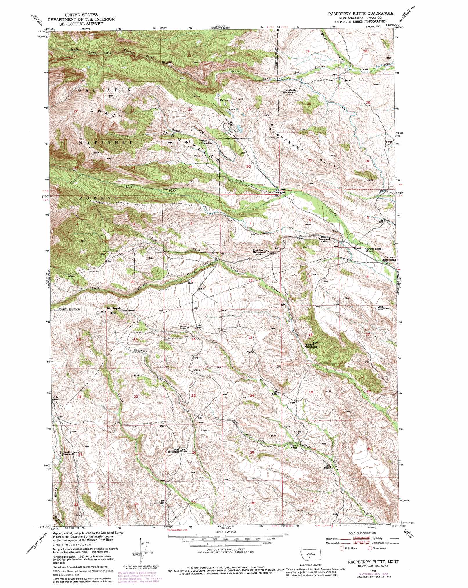
USGS Topo Quad 45110h2 - 1:24,000 scale
| Topo Map Name: | Raspberry Butte |
| USGS Topo Quad ID: | 45110h2 |
| Print Size: | ca. 21 1/4" wide x 27" high |
| Southeast Coordinates: | 45.875° N latitude / 110.125° W longitude |
| Map Center Coordinates: | 45.9375° N latitude / 110.1875° W longitude |
| U.S. State: | MT |
| Filename: | o45110h2.jpg |
| Download Map JPG Image: | Raspberry Butte topo map 1:24,000 scale |
| Map Type: | Topographic |
| Topo Series: | 7.5´ |
| Map Scale: | 1:24,000 |
| Source of Map Images: | United States Geological Survey (USGS) |
| Alternate Map Versions: |
Raspberry Butte MT 1951, updated 1953 Download PDF Buy paper map Raspberry Butte MT 1951, updated 1976 Download PDF Buy paper map Raspberry Butte MT 1951, updated 1981 Download PDF Buy paper map Raspberry Butte MT 2000, updated 2005 Download PDF Buy paper map Raspberry Butte MT 2011 Download PDF Buy paper map Raspberry Butte MT 2014 Download PDF Buy paper map |
| FStopo: | US Forest Service topo Raspberry Butte is available: Download FStopo PDF Download FStopo TIF |
1:24,000 Topo Quads surrounding Raspberry Butte
Virginia Peak |
Loco Mountain |
Rein Lake |
Porcupine Butte |
Melville Nw |
Campfire Lake |
Crazy Peak |
Amelong Creek |
Battleship Butte |
Melville |
Ibex Mountain |
Fairview Peak |
Raspberry Butte |
Grosfield Ranch |
Otter Creek School |
Grannis |
Hunters Hot Springs |
Kelly Hills |
Carney |
Big Timber |
Mission |
Elton |
Springdale |
Mcleod |
Ross Canyon |
> Back to 45110e1 at 1:100,000 scale
> Back to 45110a1 at 1:250,000 scale
> Back to U.S. Topo Maps home
Raspberry Butte topo map: Gazetteer
Raspberry Butte: Lakes
Beley Lakes elevation 1966m 6450′Raspberry Butte: Streams
Cort Creek elevation 1537m 5042′Henry Creek elevation 1648m 5406′
Middle Fork Big Timber Creek elevation 1663m 5456′
North Fork Little Timber Creek elevation 1739m 5705′
Sawmill Creek elevation 1578m 5177′
South Fork Swamp Creek elevation 1797m 5895′
Raspberry Butte: Summits
Kid Royal Mountain elevation 2101m 6893′Raspberry Butte elevation 2028m 6653′
Raspberry Butte digital topo map on disk
Buy this Raspberry Butte topo map showing relief, roads, GPS coordinates and other geographical features, as a high-resolution digital map file on DVD: