Green Hills Topo Map Michigan
To zoom in, hover over the map of Green Hills
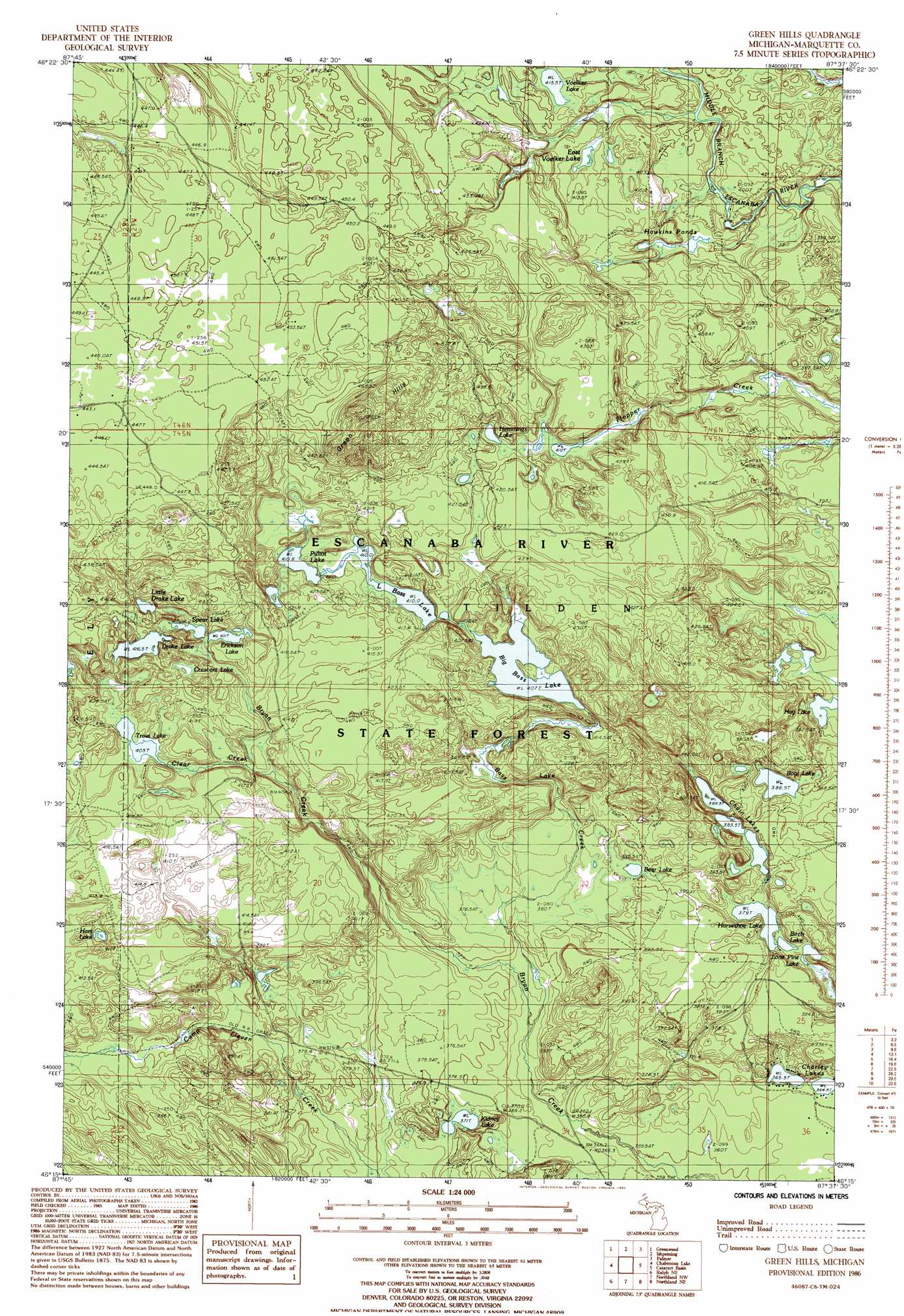
USGS Topo Quad 46087c6 - 1:24,000 scale
| Topo Map Name: | Green Hills |
| USGS Topo Quad ID: | 46087c6 |
| Print Size: | ca. 21 1/4" wide x 27" high |
| Southeast Coordinates: | 46.25° N latitude / 87.625° W longitude |
| Map Center Coordinates: | 46.3125° N latitude / 87.6875° W longitude |
| U.S. State: | MI |
| Filename: | o46087c6.jpg |
| Download Map JPG Image: | Green Hills topo map 1:24,000 scale |
| Map Type: | Topographic |
| Topo Series: | 7.5´ |
| Map Scale: | 1:24,000 |
| Source of Map Images: | United States Geological Survey (USGS) |
| Alternate Map Versions: |
Green Hills MI 1986, updated 1986 Download PDF Buy paper map Green Hills MI 1986, updated 1992 Download PDF Buy paper map Green Hills MI 2011 Download PDF Buy paper map Green Hills MI 2014 Download PDF Buy paper map Green Hills MI 2017 Download PDF Buy paper map |
1:24,000 Topo Quads surrounding Green Hills
Champion |
Diorite |
Negaunee Sw |
Negaunee |
Marquette |
Republic |
Greenwood |
Ishpeming |
Palmer |
Sands |
Republic Sw |
Chabeneau Lake |
Green Hills |
Cataract Basin |
Gwinn |
Ralph Nw |
Ralph Ne |
Northland Nw |
Northland Ne |
Anderson Lake |
Ralph Sw |
Ralph |
Alfred |
Northland |
Arnold |
> Back to 46087a1 at 1:100,000 scale
> Back to 46086a1 at 1:250,000 scale
> Back to U.S. Topo Maps home
Green Hills topo map: Gazetteer
Green Hills: Lakes
Bear Lake elevation 386m 1266′Big Bass Lake elevation 407m 1335′
Birch Lake elevation 379m 1243′
Boot Lake elevation 388m 1272′
Chain Lakes elevation 383m 1256′
Charley Lakes elevation 365m 1197′
Crescent Lake elevation 413m 1354′
Drake Lake elevation 416m 1364′
East Voelker Lake elevation 410m 1345′
Erickson Lake elevation 411m 1348′
Hawkins Ponds elevation 398m 1305′
Hay Lake elevation 382m 1253′
Hemmings Lake elevation 417m 1368′
Horseshoe Lake elevation 379m 1243′
Hurt Lake elevation 418m 1371′
Kidney Lake elevation 371m 1217′
Little Bass Lake elevation 410m 1345′
Little Drake Lake elevation 416m 1364′
Lone Pine Lake elevation 386m 1266′
Pilliot Lake elevation 410m 1345′
Spear Lake elevation 416m 1364′
Trout Lake elevation 405m 1328′
Voelker Lake elevation 415m 1361′
Green Hills: Streams
Bass Creek elevation 366m 1200′Camp Eleven Creek elevation 364m 1194′
Clear Creek elevation 398m 1305′
Green Hills: Summits
Green Hills elevation 467m 1532′Green Hills digital topo map on disk
Buy this Green Hills topo map showing relief, roads, GPS coordinates and other geographical features, as a high-resolution digital map file on DVD: