Ewen Topo Map Michigan
To zoom in, hover over the map of Ewen
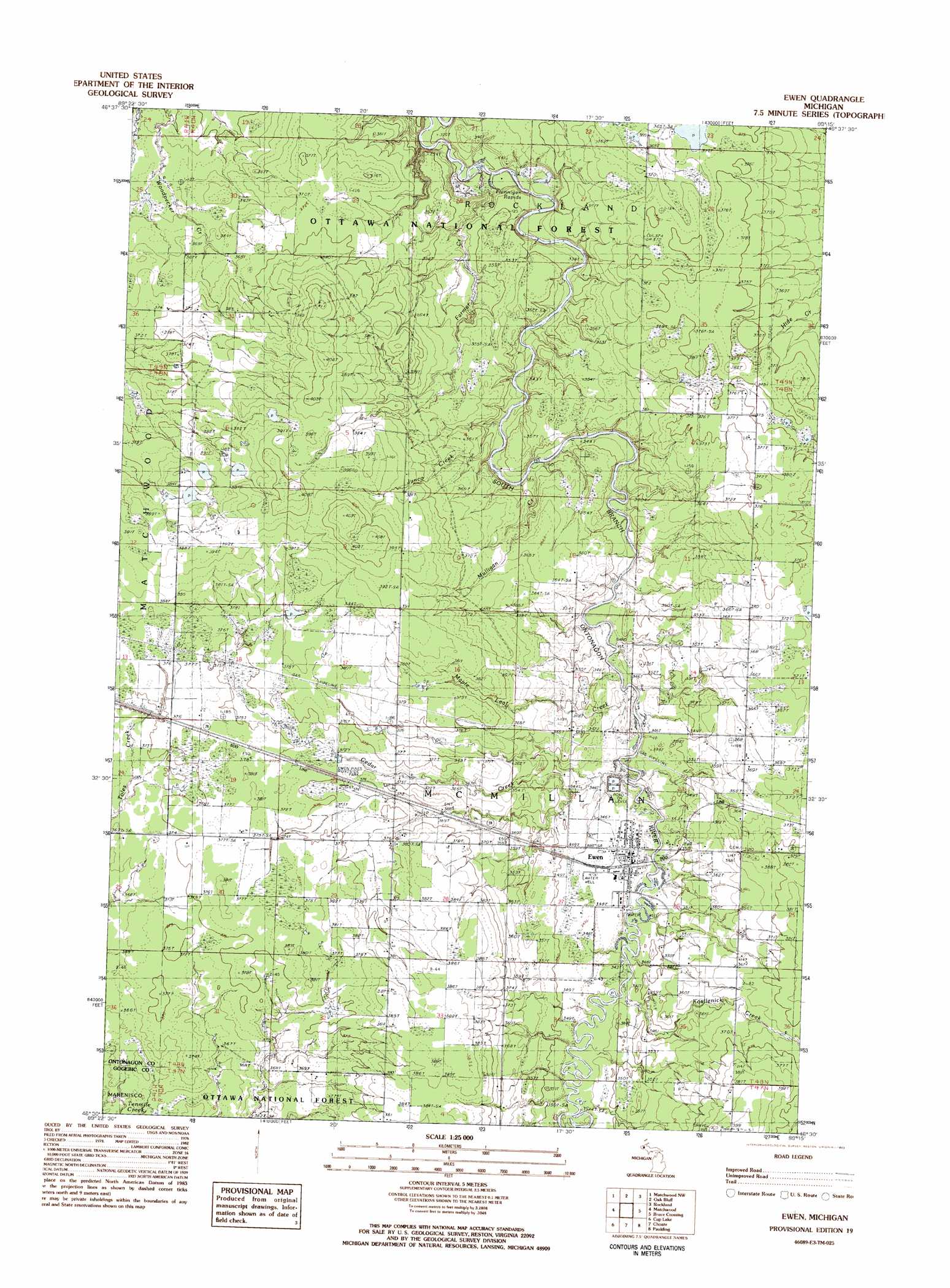
USGS Topo Quad 46089e3 - 1:25,000 scale
| Topo Map Name: | Ewen |
| USGS Topo Quad ID: | 46089e3 |
| Print Size: | ca. 21 1/4" wide x 27" high |
| Southeast Coordinates: | 46.5° N latitude / 89.25° W longitude |
| Map Center Coordinates: | 46.5625° N latitude / 89.3125° W longitude |
| U.S. State: | MI |
| Filename: | l46089e3.jpg |
| Download Map JPG Image: | Ewen topo map 1:25,000 scale |
| Map Type: | Topographic |
| Topo Series: | 7.5´ |
| Map Scale: | 1:25,000 |
| Source of Map Images: | United States Geological Survey (USGS) |
| Alternate Map Versions: |
Ewen MI 1982, updated 1983 Download PDF Buy paper map |
| FStopo: | US Forest Service topo Ewen is available: Download FStopo PDF Download FStopo TIF |
1:24,000 Topo Quads surrounding Ewen
White Pine |
Green |
Ontonagon South |
Firesteel |
Greenland |
Bergland Ne |
Matchwood Nw |
Oak Bluff |
Rockland |
Mckeever |
Bergland |
Matchwood |
Ewen |
Bruce Crossing |
Paynesville |
Marshall Creek |
Cup Lake |
Choate |
Paulding |
Trout Creek |
Gogebic |
Thayer |
Beaton |
Watersmeet |
Fuller |
> Back to 46089e1 at 1:100,000 scale
> Back to 46088a1 at 1:250,000 scale
> Back to U.S. Topo Maps home
Ewen topo map: Gazetteer
Ewen: Parks
Ewen Pines Roadside Park elevation 371m 1217′Ewen: Populated Places
Ewen elevation 346m 1135′Ewen: Post Offices
Ewen Post Office elevation 346m 1135′Ewen: Rapids
Flannigan Rapids elevation 324m 1062′Ewen: Streams
Cedar Creek elevation 338m 1108′Farmer Creek elevation 322m 1056′
Junco Creek elevation 338m 1108′
Kostlenick Creek elevation 343m 1125′
Maple Leaf Creek elevation 340m 1115′
Mulligan Creek elevation 336m 1102′
Wanagan Creek elevation 356m 1167′
Ewen digital topo map on disk
Buy this Ewen topo map showing relief, roads, GPS coordinates and other geographical features, as a high-resolution digital map file on DVD: