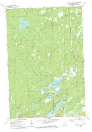
Lake Of The Falls Topo Map Wisconsin
To zoom in, hover over the map of Lake Of The Falls
USGS Topo Quad 46090b2 - 1:24,000 scale
| Topo Map Name: | Lake Of The Falls |
| USGS Topo Quad ID: | 46090b2 |
| Print Size: | ca. 21 1/4" wide x 27" high |
| Southeast Coordinates: | 46.125° N latitude / 90.125° W longitude |
| Map Center Coordinates: | 46.1875° N latitude / 90.1875° W longitude |
| U.S. State: | WI |
| Filename: | o46090b2.jpg |
| Download Map JPG Image: | Lake Of The Falls topo map 1:24,000 scale |
| Map Type: | Topographic |
| Topo Series: | 7.5´ |
| Map Scale: | 1:24,000 |
| Source of Map Images: | United States Geological Survey (USGS) |
| Alternate Map Versions: |
Lake of The Falls WI 1973, updated 1976 Download PDF Buy paper map Lake of the Falls WI 2010 Download PDF Buy paper map Lake of the Falls WI 2013 Download PDF Buy paper map Lake of the Falls WI 2015 Download PDF Buy paper map |
1:24,000 Topo Quads surrounding Lake Of The Falls
> Back to 46090a1 at 1:100,000 scale
> Back to 46090a1 at 1:250,000 scale
> Back to U.S. Topo Maps home
Lake Of The Falls topo map: Gazetteer
Lake Of The Falls: Dams
Lake of the Falls Dam elevation 488m 1601′Lake Of The Falls: Lakes
Altman Lake elevation 483m 1584′Davis Lake elevation 486m 1594′
Dead Horse Lake elevation 479m 1571′
Dollar Lake elevation 480m 1574′
First Black Lake elevation 480m 1574′
Fox Lake elevation 482m 1581′
Kyle Lake elevation 479m 1571′
Lake of the Falls elevation 480m 1574′
Lipp Lake elevation 482m 1581′
Little Moose Lake elevation 507m 1663′
Moose Lake elevation 506m 1660′
Popko Lake elevation 487m 1597′
Second Black Lake elevation 480m 1574′
Third Black Lake elevation 480m 1574′
Weber Lake elevation 486m 1594′
Lake Of The Falls: Parks
Lake of the Falls County Park elevation 481m 1578′Moose Lake State Natural Area elevation 508m 1666′
Lake Of The Falls: Populated Places
Carter elevation 494m 1620′Lake Of The Falls: Reservoirs
Lake of the Falls 139 elevation 488m 1601′Lake Of The Falls: Streams
Dollar Creek elevation 482m 1581′Drinkwine Creek elevation 480m 1574′
Little Turtle River elevation 479m 1571′
Moose Creek elevation 480m 1574′
Weber Creek elevation 484m 1587′
Lake Of The Falls digital topo map on disk
Buy this Lake Of The Falls topo map showing relief, roads, GPS coordinates and other geographical features, as a high-resolution digital map file on DVD:


