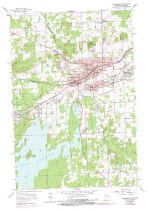
Ironwood Topo Map Wisconsin
To zoom in, hover over the map of Ironwood
USGS Topo Quad 46090d2 - 1:24,000 scale
| Topo Map Name: | Ironwood |
| USGS Topo Quad ID: | 46090d2 |
| Print Size: | ca. 21 1/4" wide x 27" high |
| Southeast Coordinates: | 46.375° N latitude / 90.125° W longitude |
| Map Center Coordinates: | 46.4375° N latitude / 90.1875° W longitude |
| U.S. States: | WI, MI |
| Filename: | o46090d2.jpg |
| Download Map JPG Image: | Ironwood topo map 1:24,000 scale |
| Map Type: | Topographic |
| Topo Series: | 7.5´ |
| Map Scale: | 1:24,000 |
| Source of Map Images: | United States Geological Survey (USGS) |
| Alternate Map Versions: |
Ironwood MI 1955, updated 1957 Download PDF Buy paper map Ironwood MI 1955, updated 1973 Download PDF Buy paper map Ironwood MI 1955, updated 1977 Download PDF Buy paper map Ironwood MI 1955, updated 1977 Download PDF Buy paper map Ironwood MI 1955, updated 1997 Download PDF Buy paper map Ironwood MI 2011 Download PDF Buy paper map Ironwood MI 2014 Download PDF Buy paper map Ironwood MI 2016 Download PDF Buy paper map |
1:24,000 Topo Quads surrounding Ironwood
> Back to 46090a1 at 1:100,000 scale
> Back to 46090a1 at 1:250,000 scale
> Back to U.S. Topo Maps home
Ironwood topo map: Gazetteer
Ironwood: Channels
Gile Flowage elevation 454m 1489′Ironwood: Dams
Gile Reservoir 2WP271 Dam elevation 451m 1479′La Blonde G1679 Dam elevation 432m 1417′
Ironwood: Falls
Interstate Falls elevation 414m 1358′Peterson Falls elevation 420m 1377′
Ironwood: Lakes
Lake Lavina elevation 454m 1489′Ironwood: Mines
Cary Mine elevation 472m 1548′Ironwood: Parks
Curry House Historical Marker elevation 474m 1555′Curry Park elevation 445m 1459′
Downtown Ironwood Pocket Park elevation 461m 1512′
Hiawatha Park elevation 488m 1601′
Ironwood City Hall Historical Marker elevation 458m 1502′
Kuitunen Park elevation 459m 1505′
Longyear Park elevation 450m 1476′
Memorial Field elevation 441m 1446′
Mount Zion Park elevation 458m 1502′
Newport Hill Historical Marker elevation 518m 1699′
Norrie Park elevation 457m 1499′
Norrie Park Historical Marker elevation 456m 1496′
Ironwood: Populated Places
Aurora elevation 482m 1581′Germania elevation 457m 1499′
Gile elevation 456m 1496′
Hillcrest elevation 420m 1377′
Hurley elevation 456m 1496′
Ironwood elevation 459m 1505′
Jessieville elevation 509m 1669′
Montreal elevation 487m 1597′
Norrie elevation 484m 1587′
Orva elevation 437m 1433′
Van Buskirk elevation 463m 1519′
Ironwood: Post Offices
Hillcrest Post Office (historical) elevation 420m 1377′Ironwood Post Office elevation 460m 1509′
Jessieville Post Office (historical) elevation 509m 1669′
Ironwood: Reservoirs
Gile Flowage 70 elevation 451m 1479′La Blonde Flowage 1 elevation 432m 1417′
Ironwood: Streams
Cominski Creek elevation 410m 1345′Fifield Creek elevation 454m 1489′
Linnunpuro Creek elevation 454m 1489′
Whiskers Creek elevation 455m 1492′
Whitney Creek elevation 460m 1509′
Ironwood: Summits
Mount Zion elevation 525m 1722′Ironwood: Swamps
Reins Swamp elevation 455m 1492′Ironwood digital topo map on disk
Buy this Ironwood topo map showing relief, roads, GPS coordinates and other geographical features, as a high-resolution digital map file on DVD:


