Holyoke Sw Topo Map Minnesota
To zoom in, hover over the map of Holyoke Sw
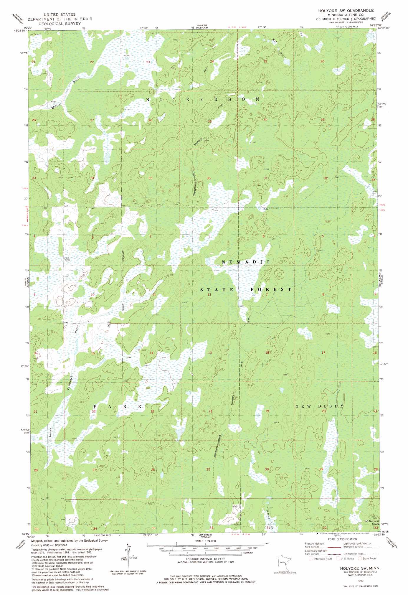
USGS Topo Quad 46092c4 - 1:24,000 scale
| Topo Map Name: | Holyoke Sw |
| USGS Topo Quad ID: | 46092c4 |
| Print Size: | ca. 21 1/4" wide x 27" high |
| Southeast Coordinates: | 46.25° N latitude / 92.375° W longitude |
| Map Center Coordinates: | 46.3125° N latitude / 92.4375° W longitude |
| U.S. State: | MN |
| Filename: | o46092c4.jpg |
| Download Map JPG Image: | Holyoke Sw topo map 1:24,000 scale |
| Map Type: | Topographic |
| Topo Series: | 7.5´ |
| Map Scale: | 1:24,000 |
| Source of Map Images: | United States Geological Survey (USGS) |
| Alternate Map Versions: |
Holyoke SW MN 1983, updated 1983 Download PDF Buy paper map Holyoke SW MN 2010 Download PDF Buy paper map Holyoke SW MN 2013 Download PDF Buy paper map Holyoke SW MN 2016 Download PDF Buy paper map |
1:24,000 Topo Quads surrounding Holyoke Sw
Barnum |
Atkinson |
Wrenshall |
Frogner |
Borea |
Hanging Horn Lake |
Nickerson |
Holyoke |
Foxboro |
Patzau |
Bruno |
Kerrick |
Holyoke Sw |
Black Lake |
Moose Junction |
Askov Lookout Tower |
Duxbury |
Ox Creek |
Cloverton |
Dairyland |
Cloverdale |
Wilbur Lake |
Danbury West |
Danbury East |
Webb Lake |
> Back to 46092a1 at 1:100,000 scale
> Back to 46092a1 at 1:250,000 scale
> Back to U.S. Topo Maps home
Holyoke Sw digital topo map on disk
Buy this Holyoke Sw topo map showing relief, roads, GPS coordinates and other geographical features, as a high-resolution digital map file on DVD: