Nickerson Topo Map Minnesota
To zoom in, hover over the map of Nickerson
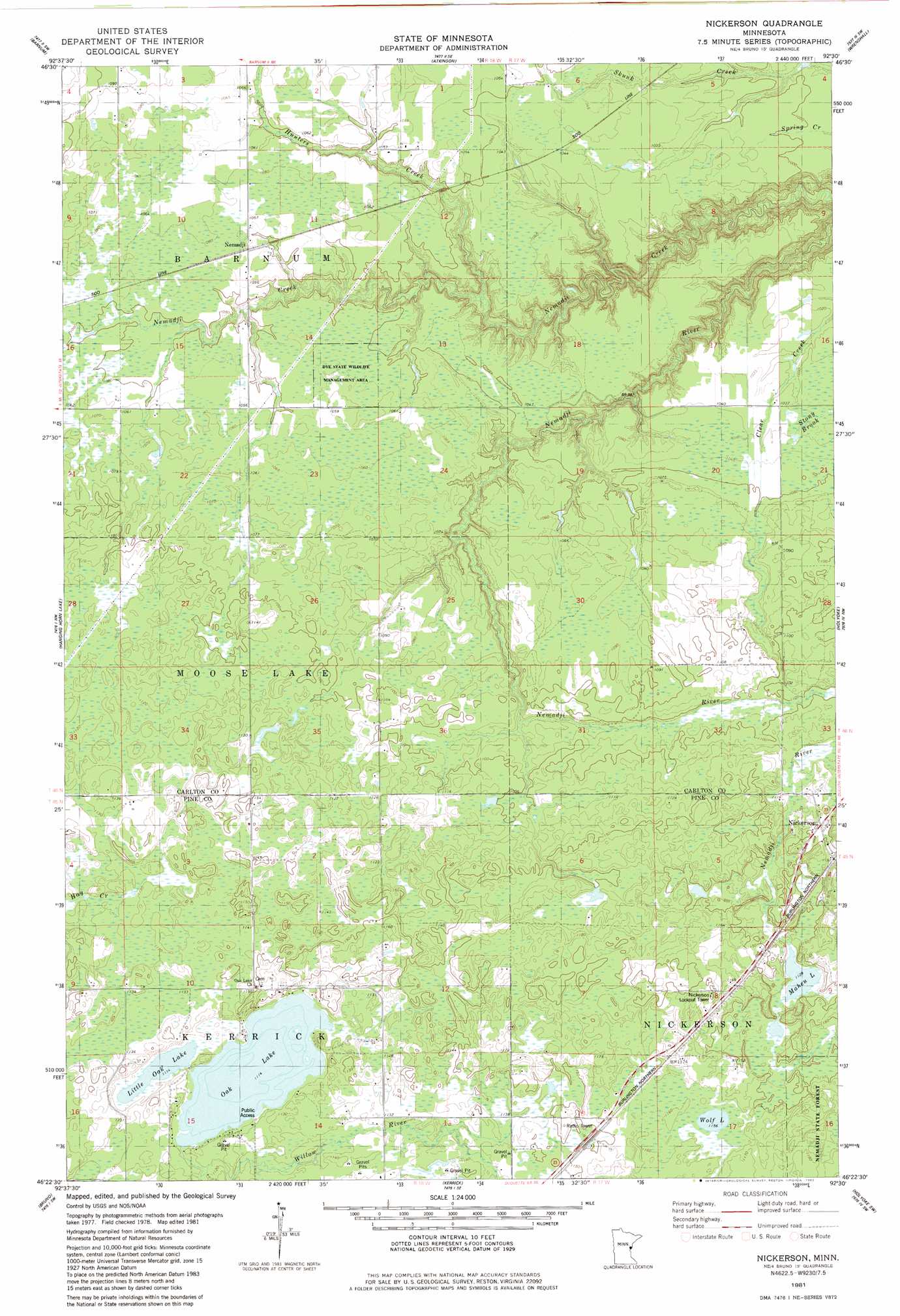
USGS Topo Quad 46092d5 - 1:24,000 scale
| Topo Map Name: | Nickerson |
| USGS Topo Quad ID: | 46092d5 |
| Print Size: | ca. 21 1/4" wide x 27" high |
| Southeast Coordinates: | 46.375° N latitude / 92.5° W longitude |
| Map Center Coordinates: | 46.4375° N latitude / 92.5625° W longitude |
| U.S. State: | MN |
| Filename: | o46092d5.jpg |
| Download Map JPG Image: | Nickerson topo map 1:24,000 scale |
| Map Type: | Topographic |
| Topo Series: | 7.5´ |
| Map Scale: | 1:24,000 |
| Source of Map Images: | United States Geological Survey (USGS) |
| Alternate Map Versions: |
Nickerson MN 1981, updated 1982 Download PDF Buy paper map Nickerson MN 2010 Download PDF Buy paper map Nickerson MN 2013 Download PDF Buy paper map Nickerson MN 2016 Download PDF Buy paper map |
1:24,000 Topo Quads surrounding Nickerson
Cromwell East |
Sawyer |
Iverson |
Cloquet |
Esko |
Cromwell Se |
Barnum |
Atkinson |
Wrenshall |
Frogner |
Moose Lake |
Hanging Horn Lake |
Nickerson |
Holyoke |
Foxboro |
Willow River |
Bruno |
Kerrick |
Holyoke Sw |
Black Lake |
Sandstone North |
Askov Lookout Tower |
Duxbury |
Ox Creek |
Cloverton |
> Back to 46092a1 at 1:100,000 scale
> Back to 46092a1 at 1:250,000 scale
> Back to U.S. Topo Maps home
Nickerson topo map: Gazetteer
Nickerson: Dams
Hanson Dam elevation 300m 984′Nickerson: Lakes
Little Oak Lake elevation 338m 1108′Maheu Lake elevation 342m 1122′
Oak Lake elevation 338m 1108′
Wolf Lake elevation 351m 1151′
Nickerson: Parks
Dye State Wildlife Management Area elevation 322m 1056′Storlie Wildlife Management Area elevation 353m 1158′
Nickerson: Populated Places
Nemadji elevation 323m 1059′Nickerson: Post Offices
Nemadji Post Office elevation 322m 1056′Nickerson: Streams
Hunters Creek elevation 297m 974′Nickerson digital topo map on disk
Buy this Nickerson topo map showing relief, roads, GPS coordinates and other geographical features, as a high-resolution digital map file on DVD: