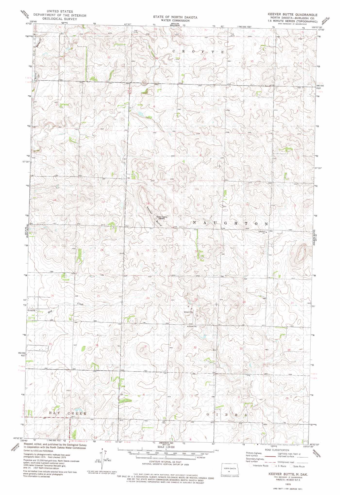
Keever Butte Topo Map North Dakota
To zoom in, hover over the map of Keever Butte
USGS Topo Quad 46100h6 - 1:24,000 scale
| Topo Map Name: | Keever Butte |
| USGS Topo Quad ID: | 46100h6 |
| Print Size: | ca. 21 1/4" wide x 27" high |
| Southeast Coordinates: | 46.875° N latitude / 100.625° W longitude |
| Map Center Coordinates: | 46.9375° N latitude / 100.6875° W longitude |
| U.S. State: | ND |
| Filename: | O46100H6.jpg |
| Download Map JPG Image: | Keever Butte topo map 1:24,000 scale |
| Map Type: | Topographic |
| Topo Series: | 7.5´ |
| Map Scale: | 1:24,000 |
| Source of Map Images: | United States Geological Survey (USGS) |
| Alternate Map Versions: |
Keever Butte ND 1975, updated 1977 Download PDF Buy paper map Keever Butte ND 2011 Download PDF Buy paper map Keever Butte ND 2014 Download PDF Buy paper map |
1:24,000 Topo Quads surrounding Keever Butte
Sanger |
Wilton |
Grass Lake |
Regan |
Canfield Lake |
Price |
Wilton Se |
Baldwin |
Regan Se |
Wing Sw |
Harmon |
Burnt Butte |
Keever Butte |
Solberg Butte |
Mckenzie Nw |
Mandan |
Bismarck |
Menoken Sw |
Menoken |
Mckenzie |
Lynwood |
Schmidt |
Sugarloaf Butte |
Huff Ne |
Moffit Nw |
> Back to 46100e1 at 1:100,000 scale
> Back to 46100a1 at 1:250,000 scale
> Back to U.S. Topo Maps home
Keever Butte digital topo map on disk
Buy this Keever Butte topo map showing relief, roads, GPS coordinates and other geographical features, as a high-resolution digital map file on DVD:
Eastern North Dakota & Eastern South Dakota
Buy digital topo maps: Eastern North Dakota & Eastern South Dakota