Mineral Ridge Topo Map Montana
To zoom in, hover over the map of Mineral Ridge
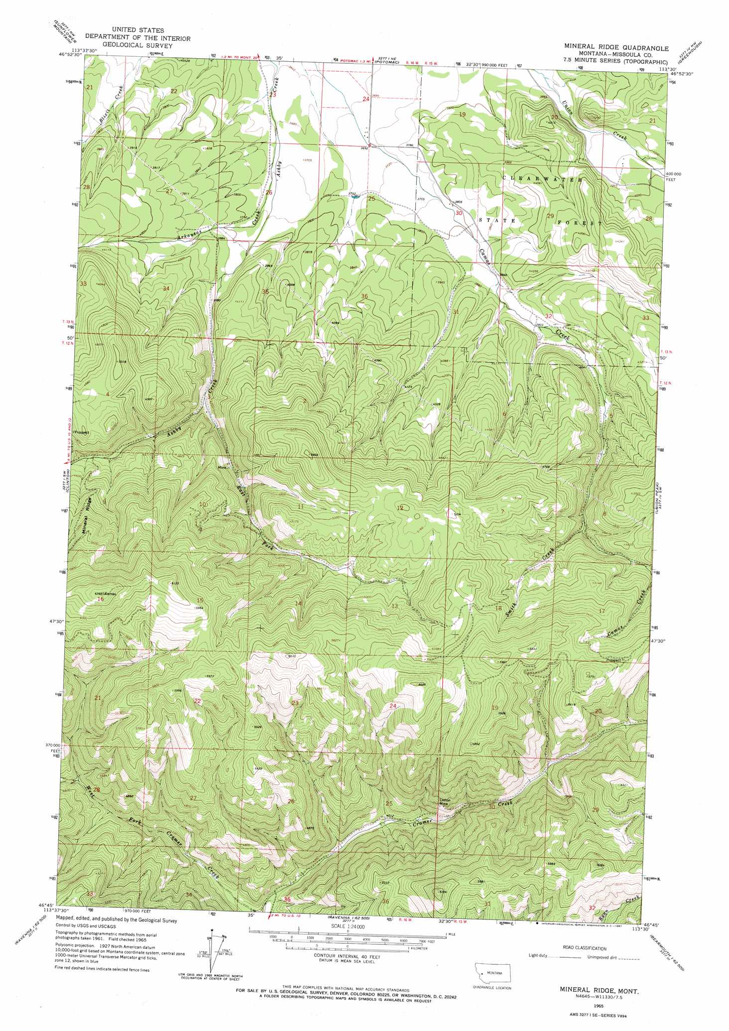
USGS Topo Quad 46113g5 - 1:24,000 scale
| Topo Map Name: | Mineral Ridge |
| USGS Topo Quad ID: | 46113g5 |
| Print Size: | ca. 21 1/4" wide x 27" high |
| Southeast Coordinates: | 46.75° N latitude / 113.5° W longitude |
| Map Center Coordinates: | 46.8125° N latitude / 113.5625° W longitude |
| U.S. State: | MT |
| Filename: | o46113g5.jpg |
| Download Map JPG Image: | Mineral Ridge topo map 1:24,000 scale |
| Map Type: | Topographic |
| Topo Series: | 7.5´ |
| Map Scale: | 1:24,000 |
| Source of Map Images: | United States Geological Survey (USGS) |
| Alternate Map Versions: |
Mineral Ridge MT 1965, updated 1967 Download PDF Buy paper map Mineral Ridge MT 2011 Download PDF Buy paper map Mineral Ridge MT 2014 Download PDF Buy paper map |
1:24,000 Topo Quads surrounding Mineral Ridge
Wapiti Lake |
Gold Creek Peak |
Belmont Point |
Salmon Lake |
Woodworth |
Blue Point |
Sunflower Mountain |
Potomac |
Greenough |
Bata Mountain |
Bonner |
Clinton |
Mineral Ridge |
Union Peak |
Elevation Mountain |
Elk Mountain |
Iris Point |
Ravenna |
Medicine Tree Hill |
Bearmouth |
Cleveland Mountain |
Grizzly Point |
Spink Point |
Harvey Point |
Nirling Hill |
> Back to 46113e1 at 1:100,000 scale
> Back to 46112a1 at 1:250,000 scale
> Back to U.S. Topo Maps home
Mineral Ridge topo map: Gazetteer
Mineral Ridge: Airports
Camas Airport elevation 1171m 3841′Mineral Ridge: Mines
Charcoal Mine elevation 1338m 4389′Chloride Mine elevation 1687m 5534′
Linton Mine elevation 1571m 5154′
Linton Mine elevation 1383m 4537′
SW Section 10 Mine elevation 1483m 4865′
Mineral Ridge: Ridges
Mineral Ridge elevation 1567m 5141′Mineral Ridge: Streams
Arkansas Creek elevation 1123m 3684′Ashby Creek elevation 1228m 4028′
Smith Creek elevation 1335m 4379′
Mineral Ridge digital topo map on disk
Buy this Mineral Ridge topo map showing relief, roads, GPS coordinates and other geographical features, as a high-resolution digital map file on DVD: