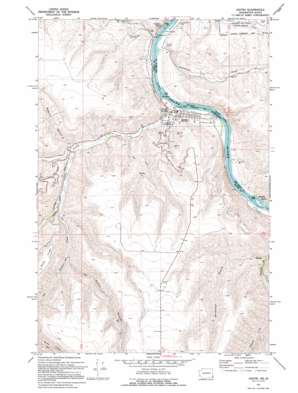
Asotin Topo Map Washington
To zoom in, hover over the map of Asotin
USGS Topo Quad 46117c1 - 1:24,000 scale
| Topo Map Name: | Asotin |
| USGS Topo Quad ID: | 46117c1 |
| Print Size: | ca. 21 1/4" wide x 27" high |
| Southeast Coordinates: | 46.25° N latitude / 117° W longitude |
| Map Center Coordinates: | 46.3125° N latitude / 117.0625° W longitude |
| U.S. States: | WA, ID |
| Filename: | o46117c1.jpg |
| Download Map JPG Image: | Asotin topo map 1:24,000 scale |
| Map Type: | Topographic |
| Topo Series: | 7.5´ |
| Map Scale: | 1:24,000 |
| Source of Map Images: | United States Geological Survey (USGS) |
| Alternate Map Versions: |
Asotin WA 1971, updated 1974 Download PDF Buy paper map Asotin WA 1971, updated 1995 Download PDF Buy paper map Asotin WA 2011 Download PDF Buy paper map Asotin WA 2014 Download PDF Buy paper map |
1:24,000 Topo Quads surrounding Asotin
> Back to 46117a1 at 1:100,000 scale
> Back to 46116a1 at 1:250,000 scale
> Back to U.S. Topo Maps home
Asotin topo map: Gazetteer
Asotin: Airports
Lewiston Airport elevation 436m 1430′Asotin: Cliffs
Swallows Nest elevation 228m 748′Asotin: Dams
Asotin Dam elevation 479m 1571′Asotin: Parks
Airway Park elevation 440m 1443′Chief Looking Glass Park elevation 230m 754′
Hells Gate State Recreation Area elevation 257m 843′
Asotin: Populated Places
Asotin elevation 244m 800′Jerry elevation 296m 971′
Asotin: Rapids
Tenmile Rapids elevation 229m 751′Tenmile Rapids elevation 230m 754′
Asotin: Ridges
Ayers Ridge elevation 558m 1830′Asotin: Streams
Asotin Creek elevation 226m 741′George Creek elevation 283m 928′
Pintler Creek elevation 326m 1069′
Tammany Creek elevation 226m 741′
Asotin: Valleys
Ayers Gulch elevation 401m 1315′Beckman Gulch elevation 294m 964′
Maguire Gulch elevation 293m 961′
Asotin digital topo map on disk
Buy this Asotin topo map showing relief, roads, GPS coordinates and other geographical features, as a high-resolution digital map file on DVD:


