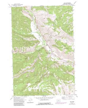
Nile Topo Map Washington
To zoom in, hover over the map of Nile
USGS Topo Quad 46120g8 - 1:24,000 scale
| Topo Map Name: | Nile |
| USGS Topo Quad ID: | 46120g8 |
| Print Size: | ca. 21 1/4" wide x 27" high |
| Southeast Coordinates: | 46.75° N latitude / 120.875° W longitude |
| Map Center Coordinates: | 46.8125° N latitude / 120.9375° W longitude |
| U.S. State: | WA |
| Filename: | o46120g8.jpg |
| Download Map JPG Image: | Nile topo map 1:24,000 scale |
| Map Type: | Topographic |
| Topo Series: | 7.5´ |
| Map Scale: | 1:24,000 |
| Source of Map Images: | United States Geological Survey (USGS) |
| Alternate Map Versions: |
Nile WA 1971, updated 1973 Download PDF Buy paper map Nile WA 1971, updated 1987 Download PDF Buy paper map Nile WA 2000, updated 2001 Download PDF Buy paper map Nile WA 2011 Download PDF Buy paper map Nile WA 2014 Download PDF Buy paper map |
| FStopo: | US Forest Service topo Nile is available: Download FStopo PDF Download FStopo TIF |
1:24,000 Topo Quads surrounding Nile
> Back to 46120e1 at 1:100,000 scale
> Back to 46120a1 at 1:250,000 scale
> Back to U.S. Topo Maps home
Nile topo map: Gazetteer
Nile: Flats
Carrol Flats elevation 965m 3166′Sanford Pasture elevation 971m 3185′
Nile: Lakes
Little Mud Lake elevation 1252m 4107′Nile: Populated Places
Nile elevation 611m 2004′Nile: Ridges
Bethel Ridge elevation 1478m 4849′Cowpuncher Ridge elevation 1274m 4179′
Nile: Springs
Box Spring elevation 1377m 4517′Nile: Streams
Benton Creek elevation 671m 2201′Dry Creek elevation 605m 1984′
Little Rattlesnake Creek elevation 627m 2057′
Nile Creek elevation 609m 1998′
Rattlesnake Creek elevation 597m 1958′
Nile: Summits
Eagle Rock elevation 614m 2014′Nile: Valleys
Carmack Canyon elevation 589m 1932′Garrett Canyon elevation 632m 2073′
Johnson Canyon elevation 640m 2099′
Logger Canyon elevation 657m 2155′
Meloy Canyon elevation 577m 1893′
Nile digital topo map on disk
Buy this Nile topo map showing relief, roads, GPS coordinates and other geographical features, as a high-resolution digital map file on DVD:


