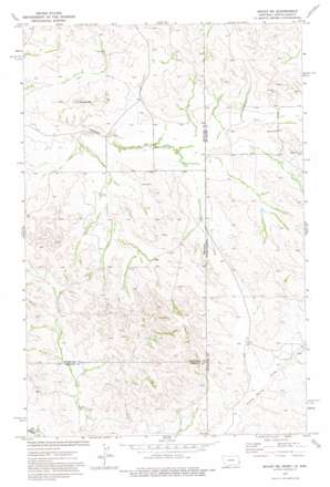
Skaar Ne Topo Map Montana
To zoom in, hover over the map of Skaar Ne
USGS Topo Quad 47104d1 - 1:24,000 scale
| Topo Map Name: | Skaar Ne |
| USGS Topo Quad ID: | 47104d1 |
| Print Size: | ca. 21 1/4" wide x 27" high |
| Southeast Coordinates: | 47.375° N latitude / 104° W longitude |
| Map Center Coordinates: | 47.4375° N latitude / 104.0625° W longitude |
| U.S. States: | MT, ND |
| Filename: | o47104d1.jpg |
| Download Map JPG Image: | Skaar Ne topo map 1:24,000 scale |
| Map Type: | Topographic |
| Topo Series: | 7.5´ |
| Map Scale: | 1:24,000 |
| Source of Map Images: | United States Geological Survey (USGS) |
| Alternate Map Versions: |
Skaar NE MT 1974, updated 1977 Download PDF Buy paper map Skaar NE MT 1974, updated 1977 Download PDF Buy paper map Skaar NE MT 1997, updated 2001 Download PDF Buy paper map Skaar NE MT 2011 Download PDF Buy paper map Skaar NE MT 2014 Download PDF Buy paper map |
| FStopo: | US Forest Service topo Skaar NE is available: Download FStopo PDF Download FStopo TIF |
1:24,000 Topo Quads surrounding Skaar Ne
> Back to 47104a1 at 1:100,000 scale
> Back to 47104a1 at 1:250,000 scale
> Back to U.S. Topo Maps home
Skaar Ne topo map: Gazetteer
Skaar Ne: Post Offices
Clark Post Office (historical) elevation 696m 2283′Skaar Ne: Summits
Bull Butte elevation 756m 2480′Skaar Ne: Wells
19N60E17CD__01 Well elevation 691m 2267′19N60E27AC__01 Well elevation 695m 2280′
19N60E28BA__01 Well elevation 690m 2263′
20N60E17AD__01 Well elevation 707m 2319′
Thompson Headquarter Water Well elevation 724m 2375′
Thompson Headquarter Water Well elevation 715m 2345′
Skaar Ne digital topo map on disk
Buy this Skaar Ne topo map showing relief, roads, GPS coordinates and other geographical features, as a high-resolution digital map file on DVD:
Eastern Montana & Western North Dakota
Buy digital topo maps: Eastern Montana & Western North Dakota


