Odland Dam Nw Topo Map Montana
To zoom in, hover over the map of Odland Dam Nw
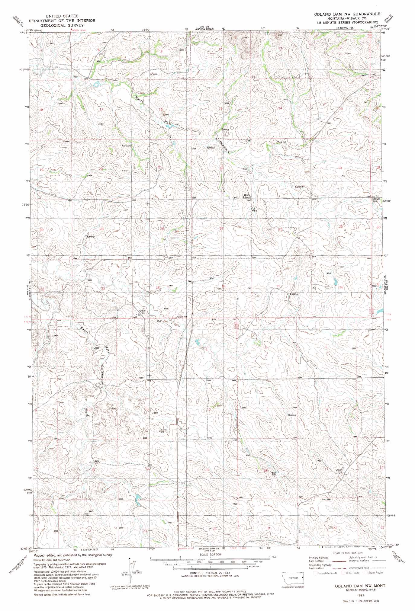
USGS Topo Quad 47104b2 - 1:24,000 scale
| Topo Map Name: | Odland Dam Nw |
| USGS Topo Quad ID: | 47104b2 |
| Print Size: | ca. 21 1/4" wide x 27" high |
| Southeast Coordinates: | 47.125° N latitude / 104.125° W longitude |
| Map Center Coordinates: | 47.1875° N latitude / 104.1875° W longitude |
| U.S. State: | MT |
| Filename: | o47104b2.jpg |
| Download Map JPG Image: | Odland Dam Nw topo map 1:24,000 scale |
| Map Type: | Topographic |
| Topo Series: | 7.5´ |
| Map Scale: | 1:24,000 |
| Source of Map Images: | United States Geological Survey (USGS) |
| Alternate Map Versions: |
Odland Dam NW MT 1982, updated 1983 Download PDF Buy paper map Odland Dam NW MT 2011 Download PDF Buy paper map Odland Dam NW MT 2014 Download PDF Buy paper map |
1:24,000 Topo Quads surrounding Odland Dam Nw
Knife River Mine |
Savage |
Skaar Nw |
Skaar Ne |
Squaw Gap |
Savage Sw |
Savage Se |
Parson Creek |
Skaar |
Trotters |
Cluster Buttes Nw |
Cluster Buttes |
Odland Dam Nw |
Odland Dam Ne |
Hootowl Creek West |
Cluster Buttes Sw |
Cluster Buttes Se |
Odland Dam Sw |
Odland Dam |
Hootowl Creek Sw |
Hodges |
Freeman Creek |
Wibaux |
Beach West |
Beach East |
> Back to 47104a1 at 1:100,000 scale
> Back to 47104a1 at 1:250,000 scale
> Back to U.S. Topo Maps home
Odland Dam Nw topo map: Gazetteer
Odland Dam Nw: Populated Places
Been (historical) elevation 768m 2519′Odland Dam Nw: Post Offices
Been Post Office (historical) elevation 768m 2519′Odland Dam Nw: Wells
16N59E13CCB_01 Well elevation 789m 2588′17N59E14ACBD01 Well elevation 782m 2565′
17N59E15AC__01 Well elevation 774m 2539′
17N59E23BACD01 Well elevation 784m 2572′
17N59E24BCC_01 Well elevation 784m 2572′
17N59E26DBA_01 Well elevation 790m 2591′
17N59E36BA__01 Well elevation 790m 2591′
Odland Dam Nw digital topo map on disk
Buy this Odland Dam Nw topo map showing relief, roads, GPS coordinates and other geographical features, as a high-resolution digital map file on DVD:
Eastern Montana & Western North Dakota
Buy digital topo maps: Eastern Montana & Western North Dakota