Edwards Topo Map Montana
To zoom in, hover over the map of Edwards
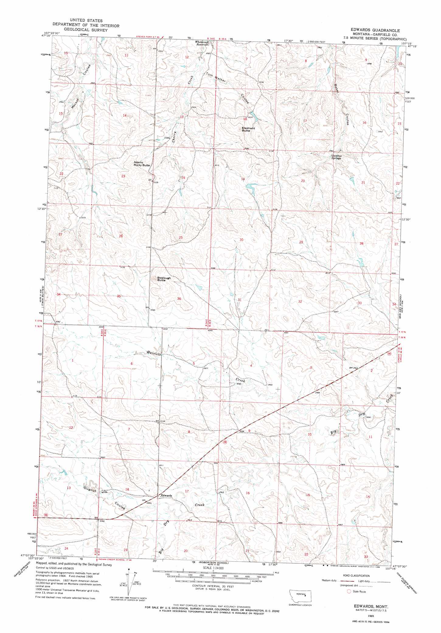
USGS Topo Quad 47107b3 - 1:24,000 scale
| Topo Map Name: | Edwards |
| USGS Topo Quad ID: | 47107b3 |
| Print Size: | ca. 21 1/4" wide x 27" high |
| Southeast Coordinates: | 47.125° N latitude / 107.25° W longitude |
| Map Center Coordinates: | 47.1875° N latitude / 107.3125° W longitude |
| U.S. State: | MT |
| Filename: | o47107b3.jpg |
| Download Map JPG Image: | Edwards topo map 1:24,000 scale |
| Map Type: | Topographic |
| Topo Series: | 7.5´ |
| Map Scale: | 1:24,000 |
| Source of Map Images: | United States Geological Survey (USGS) |
| Alternate Map Versions: |
Edwards MT 1965, updated 1968 Download PDF Buy paper map Edwards MT 2011 Download PDF Buy paper map Edwards MT 2014 Download PDF Buy paper map |
1:24,000 Topo Quads surrounding Edwards
Spring Creek School |
Blackfoot School |
Brusett |
Moonlight Creek |
Biscuit Butte |
Hay Coulee |
Steve Forks Sw |
Steve Forks |
Smoky Butte Creek |
Smoky Butte |
Coffin Butte |
Twin Buttes |
Edwards |
Big Dry School |
Ziegele |
Cox Butte |
Sand Springs |
Robertson School |
Van Dusen Spring |
Fig Mountain |
Mcwilliams Springs |
Mcginnis Butte |
Emma Butte |
School Butte |
Kramer Ranch |
> Back to 47107a1 at 1:100,000 scale
> Back to 47106a1 at 1:250,000 scale
> Back to U.S. Topo Maps home
Edwards topo map: Gazetteer
Edwards: Dams
Cherry Number 1 Dam elevation 918m 3011′Edwards: Populated Places
Anad (historical) elevation 899m 2949′Edwards elevation 916m 3005′
Edwards: Post Offices
Anad Post Office (historical) elevation 899m 2949′Edwards Post Office (historical) elevation 916m 3005′
Edwards: Springs
Goodhue Springs elevation 902m 2959′Edwards: Streams
Haislett Creek elevation 887m 2910′Edwards: Summits
Adams Rocky Butte elevation 967m 3172′Boslough Butte elevation 966m 3169′
Elephant Butte elevation 950m 3116′
Edwards: Valleys
Dugout Coulee elevation 904m 2965′Tom Walker Coulee elevation 880m 2887′
Edwards digital topo map on disk
Buy this Edwards topo map showing relief, roads, GPS coordinates and other geographical features, as a high-resolution digital map file on DVD:
Eastern Montana & Western North Dakota
Buy digital topo maps: Eastern Montana & Western North Dakota