Coffin Butte Topo Map Montana
To zoom in, hover over the map of Coffin Butte
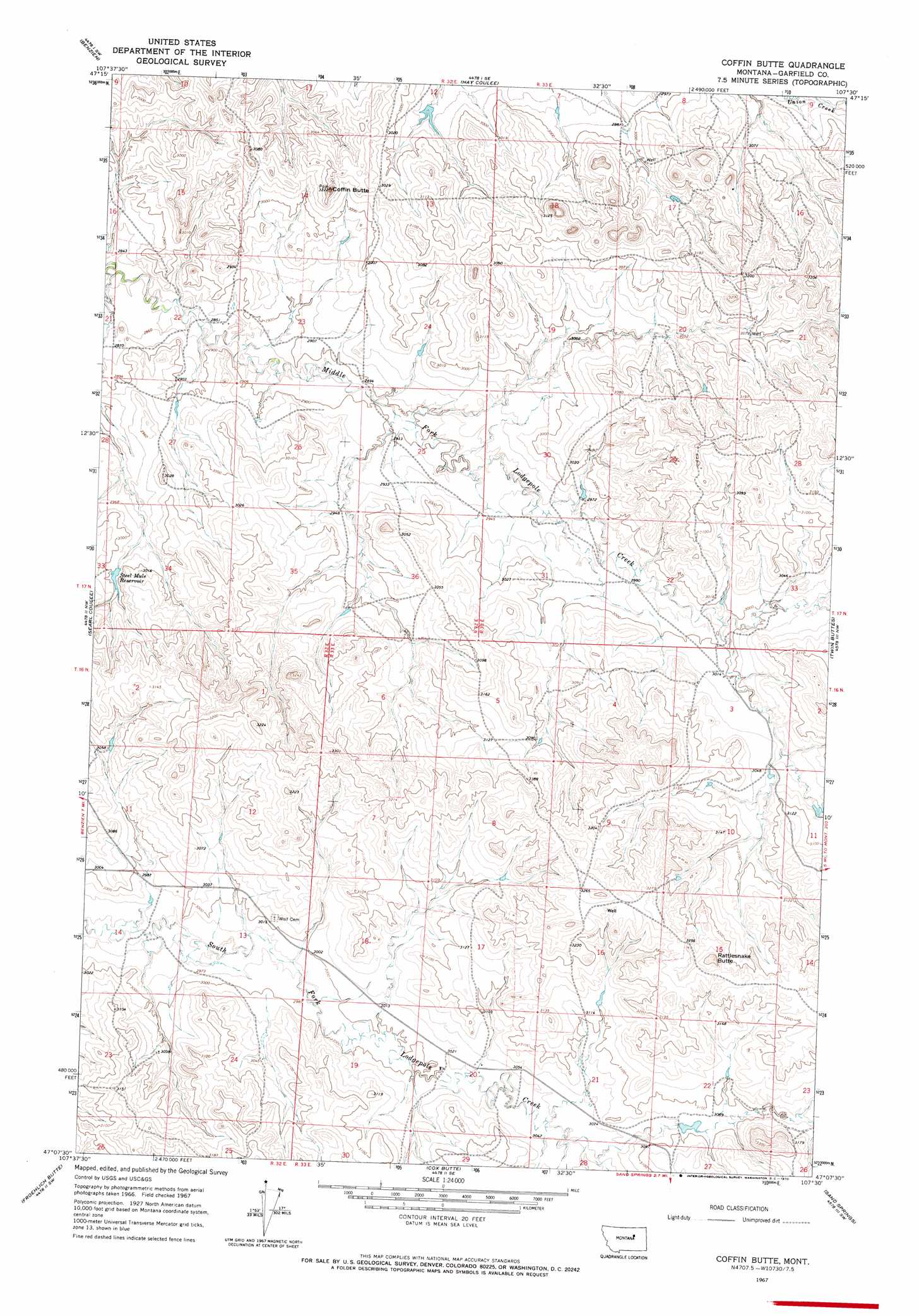
USGS Topo Quad 47107b5 - 1:24,000 scale
| Topo Map Name: | Coffin Butte |
| USGS Topo Quad ID: | 47107b5 |
| Print Size: | ca. 21 1/4" wide x 27" high |
| Southeast Coordinates: | 47.125° N latitude / 107.5° W longitude |
| Map Center Coordinates: | 47.1875° N latitude / 107.5625° W longitude |
| U.S. State: | MT |
| Filename: | o47107b5.jpg |
| Download Map JPG Image: | Coffin Butte topo map 1:24,000 scale |
| Map Type: | Topographic |
| Topo Series: | 7.5´ |
| Map Scale: | 1:24,000 |
| Source of Map Images: | United States Geological Survey (USGS) |
| Alternate Map Versions: |
Coffin Butte MT 1967, updated 1970 Download PDF Buy paper map Coffin Butte MT 2011 Download PDF Buy paper map Coffin Butte MT 2014 Download PDF Buy paper map |
1:24,000 Topo Quads surrounding Coffin Butte
Germaine Coulee East |
Cap Rock Butte |
Spring Creek School |
Blackfoot School |
Brusett |
Seventynine Coulee |
Benzien |
Hay Coulee |
Steve Forks Sw |
Steve Forks |
Lelig Coulee |
Searl Coulee |
Coffin Butte |
Twin Buttes |
Edwards |
Barney Pinnacle |
Froehlich Butte |
Cox Butte |
Sand Springs |
Robertson School |
Hill Ranch |
Dutton Ranch |
Mcwilliams Springs |
Mcginnis Butte |
Emma Butte |
> Back to 47107a1 at 1:100,000 scale
> Back to 47106a1 at 1:250,000 scale
> Back to U.S. Topo Maps home
Coffin Butte topo map: Gazetteer
Coffin Butte: Populated Places
Tindall (historical) elevation 915m 3001′Coffin Butte: Post Offices
Tindall Post Office (historical) elevation 915m 3001′Coffin Butte: Reservoirs
Steel Mule Reservoir elevation 915m 3001′Coffin Butte: Summits
Coffin Butte elevation 955m 3133′Rattlesnake Butte elevation 1010m 3313′
Coffin Butte: Wells
16N33E16ABCB01 Well elevation 996m 3267′17N33E19DBBC01 Well elevation 910m 2985′
Coffin Butte digital topo map on disk
Buy this Coffin Butte topo map showing relief, roads, GPS coordinates and other geographical features, as a high-resolution digital map file on DVD:
Eastern Montana & Western North Dakota
Buy digital topo maps: Eastern Montana & Western North Dakota