Steve Forks Sw Topo Map Montana
To zoom in, hover over the map of Steve Forks Sw
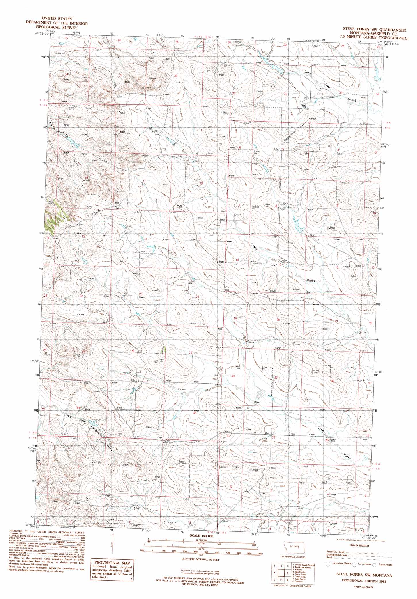
USGS Topo Quad 47107c4 - 1:24,000 scale
| Topo Map Name: | Steve Forks Sw |
| USGS Topo Quad ID: | 47107c4 |
| Print Size: | ca. 21 1/4" wide x 27" high |
| Southeast Coordinates: | 47.25° N latitude / 107.375° W longitude |
| Map Center Coordinates: | 47.3125° N latitude / 107.4375° W longitude |
| U.S. State: | MT |
| Filename: | o47107c4.jpg |
| Download Map JPG Image: | Steve Forks Sw topo map 1:24,000 scale |
| Map Type: | Topographic |
| Topo Series: | 7.5´ |
| Map Scale: | 1:24,000 |
| Source of Map Images: | United States Geological Survey (USGS) |
| Alternate Map Versions: |
Steve Forks SW MT 1983, updated 1984 Download PDF Buy paper map Steve Forks SW MT 2011 Download PDF Buy paper map Steve Forks SW MT 2014 Download PDF Buy paper map |
1:24,000 Topo Quads surrounding Steve Forks Sw
Lost Creek |
Pine Grove School |
Sawmill Creek |
Chalk Butte |
Hell Hollow |
Cap Rock Butte |
Spring Creek School |
Blackfoot School |
Brusett |
Moonlight Creek |
Benzien |
Hay Coulee |
Steve Forks Sw |
Steve Forks |
Smoky Butte Creek |
Searl Coulee |
Coffin Butte |
Twin Buttes |
Edwards |
Big Dry School |
Froehlich Butte |
Cox Butte |
Sand Springs |
Robertson School |
Van Dusen Spring |
> Back to 47107a1 at 1:100,000 scale
> Back to 47106a1 at 1:250,000 scale
> Back to U.S. Topo Maps home
Steve Forks Sw topo map: Gazetteer
Steve Forks Sw: Dams
Childers Dam elevation 926m 3038′Saylor Dam elevation 909m 2982′
Saylor Reservoir Dam elevation 923m 3028′
Steve Forks Sw: Post Offices
Karch Post Office (historical) elevation 988m 3241′Steve Forks Sw: Wells
19N34E32BD__01 Well elevation 939m 3080′Steve Forks Sw digital topo map on disk
Buy this Steve Forks Sw topo map showing relief, roads, GPS coordinates and other geographical features, as a high-resolution digital map file on DVD:
Eastern Montana & Western North Dakota
Buy digital topo maps: Eastern Montana & Western North Dakota