Lake Chaplain Topo Map Washington
To zoom in, hover over the map of Lake Chaplain
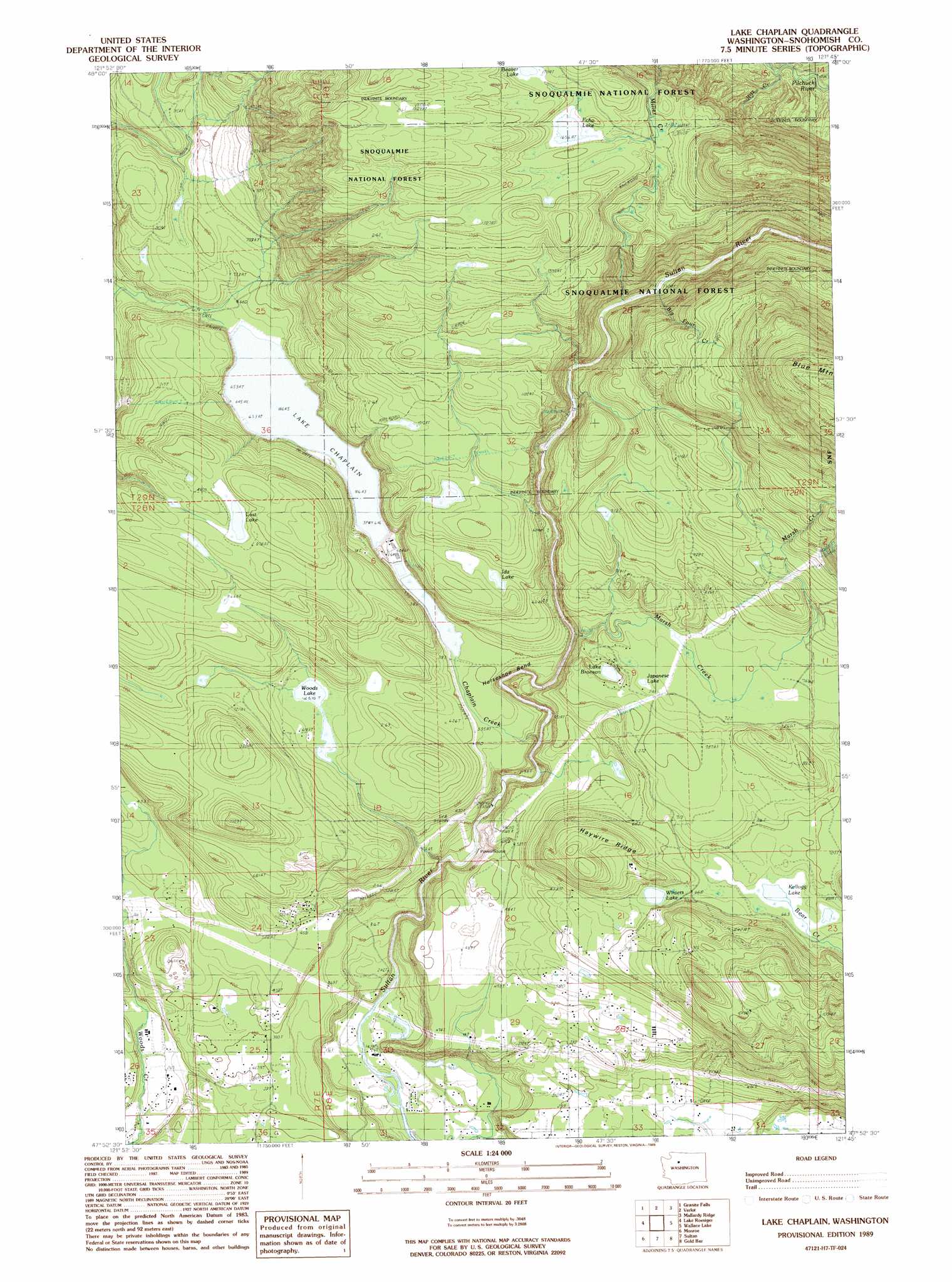
USGS Topo Quad 47121h7 - 1:24,000 scale
| Topo Map Name: | Lake Chaplain |
| USGS Topo Quad ID: | 47121h7 |
| Print Size: | ca. 21 1/4" wide x 27" high |
| Southeast Coordinates: | 47.875° N latitude / 121.75° W longitude |
| Map Center Coordinates: | 47.9375° N latitude / 121.8125° W longitude |
| U.S. State: | WA |
| Filename: | o47121h7.jpg |
| Download Map JPG Image: | Lake Chaplain topo map 1:24,000 scale |
| Map Type: | Topographic |
| Topo Series: | 7.5´ |
| Map Scale: | 1:24,000 |
| Source of Map Images: | United States Geological Survey (USGS) |
| Alternate Map Versions: |
Lake Chaplain WA 1989, updated 1989 Download PDF Buy paper map Lake Chaplain WA 2011 Download PDF Buy paper map Lake Chaplain WA 2014 Download PDF Buy paper map |
| FStopo: | US Forest Service topo Lake Chaplain is available: Download FStopo PDF Download FStopo TIF |
1:24,000 Topo Quads surrounding Lake Chaplain
Arlington East |
Riley Lake |
Meadow Mountain |
Whitehorse Mountain |
Helena Ridge |
Lake Stevens |
Granite Falls |
Verlot |
Mallardy Ridge |
Silverton |
Snohomish |
Lake Roesiger |
Lake Chaplain |
Wallace Lake |
Mount Stickney |
Maltby |
Monroe |
Sultan |
Gold Bar |
Index |
Redmond |
Carnation |
Lake Joy |
Tolt Reservoir |
Mount Phelps |
> Back to 47121e1 at 1:100,000 scale
> Back to 47120a1 at 1:250,000 scale
> Back to U.S. Topo Maps home
Lake Chaplain topo map: Gazetteer
Lake Chaplain: Bends
Horseshoe Bend elevation 139m 456′Lake Chaplain: Dams
Chaplain Lake North Dam elevation 198m 649′Chaplain Lake South Dam elevation 198m 649′
Freeman Dam elevation 133m 436′
Lake Chaplain: Lakes
Echo Lake elevation 506m 1660′Ida Lake elevation 253m 830′
Japanese Lake elevation 226m 741′
Kellog Lake elevation 199m 652′
Lake Bronson elevation 211m 692′
Lost Lake elevation 291m 954′
Winters Lake elevation 207m 679′
Woods Lake elevation 187m 613′
Lake Chaplain: Populated Places
North Sultan elevation 102m 334′Lake Chaplain: Reservoirs
Lake Chaplain elevation 198m 649′Lake Chaplain: Ridges
Haywire Ridge elevation 309m 1013′Lake Chaplain: Streams
Big Four Creek elevation 232m 761′Chaplain Creek elevation 101m 331′
Marsh Creek elevation 183m 600′
Miners Creek elevation 226m 741′
Ritz Creek elevation 301m 987′
Lake Chaplain digital topo map on disk
Buy this Lake Chaplain topo map showing relief, roads, GPS coordinates and other geographical features, as a high-resolution digital map file on DVD: