Haystack Mountain Topo Map Washington
To zoom in, hover over the map of Haystack Mountain
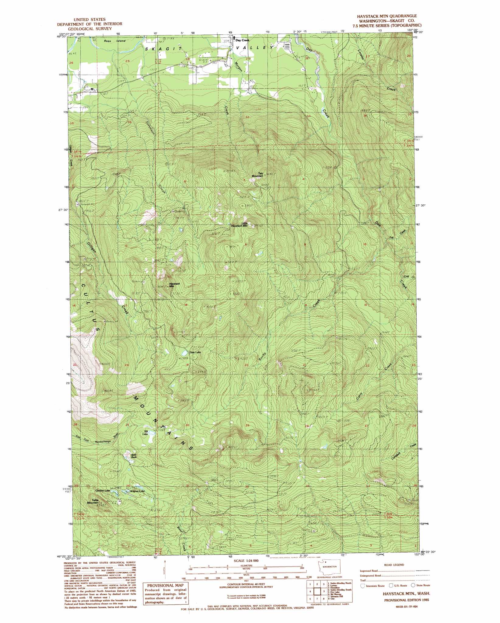
USGS Topo Quad 48122d1 - 1:24,000 scale
| Topo Map Name: | Haystack Mountain |
| USGS Topo Quad ID: | 48122d1 |
| Print Size: | ca. 21 1/4" wide x 27" high |
| Southeast Coordinates: | 48.375° N latitude / 122° W longitude |
| Map Center Coordinates: | 48.4375° N latitude / 122.0625° W longitude |
| U.S. State: | WA |
| Filename: | o48122d1.jpg |
| Download Map JPG Image: | Haystack Mountain topo map 1:24,000 scale |
| Map Type: | Topographic |
| Topo Series: | 7.5´ |
| Map Scale: | 1:24,000 |
| Source of Map Images: | United States Geological Survey (USGS) |
| Alternate Map Versions: |
Haystack Mtn WA 1985, updated 1985 Download PDF Buy paper map Haystack Mountain WA 2011 Download PDF Buy paper map Haystack Mountain WA 2014 Download PDF Buy paper map |
| FStopo: | US Forest Service topo Haystack Mountain is available: Download FStopo PDF Download FStopo TIF |
1:24,000 Topo Quads surrounding Haystack Mountain
Lake Whatcom |
Acme |
Cavanaugh Creek |
Twin Sisters Mountain |
Baker Pass |
Alger |
Sedro-Woolley North |
Lyman |
Hamilton |
Grandy Lake |
Mount Vernon |
Sedro-Woolley South |
Haystack Mountain |
Day Lake |
Gee Point |
Conway |
Mcmurray |
Stimson Hill |
Oso |
Mount Higgins |
Stanwood |
Arlington West |
Arlington East |
Riley Lake |
Meadow Mountain |
> Back to 48122a1 at 1:100,000 scale
> Back to 48122a1 at 1:250,000 scale
> Back to U.S. Topo Maps home
Haystack Mountain topo map: Gazetteer
Haystack Mountain: Lakes
Dixie Lake elevation 1057m 3467′Gordon Lake elevation 915m 3001′
R B Lake elevation 1004m 3293′
Wagner Lake elevation 914m 2998′
Haystack Mountain: Populated Places
Day Creek elevation 33m 108′Haystack Mountain: Ranges
Cultus Mountains elevation 1248m 4094′Haystack Mountain: Streams
Coal Creek elevation 297m 974′Fall Creek elevation 260m 853′
Rocky Creek elevation 203m 666′
Sorenson Creek elevation 22m 72′
Haystack Mountain: Summits
Haystack Mountain elevation 1219m 3999′Little Haystack Mountain elevation 1171m 3841′
Split Rock elevation 964m 3162′
Table Mountain elevation 977m 3205′
Talc Mountain elevation 988m 3241′
Haystack Mountain: Valleys
Rocky Canyon elevation 204m 669′Haystack Mountain digital topo map on disk
Buy this Haystack Mountain topo map showing relief, roads, GPS coordinates and other geographical features, as a high-resolution digital map file on DVD: