Stinkingwater Mountains Topo Map Oregon
To zoom in, hover over the map of Stinkingwater Mountains
USGS Topo Map 43118e1 - 1:100,000 scale
| Topo Map Name: | Stinkingwater Mountains |
| USGS Topo Quad ID: | 43118e1 |
| Print Size: | ca. 39" wide x 24" high |
| Southeast Coordinates: | 43.5° N latitude / 118° W longitude |
| Map Center Coordinates: | 43.75° N latitude / 118.5° W longitude |
| U.S. State: | OR |
| Filename: | 43118e1.jpg |
| Download Map JPG Image: | Stinkingwater Mountains topo map 1:100,000 scale |
| Map Type: | Topographic |
| Topo Series: | 30´x60´ |
| Map Scale: | 1:100,000 |
| Source of Map Images: | United States Geological Survey (USGS) |
| Alternate Map Versions: |
Stinkingwater Mountains OR 1978, updated 1997 Download PDF Buy paper map |
1:100,000 Topos surrounding Stinkingwater Mountains
Dayville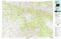 |
John Day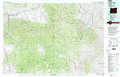 |
Brogan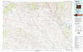 |
Burns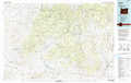 |
Stinkingwater Mountains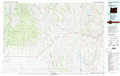 |
Vale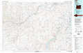 |
Harney Lake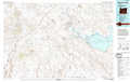 |
Malheur Lake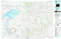 |
Mahogany Mountain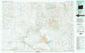 |
> Back to 43118a1 at 1:250,000 scale
> Back to U.S. Topo Maps home
1:24,000 Topo Quads covered by the spatial extent of this 100k map (Stinkingwater Mountains)
|
Trout Creek 
|
Calamity Butte 
|
Van 
|
Moffit Table 
|
Otis Mountain 
|
Cottonwood Reservoir 
|
Beulah 
|
De Armond Mountain 
|
|
Devine Ridge North 
|
Telephone Butte 
|
Craft Point 
|
House Butte 
|
Drewsey 
|
Drinkwater Pass 
|
Petes Mountain 
|
Stemler Ridge 
|
|
Devine Ridge South 
|
Harney 
|
Buchanan 
|
Stinkingwater Pass 
|
Bartlett Mountain 
|
Upton Mountain 
|
Selle Gap 
|
Juntura 
|
|
Poison Creek Slough 
|
Ninemile Slough 
|
Carson Point 
|
Mahon Creek 
|
Coleman Mountain 
|
Warm Springs Creek 
|
Warm Springs Reservoir 
|
Mosquito Mountain 
|
