Iron River Topo Map Michigan
To zoom in, hover over the map of Iron River
USGS Topo Map 46088a1 - 1:100,000 scale
| Topo Map Name: | Iron River |
| USGS Topo Quad ID: | 46088a1 |
| Print Size: | ca. 39" wide x 24" high |
| Southeast Coordinates: | 46° N latitude / 88° W longitude |
| Map Center Coordinates: | 46.25° N latitude / 88.5° W longitude |
| U.S. States: | MI, WI |
| Filename: | 46088a1.jpg |
| Download Map JPG Image: | Iron River topo map 1:100,000 scale |
| Map Type: | Topographic |
| Topo Series: | 30´x60´ |
| Map Scale: | 1:100,000 |
| Source of Map Images: | United States Geological Survey (USGS) |
| Alternate Map Versions: |
Iron River MI 1989, updated 1990 Download PDF Buy paper map |
1:100,000 Topos surrounding Iron River
Ontonagon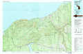 |
L'Anse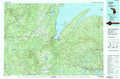 |
Marquette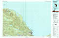 |
Wakefield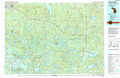 |
Iron River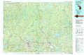 |
Gwinn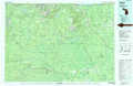 |
Rhinelander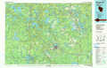 |
Iron Mountain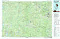 |
Escanaba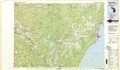 |
> Back to 46088a1 at 1:250,000 scale
> Back to U.S. Topo Maps home
1:24,000 Topo Quads covered by the spatial extent of this 100k map (Iron River)
|
Kenton 
|
Glitter Lake 
|
Marten Lake 
|
Tunis 
|
Drummond Lake 
|
Ned Lake 
|
Nelson Lake 
|
Witch Lake Ne 
|
|
Lake Mitigwaki 
|
Winslow Lake 
|
Perch Lake 
|
Porter Lake 
|
Triangle Ranch 
|
Neo Lake Se 
|
Hickman Lake 
|
Witch Lake 
|
|
Golden Lake 
|
Beechwood 
|
Gibbs City 
|
Sunset Lake 
|
Amasa 
|
Kelso Junction 
|
Kiernan 
|
Channing 
|
|
Smoky Lake 
|
Hagerman Lake 
|
Iron River 
|
Gaastra 
|
Fortune Lakes 
|
Crystal Falls 
|
Lake Mary 
|
Sagola 
|
