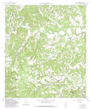
Fall Creek Topo Map Texas
To zoom in, hover over the map of Fall Creek
USGS Topo Quad 29099h2 - 1:24,000 scale
| Topo Map Name: | Fall Creek |
| USGS Topo Quad ID: | 29099h2 |
| Print Size: | ca. 21 1/4" wide x 27" high |
| Southeast Coordinates: | 29.875° N latitude / 99.125° W longitude |
| Map Center Coordinates: | 29.9375° N latitude / 99.1875° W longitude |
| U.S. State: | TX |
| Filename: | o29099h2.jpg |
| Download Map JPG Image: | Fall Creek topo map 1:24,000 scale |
| Map Type: | Topographic |
| Topo Series: | 7.5´ |
| Map Scale: | 1:24,000 |
| Source of Map Images: | United States Geological Survey (USGS) |
| Alternate Map Versions: |
Fall Creek TX 1964, updated 1968 Download PDF Buy paper map Fall Creek TX 1964, updated 1982 Download PDF Buy paper map Fall Creek TX 2010 Download PDF Buy paper map Fall Creek TX 2013 Download PDF Buy paper map Fall Creek TX 2016 Download PDF Buy paper map |
1:24,000 Topo Quads surrounding Fall Creek
> Back to 29099e1 at 1:100,000 scale
> Back to 29098a1 at 1:250,000 scale
> Back to U.S. Topo Maps home
Fall Creek topo map: Gazetteer
Fall Creek: Airports
Barclays Roost Airport elevation 506m 1660′Fall Creek: Dams
Falls Lake Dam elevation 544m 1784′Roden Lake Dam elevation 520m 1706′
T S Clements Dam elevation 534m 1751′
Walters Dam elevation 500m 1640′
Fall Creek: Reservoirs
Falls Lake elevation 544m 1784′Roden Lake elevation 520m 1706′
T S Clements Lake elevation 534m 1751′
Walters Lake elevation 500m 1640′
Fall Creek: Ridges
Huntsberry Ridge elevation 641m 2103′Fall Creek: Springs
Peterson Spring elevation 582m 1909′Verde Springs elevation 576m 1889′
Fall Creek: Streams
Bushwhack Creek elevation 529m 1735′Calf Run elevation 548m 1797′
Cow Creek elevation 475m 1558′
Fall Creek elevation 487m 1597′
Hog Branch elevation 560m 1837′
Indian Creek elevation 496m 1627′
Lambs Creek elevation 512m 1679′
Lin Prong elevation 532m 1745′
Little Lambs Creek elevation 506m 1660′
Marshall Creek elevation 507m 1663′
Palmer Creek elevation 498m 1633′
Peterson Creek elevation 507m 1663′
South Creek elevation 487m 1597′
Stone Creek elevation 480m 1574′
West Creek elevation 494m 1620′
Wolf Creek elevation 512m 1679′
Fall Creek: Valleys
Coker Hollow elevation 545m 1788′Crow Canyon elevation 511m 1676′
Grave Hollow elevation 541m 1774′
Mexican Hollow elevation 556m 1824′
Panther Hollow elevation 541m 1774′
Prison Canyon elevation 494m 1620′
Ranch Hollow elevation 565m 1853′
Fall Creek digital topo map on disk
Buy this Fall Creek topo map showing relief, roads, GPS coordinates and other geographical features, as a high-resolution digital map file on DVD:


