Soileau Topo Map Louisiana
To zoom in, hover over the map of Soileau
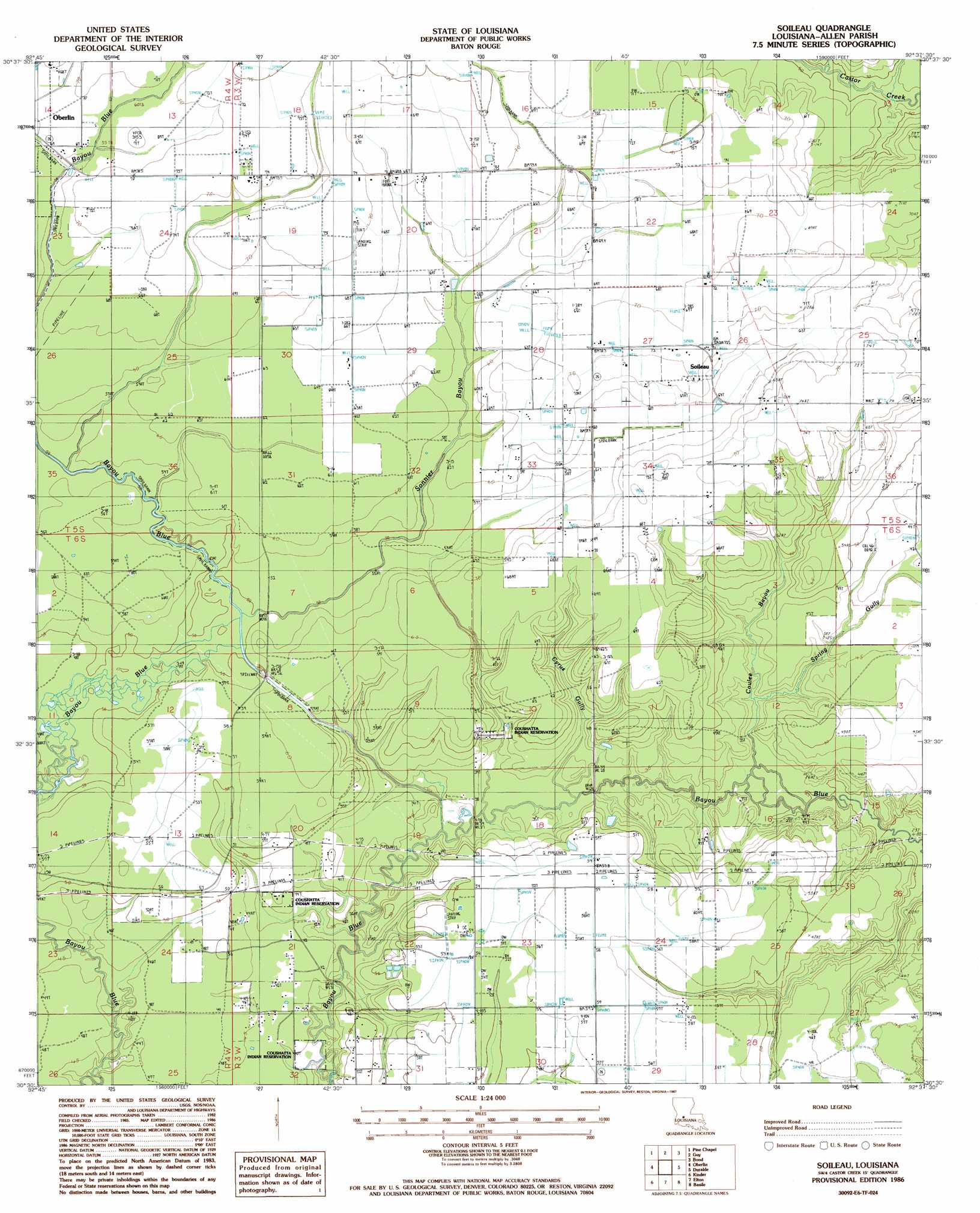
USGS Topo Quad 30092e6 - 1:24,000 scale
| Topo Map Name: | Soileau |
| USGS Topo Quad ID: | 30092e6 |
| Print Size: | ca. 21 1/4" wide x 27" high |
| Southeast Coordinates: | 30.5° N latitude / 92.625° W longitude |
| Map Center Coordinates: | 30.5625° N latitude / 92.6875° W longitude |
| U.S. State: | LA |
| Filename: | o30092e6.jpg |
| Download Map JPG Image: | Soileau topo map 1:24,000 scale |
| Map Type: | Topographic |
| Topo Series: | 7.5´ |
| Map Scale: | 1:24,000 |
| Source of Map Images: | United States Geological Survey (USGS) |
| Alternate Map Versions: |
Soileau LA 1986, updated 1987 Download PDF Buy paper map Soileau LA 2012 Download PDF Buy paper map Soileau LA 2015 Download PDF Buy paper map |
1:24,000 Topo Quads surrounding Soileau
Grant |
Elizabeth |
Oakdale |
Beaver |
Pine Prairie |
Mittie |
Pine Chapel |
Guy |
Bond |
Mamou |
Le Blanc |
Oberlin |
Soileau |
Duralde |
Eunice North |
Indian Village |
Kinder |
Elton |
Basile |
Eunice South |
Fenton |
Welsh North |
Hathaway |
Evangeline |
Iota |
> Back to 30092e1 at 1:100,000 scale
> Back to 30092a1 at 1:250,000 scale
> Back to U.S. Topo Maps home
Soileau topo map: Gazetteer
Soileau: Dams
Louisiana Noname 79 Dam elevation 18m 59′Soileau: Oilfields
North Elton Gas Field elevation 17m 55′Southeast Oberlin Oil and Gas Field elevation 21m 68′
Soileau: Populated Places
Soileau elevation 22m 72′Soileau: Streams
Coulee Bayou elevation 9m 29′Cyrus Gully elevation 9m 29′
Sonnier Bayou elevation 15m 49′
Spring Gully elevation 9m 29′
Winn Gully elevation 14m 45′
Soileau digital topo map on disk
Buy this Soileau topo map showing relief, roads, GPS coordinates and other geographical features, as a high-resolution digital map file on DVD: