Schwab City Topo Map Texas
To zoom in, hover over the map of Schwab City
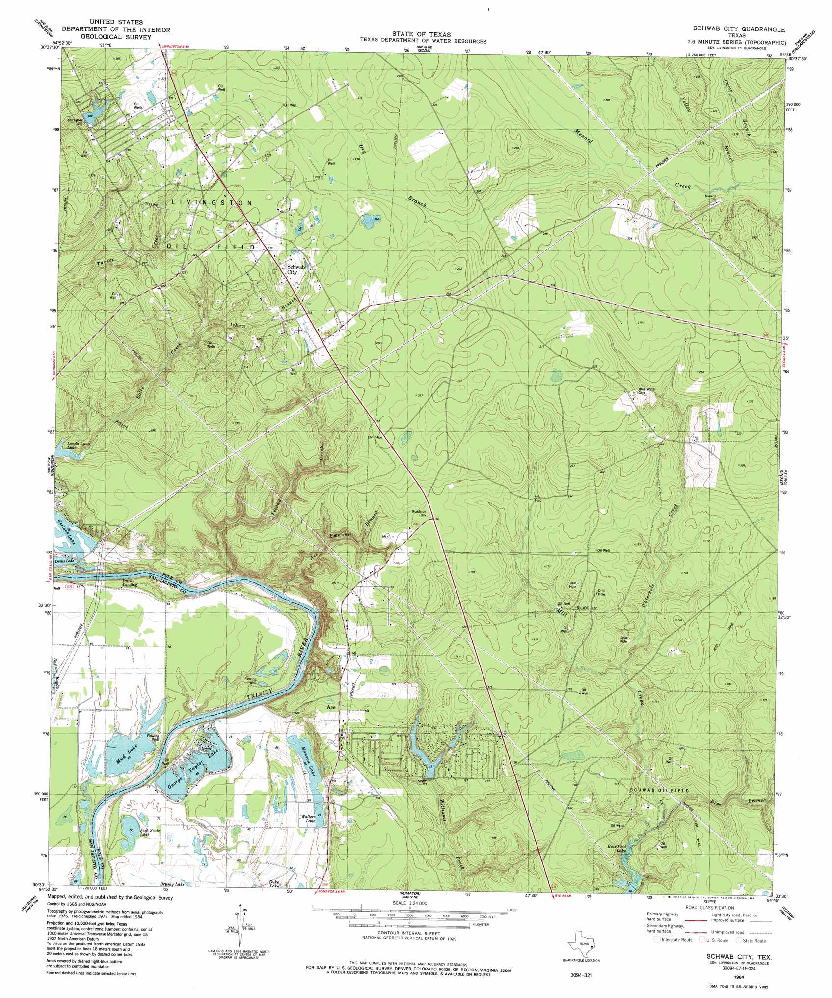
USGS Topo Quad 30094e7 - 1:24,000 scale
| Topo Map Name: | Schwab City |
| USGS Topo Quad ID: | 30094e7 |
| Print Size: | ca. 21 1/4" wide x 27" high |
| Southeast Coordinates: | 30.5° N latitude / 94.75° W longitude |
| Map Center Coordinates: | 30.5625° N latitude / 94.8125° W longitude |
| U.S. State: | TX |
| Filename: | o30094e7.jpg |
| Download Map JPG Image: | Schwab City topo map 1:24,000 scale |
| Map Type: | Topographic |
| Topo Series: | 7.5´ |
| Map Scale: | 1:24,000 |
| Source of Map Images: | United States Geological Survey (USGS) |
| Alternate Map Versions: |
Schwab City TX 1984, updated 1984 Download PDF Buy paper map Schwab City TX 2010 Download PDF Buy paper map Schwab City TX 2013 Download PDF Buy paper map Schwab City TX 2016 Download PDF Buy paper map |
1:24,000 Topo Quads surrounding Schwab City
Onalaska |
New Willard |
Leggett |
Hortense |
Chambliss Hill |
Blanchard |
Livingston |
Soda |
Dallardsville |
Jacks Creek North |
Camilla |
Goodrich |
Schwab City |
Segno |
Jacks Creek South |
Westcott |
Rayburn |
Romayor |
Votaw |
Bragg |
Cleveland |
Tarkington Prairie |
Davis Hill |
Arizona Creek |
Saratoga |
> Back to 30094e1 at 1:100,000 scale
> Back to 30094a1 at 1:250,000 scale
> Back to U.S. Topo Maps home
Schwab City topo map: Gazetteer
Schwab City: Areas
Logan League elevation 24m 78′Schwab City: Dams
C J Gerlach Dam elevation 23m 75′Devils Lake Dam elevation 23m 75′
Forest Springs Lake Dam elevation 59m 193′
Lake Connie Jean Dam elevation 38m 124′
Taylor Lake Dam elevation 21m 68′
Schwab City: Lakes
Fish Scale Lake elevation 22m 72′George Taylor Lake elevation 21m 68′
Munson Lake elevation 25m 82′
Schwab City: Oilfields
Livingston Oil Field elevation 69m 226′Schwab Oil Field elevation 46m 150′
Schwab City: Populated Places
Ace elevation 53m 173′Drews Landing elevation 26m 85′
Schwab City elevation 63m 206′
Schwab City: Reservoirs
Devils Lake elevation 23m 75′Forest Springs Lake elevation 59m 193′
Gerlach Lake elevation 23m 75′
Lake Connie Jean elevation 38m 124′
Taylor Lake elevation 21m 68′
Schwab City: Springs
Drew Springs elevation 62m 203′Schwab City: Streams
Ace Emanuel Branch elevation 19m 62′Blue Branch elevation 36m 118′
Camp Branch elevation 55m 180′
Dry Branch elevation 56m 183′
Isham Branch elevation 46m 150′
Sally Creek elevation 14m 45′
Second Creek elevation 15m 49′
Waterhole Creek elevation 39m 127′
Yellow Branch elevation 55m 180′
Schwab City digital topo map on disk
Buy this Schwab City topo map showing relief, roads, GPS coordinates and other geographical features, as a high-resolution digital map file on DVD: