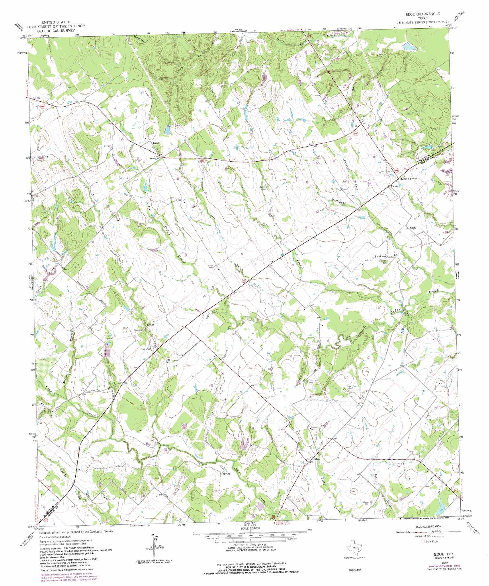
Edge Topo Map Texas
To zoom in, hover over the map of Edge
USGS Topo Quad 30096h3 - 1:24,000 scale
| Topo Map Name: | Edge |
| USGS Topo Quad ID: | 30096h3 |
| Print Size: | ca. 21 1/4" wide x 27" high |
| Southeast Coordinates: | 30.875° N latitude / 96.25° W longitude |
| Map Center Coordinates: | 30.9375° N latitude / 96.3125° W longitude |
| U.S. State: | TX |
| Filename: | o30096h3.jpg |
| Download Map JPG Image: | Edge topo map 1:24,000 scale |
| Map Type: | Topographic |
| Topo Series: | 7.5´ |
| Map Scale: | 1:24,000 |
| Source of Map Images: | United States Geological Survey (USGS) |
| Alternate Map Versions: |
Edge TX 1962, updated 1964 Download PDF Buy paper map Edge TX 1962, updated 1989 Download PDF Buy paper map Edge TX 2010 Download PDF Buy paper map Edge TX 2013 Download PDF Buy paper map Edge TX 2016 Download PDF Buy paper map |
1:24,000 Topo Quads surrounding Edge
Petteway |
Bald Prairie |
Marquez |
Margie |
Spring Seat |
Owensville |
Franklin |
Camp Creek Lake |
Hilltop Lakes |
Normangee |
Hearne North |
Wheelock |
Edge |
Canary |
North Zulch |
Hearne South |
Dunn Creek |
Kurten |
Clear Lake |
Iola |
Mumford |
Bryan West |
Bryan East |
Reliance |
Keith |
> Back to 30096e1 at 1:100,000 scale
> Back to 30096a1 at 1:250,000 scale
> Back to U.S. Topo Maps home
Edge topo map: Gazetteer
Edge: Dams
Hare Lake Dam elevation 101m 331′Matejka Lake Dam elevation 106m 347′
Stuewe Lake Dam elevation 101m 331′
Edge: Populated Places
Eaton elevation 135m 442′Edge elevation 104m 341′
Kings Highway elevation 102m 334′
Macey elevation 97m 318′
Edge: Reservoirs
Hare Lake elevation 101m 331′Matejka Lake elevation 106m 347′
Stuewe Lake elevation 101m 331′
Edge: Streams
Bee Branch elevation 80m 262′Buckhorn Branch elevation 88m 288′
Cajka Branch elevation 95m 311′
Cobb Branch elevation 86m 282′
Melton Branch elevation 98m 321′
Parker Branch elevation 96m 314′
Smith Branch elevation 91m 298′
Snake Branch elevation 96m 314′
Edge digital topo map on disk
Buy this Edge topo map showing relief, roads, GPS coordinates and other geographical features, as a high-resolution digital map file on DVD: