North Zulch Topo Map Texas
To zoom in, hover over the map of North Zulch
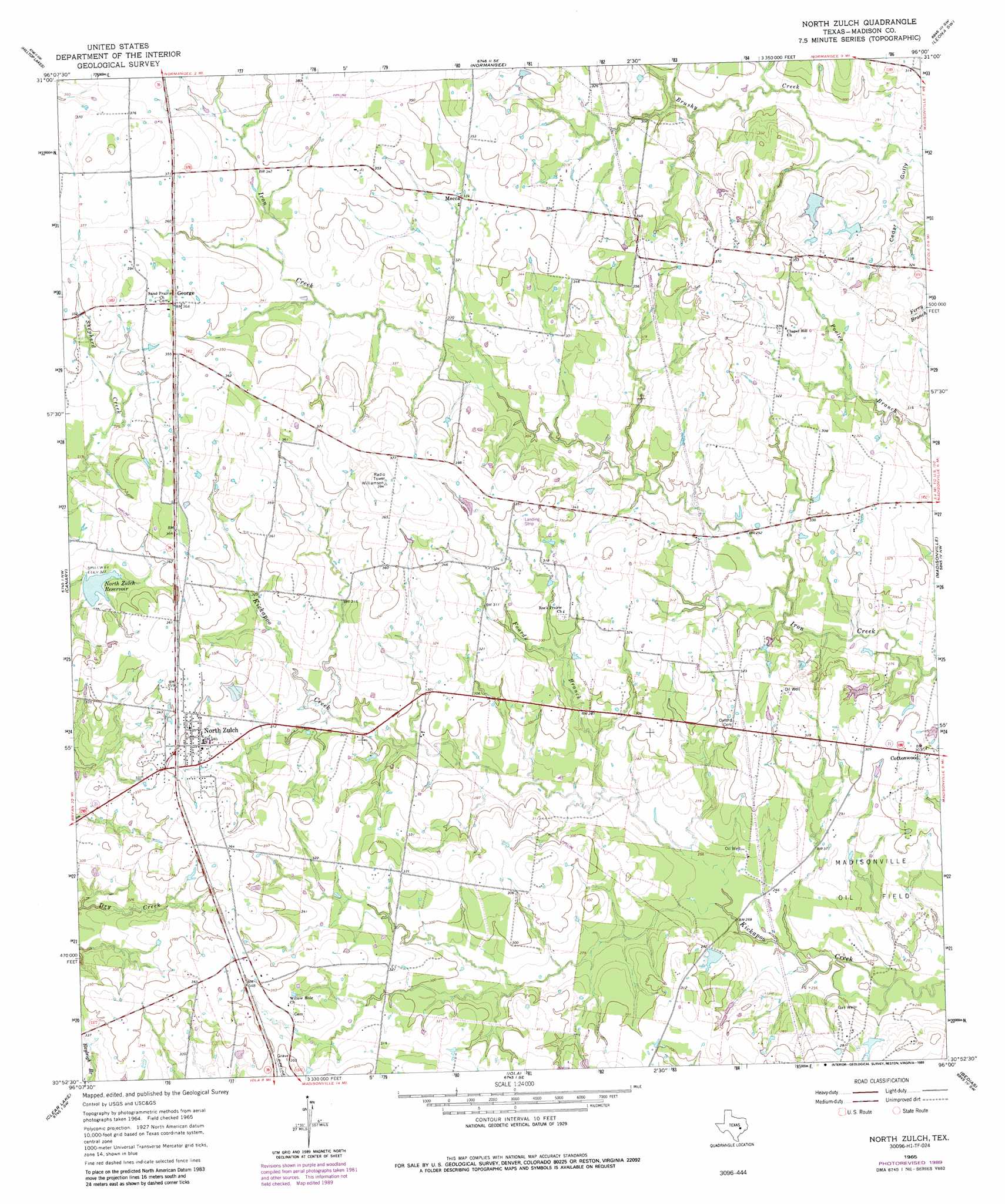
USGS Topo Quad 30096h1 - 1:24,000 scale
| Topo Map Name: | North Zulch |
| USGS Topo Quad ID: | 30096h1 |
| Print Size: | ca. 21 1/4" wide x 27" high |
| Southeast Coordinates: | 30.875° N latitude / 96° W longitude |
| Map Center Coordinates: | 30.9375° N latitude / 96.0625° W longitude |
| U.S. State: | TX |
| Filename: | o30096h1.jpg |
| Download Map JPG Image: | North Zulch topo map 1:24,000 scale |
| Map Type: | Topographic |
| Topo Series: | 7.5´ |
| Map Scale: | 1:24,000 |
| Source of Map Images: | United States Geological Survey (USGS) |
| Alternate Map Versions: |
North Zulch TX 1965, updated 1967 Download PDF Buy paper map North Zulch TX 1965, updated 1989 Download PDF Buy paper map North Zulch TX 2010 Download PDF Buy paper map North Zulch TX 2013 Download PDF Buy paper map North Zulch TX 2016 Download PDF Buy paper map |
1:24,000 Topo Quads surrounding North Zulch
Marquez |
Margie |
Spring Seat |
Leona |
Middleton |
Camp Creek Lake |
Hilltop Lakes |
Normangee |
Leona Sw |
Elwood |
Edge |
Canary |
North Zulch |
Madisonville |
Connor |
Kurten |
Clear Lake |
Iola |
Bedias |
Steep Branch |
Bryan East |
Reliance |
Keith |
Singleton |
Loma |
> Back to 30096e1 at 1:100,000 scale
> Back to 30096a1 at 1:250,000 scale
> Back to U.S. Topo Maps home
North Zulch topo map: Gazetteer
North Zulch: Dams
LFD Ranch Lake Dam elevation 90m 295′North Zulch Reservoir Dam elevation 96m 314′
Santa Alina Ranch Lake Dam elevation 93m 305′
Texas No Name Number 14 Dam elevation 92m 301′
Texas Noname Number 2 Dam elevation 85m 278′
North Zulch: Populated Places
Cottonwood elevation 94m 308′George elevation 112m 367′
Mecca elevation 101m 331′
North Zulch elevation 107m 351′
North Zulch: Reservoirs
LFD Ranch Lake elevation 90m 295′North Zulch Reservoir elevation 98m 321′
Santa Alina Ranch Lake elevation 93m 305′
North Zulch: Streams
Foards Branch elevation 79m 259′North Zulch: Valleys
Cedar Gully elevation 82m 269′North Zulch digital topo map on disk
Buy this North Zulch topo map showing relief, roads, GPS coordinates and other geographical features, as a high-resolution digital map file on DVD: