Normangee Topo Map Texas
To zoom in, hover over the map of Normangee
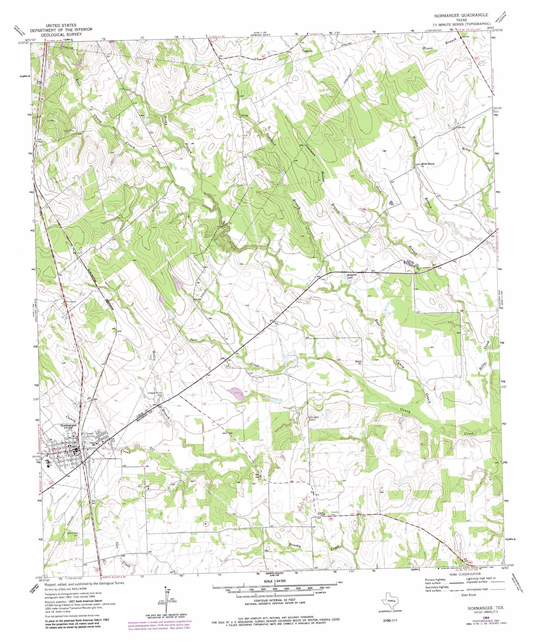
USGS Topo Quad 31096a1 - 1:24,000 scale
| Topo Map Name: | Normangee |
| USGS Topo Quad ID: | 31096a1 |
| Print Size: | ca. 21 1/4" wide x 27" high |
| Southeast Coordinates: | 31° N latitude / 96° W longitude |
| Map Center Coordinates: | 31.0625° N latitude / 96.0625° W longitude |
| U.S. State: | TX |
| Filename: | o31096a1.jpg |
| Download Map JPG Image: | Normangee topo map 1:24,000 scale |
| Map Type: | Topographic |
| Topo Series: | 7.5´ |
| Map Scale: | 1:24,000 |
| Source of Map Images: | United States Geological Survey (USGS) |
| Alternate Map Versions: |
Normangee TX 1964, updated 1967 Download PDF Buy paper map Normangee TX 1964, updated 1983 Download PDF Buy paper map Normangee TX 2010 Download PDF Buy paper map Normangee TX 2013 Download PDF Buy paper map Normangee TX 2016 Download PDF Buy paper map |
1:24,000 Topo Quads surrounding Normangee
Round Prairie |
Jewett |
Robbins |
Centerville |
Eunice |
Marquez |
Margie |
Spring Seat |
Leona |
Middleton |
Camp Creek Lake |
Hilltop Lakes |
Normangee |
Leona Sw |
Elwood |
Edge |
Canary |
North Zulch |
Madisonville |
Connor |
Kurten |
Clear Lake |
Iola |
Bedias |
Steep Branch |
> Back to 31096a1 at 1:100,000 scale
> Back to 31096a1 at 1:250,000 scale
> Back to U.S. Topo Maps home
Normangee topo map: Gazetteer
Normangee: Dams
Cook Lake Dam elevation 117m 383′Jinkins Lake Dam elevation 103m 337′
Moss Lake Dam elevation 100m 328′
Soil Conservation Service Site 1 Dam elevation 120m 393′
Normangee: Lakes
Rodgers Lake elevation 104m 341′Normangee: Populated Places
Normangee elevation 115m 377′Normangee: Reservoirs
Cook Lake elevation 117m 383′Jinkins Lake elevation 103m 337′
Moss Lake elevation 100m 328′
Soil Conservation Service Site 1 Reservoir elevation 120m 393′
Normangee: Streams
Copeland Branch elevation 102m 334′Deadman Hollow Branch elevation 104m 341′
East Caney Creek elevation 82m 269′
Hollis Branch elevation 96m 314′
Pond Branch elevation 86m 282′
Rocky Branch elevation 107m 351′
Salt Creek elevation 88m 288′
Normangee digital topo map on disk
Buy this Normangee topo map showing relief, roads, GPS coordinates and other geographical features, as a high-resolution digital map file on DVD: