Cherokee Topo Map Texas
To zoom in, hover over the map of Cherokee
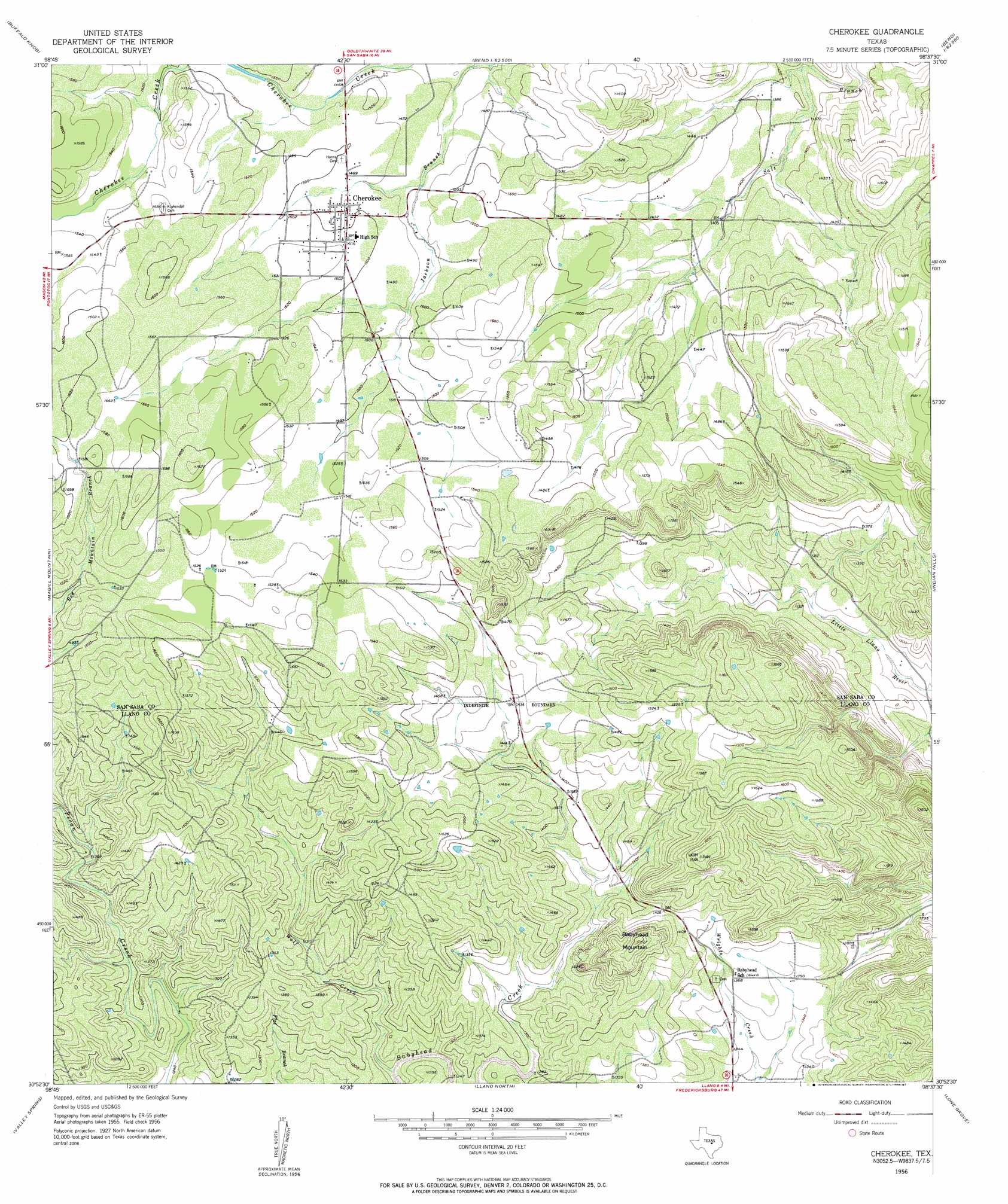
USGS Topo Quad 30098h6 - 1:24,000 scale
| Topo Map Name: | Cherokee |
| USGS Topo Quad ID: | 30098h6 |
| Print Size: | ca. 21 1/4" wide x 27" high |
| Southeast Coordinates: | 30.875° N latitude / 98.625° W longitude |
| Map Center Coordinates: | 30.9375° N latitude / 98.6875° W longitude |
| U.S. State: | TX |
| Filename: | o30098h6.jpg |
| Download Map JPG Image: | Cherokee topo map 1:24,000 scale |
| Map Type: | Topographic |
| Topo Series: | 7.5´ |
| Map Scale: | 1:24,000 |
| Source of Map Images: | United States Geological Survey (USGS) |
| Alternate Map Versions: |
Cherokee TX 1956, updated 1956 Download PDF Buy paper map Cherokee TX 1956, updated 1987 Download PDF Buy paper map Cherokee TX 2010 Download PDF Buy paper map Cherokee TX 2012 Download PDF Buy paper map Cherokee TX 2016 Download PDF Buy paper map |
1:24,000 Topo Quads surrounding Cherokee
Baker Spring |
Algerita |
San Saba |
Wolf Ridge |
Lometa |
Brady Mountain |
Buffalo Knob |
Bear Hollow |
Bend |
Gorman Falls |
Pontotoc |
Magill Mountain |
Cherokee |
Indian Hills |
Tow |
Smoothingiron Mountain |
Valley Spring |
Llano North |
Lone Grove |
Lake Buchanan |
Castell |
Scotts Crossing |
Llano South |
Cap Mountain |
Kingsland |
> Back to 30098e1 at 1:100,000 scale
> Back to 30098a1 at 1:250,000 scale
> Back to U.S. Topo Maps home
Cherokee topo map: Gazetteer
Cherokee: Parks
Indian Stadium elevation 458m 1502′Cherokee: Populated Places
Baby Head (historical) elevation 420m 1377′Cherokee elevation 456m 1496′
Cherokee: Streams
Kemp Creek elevation 449m 1473′Wolf Creek elevation 375m 1230′
Woodward Branch elevation 457m 1499′
Cherokee: Summits
Babyhead Mountain elevation 493m 1617′Cherokee digital topo map on disk
Buy this Cherokee topo map showing relief, roads, GPS coordinates and other geographical features, as a high-resolution digital map file on DVD: