Lone Grove Topo Map Texas
To zoom in, hover over the map of Lone Grove
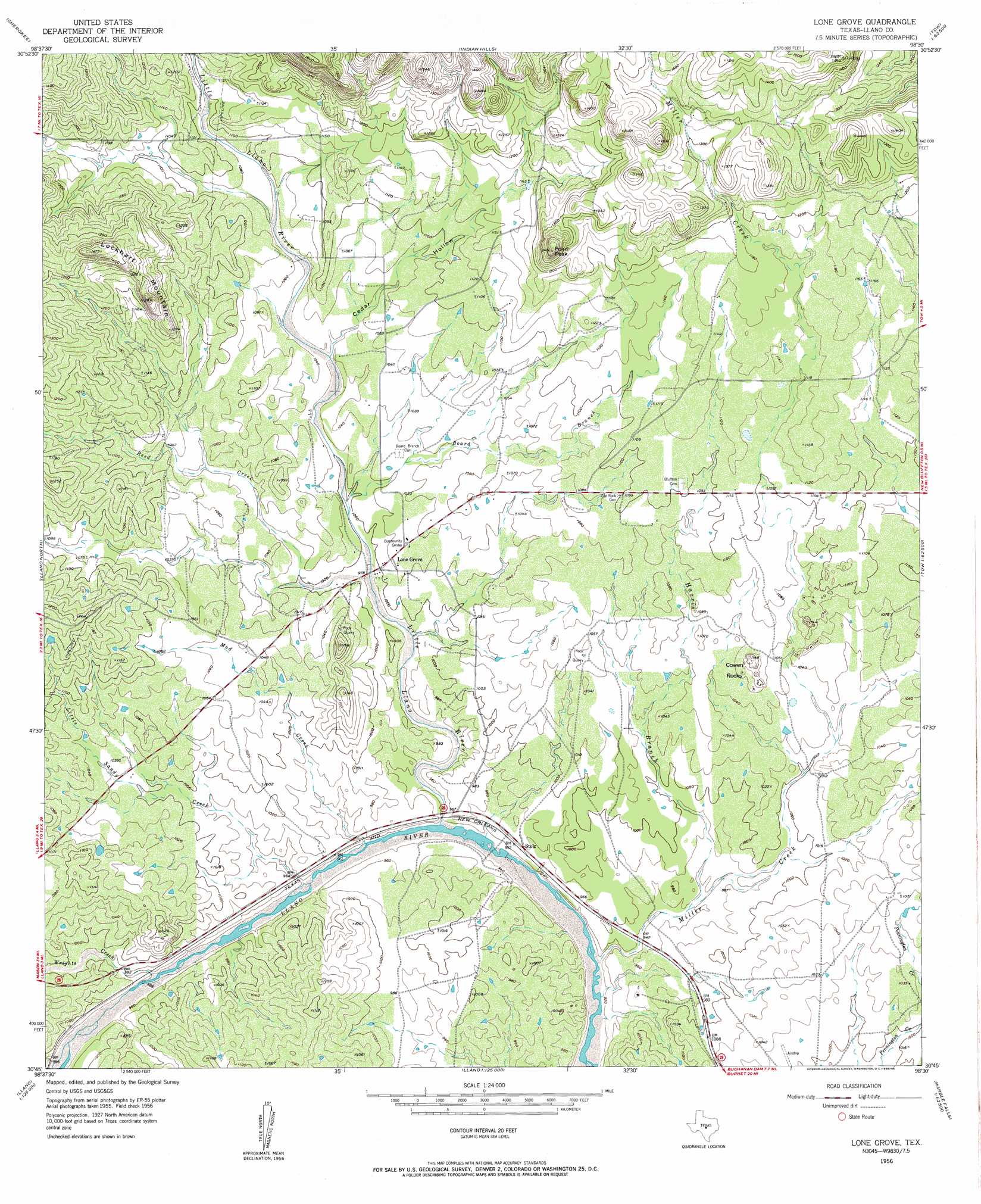
USGS Topo Quad 30098g5 - 1:24,000 scale
| Topo Map Name: | Lone Grove |
| USGS Topo Quad ID: | 30098g5 |
| Print Size: | ca. 21 1/4" wide x 27" high |
| Southeast Coordinates: | 30.75° N latitude / 98.5° W longitude |
| Map Center Coordinates: | 30.8125° N latitude / 98.5625° W longitude |
| U.S. State: | TX |
| Filename: | o30098g5.jpg |
| Download Map JPG Image: | Lone Grove topo map 1:24,000 scale |
| Map Type: | Topographic |
| Topo Series: | 7.5´ |
| Map Scale: | 1:24,000 |
| Source of Map Images: | United States Geological Survey (USGS) |
| Alternate Map Versions: |
Lone Grove TX 1956, updated 1956 Download PDF Buy paper map Lone Grove TX 2010 Download PDF Buy paper map Lone Grove TX 2012 Download PDF Buy paper map Lone Grove TX 2016 Download PDF Buy paper map |
1:24,000 Topo Quads surrounding Lone Grove
Buffalo Knob |
Bear Hollow |
Bend |
Gorman Falls |
Nix |
Magill Mountain |
Cherokee |
Indian Hills |
Tow |
Naruna |
Valley Spring |
Llano North |
Lone Grove |
Lake Buchanan |
Council Creek |
Scotts Crossing |
Llano South |
Cap Mountain |
Kingsland |
Longhorn Cavern |
Enchanted Rock |
Oxford |
Click |
Dunman Mountain |
Marble Falls |
> Back to 30098e1 at 1:100,000 scale
> Back to 30098a1 at 1:250,000 scale
> Back to U.S. Topo Maps home
Lone Grove topo map: Gazetteer
Lone Grove: Populated Places
Lone Grove elevation 311m 1020′Stolz elevation 292m 958′
Lone Grove: Streams
Board Branch elevation 302m 990′Harris Branch elevation 289m 948′
Little Llano River elevation 283m 928′
Little Sandy Creek elevation 283m 928′
Miller Creek elevation 278m 912′
Mud Creek elevation 282m 925′
Reed Creek elevation 298m 977′
Wrights Creek elevation 286m 938′
Lone Grove: Summits
Cowen Rocks elevation 346m 1135′Lockhart Mountain elevation 442m 1450′
Point Peak elevation 447m 1466′
Lone Grove: Valleys
Cedar Hollow elevation 311m 1020′Lone Grove digital topo map on disk
Buy this Lone Grove topo map showing relief, roads, GPS coordinates and other geographical features, as a high-resolution digital map file on DVD: