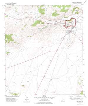
Fort Davis Topo Map Texas
To zoom in, hover over the map of Fort Davis
USGS Topo Quad 30103e8 - 1:24,000 scale
| Topo Map Name: | Fort Davis |
| USGS Topo Quad ID: | 30103e8 |
| Print Size: | ca. 21 1/4" wide x 27" high |
| Southeast Coordinates: | 30.5° N latitude / 103.875° W longitude |
| Map Center Coordinates: | 30.5625° N latitude / 103.9375° W longitude |
| U.S. State: | TX |
| Filename: | o30103e8.jpg |
| Download Map JPG Image: | Fort Davis topo map 1:24,000 scale |
| Map Type: | Topographic |
| Topo Series: | 7.5´ |
| Map Scale: | 1:24,000 |
| Source of Map Images: | United States Geological Survey (USGS) |
| Alternate Map Versions: |
Fort Davis TX 1972, updated 1975 Download PDF Buy paper map Fort Davis TX 2010 Download PDF Buy paper map Fort Davis TX 2012 Download PDF Buy paper map Fort Davis TX 2016 Download PDF Buy paper map |
1:24,000 Topo Quads surrounding Fort Davis
> Back to 30103e1 at 1:100,000 scale
> Back to 30102a1 at 1:250,000 scale
> Back to U.S. Topo Maps home
Fort Davis topo map: Gazetteer
Fort Davis: Airports
Blue Mountain Airport elevation 1531m 5022′Fort Davis: Parks
Davis Mountains State Park elevation 1526m 5006′Fort Davis National Historic Site elevation 1498m 4914′
Fort Davis: Populated Places
Fort Davis elevation 1491m 4891′Fort Davis: Reservoirs
Devils Tank elevation 1606m 5269′Sproul Reservoir elevation 1467m 4812′
Fort Davis: Springs
Fort Davis Spring (historical) elevation 1480m 4855′Fort Davis: Streams
Lone Tree Creek elevation 1598m 5242′Middle Fork Cienega Creek elevation 1554m 5098′
North Fork Cienega Creek elevation 1500m 4921′
Olds Creek elevation 1557m 5108′
South Fork Cienega Creek elevation 1500m 4921′
Fort Davis: Summits
Arabella Mountain elevation 1810m 5938′Dolores Mountain elevation 1575m 5167′
Lone Tree Hill elevation 1698m 5570′
Scobee Mountain elevation 1652m 5419′
Sleeping Lion Mountain elevation 1588m 5209′
Fort Davis: Trails
Davis Mountains State Park Trail elevation 1530m 5019′Tall Grassland Trail elevation 1560m 5118′
Fort Davis: Valleys
Hospital Canyon elevation 1497m 4911′Keesey Canyon elevation 1507m 4944′
Road Canyon elevation 1536m 5039′
Rough Canyon elevation 1548m 5078′
Fort Davis digital topo map on disk
Buy this Fort Davis topo map showing relief, roads, GPS coordinates and other geographical features, as a high-resolution digital map file on DVD:


